Hrušky (Břeclav District)
Hrušky | |
|---|---|
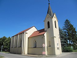 Church of Saint Bartholomew | |
 Flag  Coat of arms | |
 Hrušky Location in the Czech Republic | |
| Coordinates: 48°47′34″N 16°58′27″E / 48.79278°N 16.97417°ECoordinates: 48°47′34″N 16°58′27″E / 48.79278°N 16.97417°E | |
| Country | |
| Region | South Moravian |
| District | Břeclav |
| First mentioned | 1368 |
| Area | |
| • Total | 15.91 km2 (6.14 sq mi) |
| Elevation | 175 m (574 ft) |
| Population (2021)[1] | |
| • Total | 1,640 |
| • Density | 100/km2 (270/sq mi) |
| Time zone | UTC+1 (CET) |
| • Summer (DST) | UTC+2 (CEST) |
| Postal code | 691 56 |
| Website | www |

Hrušky (German: Birnbaum) is a municipality and village in Břeclav District in the South Moravian Region of the Czech Republic. It has about 1,600 inhabitants.
Hrušky lies approximately 8 kilometres (5 mi) north-east of Břeclav, 53 km (33 mi) south-east of Brno, and 235 km (146 mi) south-east of Prague.
History[]
The first written mention of Hrušky dates from 1368.
The village was heavily damaged by the 2021 South Moravia tornado.[2]
Notable people[]
- Rudolph Krejci (1929–2018), Czech-American philosopher
Twin towns – sister cities[]
 Waldbredimus, Luxembourg
References[]
- ^ "Population of municipalities of the Czech Republic". Czech Statistical Office. 1 January 2021.
- ^ "Mrtví, zavalení, všude trosky. Sedm obcí na Moravě zpustošilo tornádo". iDnes. Retrieved 25 June 2021.
- ^ "Obec Hrusky" (in French). Waldbredimus. Retrieved 2019-10-17.
| Wikimedia Commons has media related to Hrušky (Břeclav District). |
| show Authority control |
|---|
This South Moravian Region location article is a stub. You can help Wikipedia by . |
Categories:
- Villages in Břeclav District
- Moravian Slovakia
- South Moravian Region geography stubs