Huliaipole
Huliaipole
Гуляйполе | |
|---|---|
 Huliaipole district council | |
 Coat of arms | |
| Etymology: "Walk-about field" | |
| Nickname(s): | |
 Huliaipole | |
| Coordinates: 47°39′N 36°16′E / 47.650°N 36.267°E | |
| Country | |
| Oblast | |
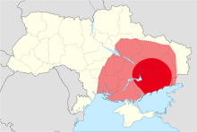
| Raion | Polohy Raion |
| Established | 1785 |
| City status | 1938 |
| Government | |
| • Body | Huliaipole City Council |
| • Mayor | Serhiy Oleksandrovych Yarmak |
| Area | |
| • Total | 23.1 km2 (8.9 sq mi) |
| Elevation | 109 m (358 ft) |
| Population (2021) | |
| • Total | 13,070 |
| • Density | 570/km2 (1,500/sq mi) |
| Postal code | 70200 |
| Area code(s) | +380 6145 |
| Climate | Dfa |
| Website | gpmrada |

Huliaipole (Ukrainian: Гуляйполе [ɦʊlʲɐjˈpɔle]; lit. 'walk-about field') is a city in Zaporizhzhia Oblast, Ukraine. It serves as the administrative centre of Huliaipole Raion. It is known as the birthplace of Ukrainian anarchist revolutionary Nestor Makhno. It has a population of 13,070 (2021 est.)[3]
History[]
Prior to the annexation of the Crimean Khanate by the Russian Empire, the area was mostly settled by the Zaporozhian Cossacks and the nomadic Lesser Nogai Horde. The settlement arose during the 1770s,[4] after the construction of the on the former lands of the Zaporozhian Sich, as part of the Russian Empire's policy to populate and develop the conquered Zaporozhian lands. When Catherine the Great dissolved the Sich, the local Cossacks either fled into exiled or were brought into serfdom, with the residents of what is now Huliaipole falling under the yoke of the Shabelskiys.[5]
In 1785, the board of the Yekaterinoslav Governorate ordered the Novomoskovsk Zemstvo Court to establish the Huliaipole state military settlement for protection from the Crimean Khanate. Archival data confirmed that the first settlers came to the newly formed settlement from the territory of Starodubsky District, and later Kyiv region, Chernihiv region, Poltava region and Sloboda Ukraine. The name "Huliaipole" (lit. 'walk-about field') reflected the nature of the area where it was founded, which had frequently played host to fairs for a long time before the settlement's foundation. The settlement was traditionally divided into centuries, administrative-territorial units formed along military lines.[5] Hundreds of people from Podolia, Pishchanka, , Verbiv[disambiguation needed], Bokhansky, Kherson and later Poland settled in this way. In 1794 the settlement had 150 yards. The inhabitants of the region were actively engaged in agriculture and animal husbandry.
In 1797 the wooden Orthodox Church "Exaltation of the Honest and Life-Giving Christ" was built, and Huliaipole became the township center of Alexandrovsky Uyezd.
Industrialization[]
From the middle of the 19th to the beginning of the 20th century, the village of Huliaipole was transformed into a commercial and industrial town. In 1859, the first trades fair took place in Huliaipole. There were more than fifty trading companies with a total turnover of 1 million rubles. Next to them there were a large number of shops. The increased trade contributed to a large influx of population.
In the post-reform period, industrial enterprises emerged one after another in Huliaipole. In 1882, Krieger's factory of agricultural machinery began operating. Ten years later, another such plant and steam mill was opened by the industrialist Kerner. Both factories produced harvesters, horse threshers, choppers[disambiguation needed], and so on. The landowner Schroeder also had a large steam mill. In the following years, distilleries, several oil mills, and warehouses were put into operation. There were 18 shops in the village, and about three dozen merchants traded. In 1898, the Chaplyne-Berdyansk railway was laid nearby, which had a positive effect on the economic development of the village.
There were 2 agricultural machinery factories, four distilleries and one brewery in Huliaipole. There were three steam mills in Huliaipole and dozens more in the surrounding villages and economies that were part of Huliaipole parish. Besides them, there were a large number of peasant "windmills" around. In addition, there were two brick and tile factories in Huliaipole and twelve in villages and hamlets.
Along with industrial enterprises, in the village there were a dozen small, semi-artisanal productions - a crew workshop, several potters, as well as oil mills, smithies, carpentry and other workshops.
From 1884 until the First World War, Zemstvo exhibitions and auctions of agricultural and industrial products took place in Huliaipole every three years.
Conflict[]
After World War I, new socio-economic transformations took place in Huliaipole, caused by the change of state power and political regime. Between 1917 and 1921, reflective of the turbulence in the region brought about by the Russian Civil War (and concurrent Ukrainian War of Independence), the town changed hands no fewer than sixteen times. During this period, Huliaipole was variously held by Austro-Hungarian forces, the Red Army, the Ukrainian People's Republic, the Hetmanate, Anton Denikin's White Army and the Makhnovist Black Army, among others.[6] During the conflict, Huliaipole became widely known as the center of the Makhnovist movement and the capital of the Free Territory.[7]
During the industrialization of the 1930s, a rapid industrial development began to take place in Huliaipole,[4] resulting in it gaining city status in 1938.[8][9] Meanwhile, at least 108 residents of Huliaipole died during the Holodomor of 1932–1933.[10]
On October 5, 1941, as a result of the German offensive, Soviet troops fled the city and it was occupied by the Wehrmacht.[11][12] On September 16, 1943, it was liberated by the Soviet troops of the Southern Front during Operation Gallop.[11][13]
Modern era[]
In 1952, a brick factory, a butter factory, a garment and footwear factory, a pedagogical school, a secondary school, four seven-year schools, six elementary schools, a cinema and a club functioned here.[4] In 1970, there was an agricultural machinery plant, a paint and varnish plant, an auto repair plant, a household goods plant, a cheese-making plant and a shoe factory.[8]
By the time of the Declaration of Independence of Ukraine, the basis of the city's economy was an agricultural machinery plant, a paints and varnishes plant, a shoe factory and food industry enterprises.[4] In May 1995, the Government of Ukraine approved the decision on the privatization of the agricultural machinery plant,[14] the paints and varnishes plant, regional agricultural and chemistry plants.[15] In July 1995, a decision was approved on the privatization of the state farm.[16] On December 17, 2004, the economic court of the Zaporizhzhia Oblast filed a bankruptcy case against a privatized agricultural machinery plant.[17]
On July 17, 2020, as a result of administrative-territorial reform and liquidation of Huliaipole Raion, the city became a part of Polohy Raion.[18]
Geography[]
The town of Huliaipole is located in the Gaichur river valley[4][8] (the name of the reservoir is etymologized from the Turkic languages: gai "free" + chur "steppe"[19]), upstream at a distance of 3.5 km is the village of , downstream at a distance of 1.5 km is the village of . It is located 8 km from the railway station of the same name and 98 km from the regional center of Zaporozhye (via highways H08 and T 0814). In the north, Polohy Raion borders with Synelnykove Raion of the Dnipropetrovsk Oblast, in the east - with Donetsk.
Demographics[]
| Year | 1810 | 1859 | 1900 | 1913 | 1917 | 1926 | 1970 | 1989 | 2013 | 2021 |
|---|---|---|---|---|---|---|---|---|---|---|
| Population | 1,852 | 2,521 | 10,000[5] | 16,150 | 25,000[20] | 12,027[7] | 16,000[8] | 19,198[21][9] | 14,358[22] | 13,070 |
Famous people[]
Gallery[]

Nestor Makhno monument, unveiled in 2009[2]
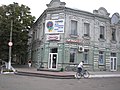
Former boys' gymnasium

Local history museum


References[]
- ^ Skirda, Alexandre (2004) [1982]. Nestor Makhno–Anarchy's Cossack: The Struggle for Free Soviets in the Ukraine 1917–1921. Translated by Sharkey, Paul. Oakland: AK Press. p. 2. ISBN 978-1-902593-68-5. OCLC 60602979.
- ^ a b c Rudenko, Eugene; Sarakhman, Eldar (9 October 2020). "Воля або смерть. Чим живе Гуляйполе – батьківщина анархіста Нестора Махна" ["We are from Makhnograd." What do they think about Zelensky in Huliaipole and how do they treat the anarchist Nestor Makhno]. Ukrayinska Pravda (in Ukrainian). Huliaipole: East View Publications. OCLC 1066371688. Retrieved 17 December 2021.
- ^ "Чисельність наявного населення України (Actual population of Ukraine)" (PDF) (in Ukrainian). State Statistics Service of Ukraine. Retrieved 11 July 2021.
- ^ a b c d e Гуляй Поле // Большая Советская Энциклопедия. / редколл., гл. ред. Б. А. Введенский. 2-е изд. том 13. М., Государственное научное издательство «Большая Советская энциклопедия», 1952. стр.194
- ^ a b c Skirda, Alexandre (2004) [1982]. Nestor Makhno–Anarchy's Cossack: The Struggle for Free Soviets in the Ukraine 1917–1921. Translated by Sharkey, Paul. Oakland: AK Press. p. 17. ISBN 978-1-902593-68-5. OCLC 60602979.
- ^ McKay, Iain. "Notes on the Makhnovista, Nestor Makhno and the Russian Civil war in the Eastern Ukraine". Struggle.ws. An Anarchist FAQ. Retrieved 17 December 2021.
- ^ a b Skirda, Alexandre (2004) [1982]. Nestor Makhno–Anarchy's Cossack: The Struggle for Free Soviets in the Ukraine 1917–1921. Translated by Sharkey, Paul. Oakland: AK Press. p. 358. ISBN 978-1-902593-68-5. OCLC 60602979.
- ^ a b c d Гуляйполе // Большая Советская Энциклопедия. / под ред. А. М. Прохорова. 3-е изд. том 7. М., «Советская энциклопедия», 1972.
- ^ a b Гуляйполе // Большой энциклопедический словарь (в 2-х тт.). / редколл., гл. ред. А. М. Прохоров. том 1. М., "Советская энциклопедия", 1991. стр.349
- ^ "Гуляйполе". Геоінформаційна система місць «Голодомор 1932—1933 років в Україні». Ukrainian Institute of National Memory. Retrieved 17 December 2021.
- ^ a b Справочник «Освобождение городов: Справочник по освобождению городов в период Великой Отечественной войны 1941—1945». М. Л. Дударенко, Ю. Г. Перечнев, В. Т. Елисеев и др. М.: Воениздат, 1985. 598 с.
- ^ Исаев А. В. От Дубно до Ростова. — М.: АСТ; Транзиткнига, 2004.
- ^ История второй мировой войны (в 12 тт.). том 7. / редколл., гл. ред. А. А. Гречко. М., Воениздат, 1976. стр.203
- ^ «235803 Гуляйпольський дослідно-експериментальний завод сільськогосподарських машин»
Постанова Кабінету міністрів України № 343а від 15 травня 1995 р. «Перелік об'єктів, що підлягають обов’язковій приватизації у 1995 році» - ^ Постанова Кабінету міністрів України № 343б від 15 травня 1995 р. «Перелік об'єктів, що підлягають обов’язковій приватизації у 1995 році»
- ^ «03572808 Радгосп „Зарічний“, м. Гуляйполе»
Постанова Кабінету міністрів України № 538 від 20 липня 1995 р. «Про доповнення переліку об'єктів, що підлягають обов’язковій приватизації у 1995 році» - ^ Господарським судом в Запорізькій області 17.12.2004 року порушено провадження у справі № 19/222 (04) про банкрутство ВАТ "Гуляйпільський завод «Сільмаш» // газета «», № 25 (3525) від 10 лютого 2005
- ^ "Про утворення та ліквідацію районів". Resolutions (in Ukrainian) (807–IX). Verkhovna Rada. 17 July 2020. Retrieved 17 December 2021.
- ^ "Гуляйполе — столиця степів". Zaporizhia Regional Tourist Information Center (in Ukrainian). Zaporizhzhia Oblast. Archived from the original on 15 November 2009. Retrieved 17 December 2021.
- ^ Skirda, Alexandre (2004) [1982]. Nestor Makhno–Anarchy's Cossack: The Struggle for Free Soviets in the Ukraine 1917–1921. Translated by Sharkey, Paul. Oakland: AK Press. pp. 17, 358. ISBN 978-1-902593-68-5. OCLC 60602979.
- ^ Всесоюзная перепись населения 1989 г. Численность городского населения союзных республик, их территориальных единиц, городских поселений и городских районов по полу
- ^ Чисельність наявного населення України на 1 січня 2013 року. Державна служба статистики України. Київ, 2013. стор.63
External links[]
- The murder of the Jews of Huliaipole during World War II, at Yad Vashem website.
| Raions | ||
|---|---|---|
| Hromadas |
| |
| Cities | ||
| Urban-type settlements | ||
| Authority control |
|---|
- Cities in Zaporizhzhia Oblast
- Alexandrovsky Uyezd (Yekaterinoslav Governorate)
- Makhnovism
- Cities of district significance in Ukraine
- Populated places established in the Russian Empire
- Holocaust locations in Ukraine
- 1785 establishments in the Russian Empire
- 1938 establishments in the Soviet Union