Yekaterinoslav Governorate
| Yekaterinoslav Governorate Екатеринославская губернія | |||||||||
|---|---|---|---|---|---|---|---|---|---|
| Governorate of Russian Empire, Ukrainian State, Ukrainian Soviet Socialist Republic | |||||||||
| 1802–1925 | |||||||||
 Coat of arms
| |||||||||
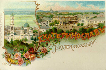
 A historic map of the Yekaterinoslav Governorate. | |||||||||
| Capital | Yekaterinoslav | ||||||||
| Population | |||||||||
• (1897) | 2113700 | ||||||||
| History | |||||||||
| History | |||||||||
• Established | 27 February 1802 | ||||||||
• Disestablished | 1 August 1925 | ||||||||
| Political subdivisions | uezds: 8 (9 1874–85) | ||||||||
| |||||||||
| Today part of | Ukraine | ||||||||
The Yekaterinoslav Governorate (Russian: Екатеринославская губернія; translit.: Yekaterinoslavskaya guberniya; Ukrainian: Катеринославська губернія, romanized: Katerynoslavska huberniia) or Government of Yekaterinoslav was a governorate in the Russian Empire. A common name for it in Ukrainian was Katerynoslavshchyna. Its capital was the city of Yekaterinoslav (Katerynoslav in Ukrainian, modern Dnipro). Today its territory is part of Ukraine.
Location[]
The government was created in 1802 out of the Yekaterinoslav vice-regency. It is located within the former lands of Zaporizhian Sich. The governorate bordered to the north with the Kharkov Governorate and Poltava Governorate, to the west and southwest with the Kherson Governorate, to the south with the Taurida Governorate and Sea of Azov, and to the east with Don Host Oblast.
Administrative divisions[]
The governorate was created in place of Novorossiysk Governorate in 1802 and encompassed a huge area of the southern Ukraine. Officially, the new governorate was created as Ekaterinoslav Governorate in 1802 and subdivided into the following uyezds with centres in:
- Yekaterinoslavsky Uyezd (Yekaterinoslav) (Екатеринославъ, Катеринослав) 1802–1923
- Pavlogradsky Uyezd (Pavlograd) (Павлоградъ, Павлоград) 1802–1923
- Bakhmutsky Uyezd (Bakhmut) (Бахмутъ, Бахмут) 1802–1920 transferred to Governorate of Donetsk
- Novomoskovsky Uyezd (Novomoskovsk) (Новомосковскъ, Новомосковськ) 1802–1923
- Mariupolsky Uyezd (Mariupol) 1802–1807, 1874–1923 (1807–1874 part of Aleksandrovsk as Greek district)
- Alexandrovsky Uyezd (Alexandrovsk) (Александровскъ, Олександрівськ) 1805–1920 transferred to Governorate of Zaporizhia, created from both Mariupol and Pavlohrad
- Slavyanoserbsky Uyezd (Slavyanoserbsk) (Славяносербскъ, Слав'яносербськ) 1805–1920 created out Bakhmut, transferred to Governorate of Donetsk
- Verkhnedneprovsky Uyezd (Verkhnedneprovsk) (Верхнеднепровск, Верхньодніпровськ) 1805–1923, created out of Yekaterinoslavsky Uyezd
- Taganrog 1805–1887, 1918 (1887–1918 part of Don Host Oblast)
- Taganrog city (Таганрог) 1802–1887
- Rostov upon Don city 1802–1887

Changes in Russian Empire[]
- 1874, the Mariupol (Марiуполь) uyezd was split off the Aleksandrovsk uyezd.
- 1887, Rostov-na-Donu city as well as Taganrog city with its uyezd were transferred back to the Don Host Oblast.
Ukraine[]
- 1918, Taganrog uyezd was transferred once again, but without the Taganrog city and later again returned to the Don Voisko Province. The Ukrainian People's Republic passed the law for the reformation of the Ukrainian administrative division dividing the governorate into five new lands. The law has failed to be implemented and was canceled due to the nationalist-conservative coup d'état of Pavlo Skoropadsky and establishment of the Ukrainian State. Thus the territory of the governorate was left unchanged and sustained without any major changes until 1919.
South Russia[]
- 1919 Krivyi Rih uyezd was created partially out of the newly annexed lands of the Kherson Governorate.
Soviet Ukraine[]
- 1920 Governorate yielded few territories in favor of the newly created Olexandrivsk Governorate and Donetsk Governorate
- 1922 Zaporizhia Governorate was abolished and its territories returned under the subordination of Yekaterinoslav Governorate together with some of .
- 1923 All Governorates uyezds were reformed into seven okrugs with two of them (Berdiansk and Oleksandriysk okrugs) liquidated on 3 June 1925.
- On 1 August 1925, the Yekaterinoslav Governorate administration was discontinued.
Okrugs[]
List of okruhas of Ukraine upon the dissolution of the Governorate:
- Yekaterinoslav
- Zaporizhia
- Kryvyi Rih
- Melitopol
- Pavlohrad
Demographics[]
The governorate's population, a majority of peasants, was 662,000 in 1811, 902,400 in 1851, 1,204,800 in 1863, and 1,792,800 in 1885. From the second half of the 19th century, with the founding of Yuzovka (Donetsk), the governorate became the coal-mining and metallurgical center of the then Ukraine, incorporating the Dnieper Industrial Region and the Donbass (Donets Basin).
Its population increased to 2,113,674 by 1897. The nationalities within the governorate were Ukrainians – 68.9%, Russians – 17.3%, Jews (4.7%), Germans (3.8%), Greeks (2.3%), and Tatars (0.8%). In 1924, the governorate had 3,424,100 (13.6% urban) inhabitants, living in 5,165 settlements, 36 of them being cities and urban-type settlements. The largest social class was that of workers (about 25%).
Principal cities[]
The data is taken from demoscope.ru. Here is also the most common language composition.
- Yekaterinoslav – 112,839[1] (1897), (Russian – 47,140, Jewish – 39,979, Ukrainian – 17,787)
- Mariupol – 31,116 (Russian – 19,670, Jewish – 4,710, Ukrainian – 3,125)
- Lugansk – 20,404 (Russian – 13,907, Ukrainian – 3,902, Jewish – 1,449)
- Bakhmut – 19,316 (Ukrainian – 11,928, Russian – 3,659, Jewish – 3,223)
- Aleksandrovsk – 18,849 (Ukrainian – 8,101, Jewish – 5,248, Russian – 4,667)
- Pavlograd 15,775 (Russian – 5,421, Ukrainian – 5,273, Jewish – 4,353)
- Novomoskovsk – 12,883 (Ukrainian – 9,956, Jewish – 1,436, Russian – 1,237)
- Verkhnedneprovsk – 6,501 (Ukrainian – 3,752, Jewish – 2,061, Russian – 739)
- Slavianoserbsk – 3,122 (Russian – 1,607, Ukrainian – 1,342, Jewish – 143)
From the turn of the 19th century until 1887 city of Rostov-na-Donu and all the Taganrog uyezd were part of the governorate, but before the census of 1897 took place they were transferred to the . Note that the biggest city of the guberniya was the city of Rostov-na-Donu while Taganrog was not much smaller and the third in size. Here is the data on them:
- Rostov-na-Donu – 119,476 (Russian – 94,673, Jewish – 11,183, Ukrainian – 5,612)
- Taganrog – 51,437 (Russian – 40,899, Ukrainian – 4,676, Jewish – 2,685)
Language[]
- By the Imperial census of 1897.
| Native language | Yekaterinoslav Governorate Екатеринославская губерния [2] |
For each uyezd (district) | ||||||||
|---|---|---|---|---|---|---|---|---|---|---|
| Yekaterinoslav Екатеринославский уезд [3] |
Pavlograd Павлоградский уезд [4] |
Bakhmut Бахмутский уезд [5] |
Novomoskovsk Новомосковский уезд [6] |
Mariupol Мариупольский уезд [7] |
Alexandrovsk Александровский уезд [8] |
Slavyanoserbsk Славяносербский уезд [9] |
Verkhnedneprovsk Верхнеднепровский уезд [10] | |||
| Number | % | Number | Number | Number | Number | Number | Number | Number | Number | |
| Total | 2,113,674 | 100% | 357,207 | 251,460 | 332,478 | 260,368 | 254,056 | 271,678 | 174,753 | 211,674 |
| Great Russian | 364,974 | 17.27% | 75,190 | 36,164 | 103,702 | 9,628 | 35,691 | 15,445 | 79,281 | 9,873 |
| Little Russian (Ukrainian) | 1,456,269 | 68.90% | 198,982 | 200,434 | 193,510 | 242,737 | 117,206 | 224,122 | 88,218 | 191,160 |
| Belorussian | 14,052 | 0.66% | 4,033 | 505 | 2,468 | 196 | 1,697 | 3,353 | 1,564 | 236 |
| Polish | 12,365 | 0.59% | 7,933 | 553 | 2,000 | 316 | 528 | 293 | 511 | 231 |
| German | 80,979 | 3.83% | 20,609 | 5,806 | 12,646 | 3,452 | 19,104 | 14,014 | 896 | 4,452 |
| French | 908 | 0.04% | 197 | 8 | 451 | 50 | 46 | 18 | 122 | 16 |
| Italian | 146 | 0.01% | 21 | 1 | 37 | 0 | 39 | 14 | 25 | 9 |
| Romanian and Moldovan | 9,175 | 0.43% | 1,771 | 29 | 6,371 | 0 | 95 | 2 | 839 | 68 |
| English | 369 | 0.02% | 14 | 1 | 284 | 0 | 41 | 2 | 13 | 14 |
| Greek | 48,740 | 2.31% | 193 | 38 | 142 | 9 | 48,290 | 45 | 14 | 9 |
| Jewish | 99,152 | 4.69% | 46,441 | 7,363 | 9,457 | 3,635 | 10,291 | 13,886 | 2,631 | 5,448 |
| Tatar | 17,253 | 0.82% | 868 | 255 | 346 | 7 | 15,472 | 128 | 151 | 26 |
| Turkish | 5,555 | 0.26% | 168 | 15 | 20 | 9 | 5,317 | 14 | 4 | 8 |
| Roma (Gypsy) | 1,293 | 0.06% | 103 | 172 | 255 | 272 | 21 | 203 | 177 | 90 |
| Other | 1,888 | 0.09% | 519 | 71 | 655 | 28 | 164 | 77 | 251 | 23 |
| Unidentified | 556 | 0.03% | 165 | 45 | 134 | 29 | 54 | 62 | 56 | 11 |
Religion[]
- By the Imperial census of 1897.[11]
| Religion | Number | percentage (%) | males | females | In the cities | Outside the cities |
|---|---|---|---|---|---|---|
| Eastern Orthodox | 1,903,264 | 90.05% | 982,616 | 920,648 | 167,263 | 1,736,001 |
| Judaism | 101,088 | 4.78% | 51,679 | 49,409 | 64,024 | 37,064 |
| Lutherans | 39,530 | 1.87% | 19,972 | 19,558 | 2,085 | 37,445 |
| Roman Catholics | 32,154 | 1.52% | 17,658 | 14,496 | 5,388 | 26,766 |
| Mennonites | 23,922 | 1.13% | 12,132 | 11,790 | 208 | 23,714 |
| Old Believers and deviants from orthodoxy | 9,393 | 0.44% | 4,699 | 4,694 | 421 | 8,972 |
| Muslims | 2,090 | 0.10% | 1,700 | 390 | 1,039 | 1,051 |
| Baptists | 1,150 | 0.05% | 606 | 544 | 5 | 1,145 |
| Armenian-Gregorian | 448 | 0.02% | 301 | 147 | 225 | 223 |
| Karaites | 359 | 0.02% | 178 | 181 | 302 | 57 |
| Reformed Christian | 157 | 0.01% | 95 | 62 | 15 | 142 |
| Anglican | 46 | 0.00% | 26 | 20 | 16 | 30 |
| Other | 73 | 0.00% | 53 | 20 | 14 | 43 |
| Total | 2,113,674 | 100% | 1,091,715 | 1,021,959 | 241,005 | 1,872,669 |
Governors[]
- General-Governors
- 1823–1844 Mikhail Vorontsov
- Governors
- 1802–1803
- 1803–1809
- 1809–1817
- 1817–1820
- 1820–1823
- 1823–1824
- 1824–1828
- 1828–1831
- 1831–1832 Otto Frank
- 1832–1836
- 1836–1837 (vice-governor)
Chairmen of the Governorate[]
- Revkoms
- 26 October 1917 – ? Emmanuil Kviring
- November 1919 – 1920
- Ispolkom
- February 1919 – 1920 Vasiliy Averin
- 1920 – 1921
- 1921
- ? – 1923
- 1923 – 1924 Samokhvalov
- February 1925 – August 1925
Chekists[]
- Cheka
- 1919 (transferred to Volyn Cheka)
- 1919–1920 (transferred to Mykolaiv Cheka)
- Gub-department of GPU
- 24 May 1922 – 16 February 1923 (transferred to Podolia Cheka)
- 1923 P. Onishchenko
- 1 September 1924 – 1 September 1925
See also[]
References[]
- ^ Population of Yekaterinoslav
- ^ Екатеринославская губерния - вся [Yekaterinoslav Governorate, all], Первая всеобщая перепись населения Российской Империи 1897 г. Распределение населения по родному языку и уездам 50 губерний Европейской России [The first national census of the Russian Empire in 1897. Distribution of the population by mother tongue and uyezd of 50 provinces of European Russia.], Демоскоп Weekly
- ^ Екатеринославский уезд - весь [Yekaterinoslav Uyezd, all], Первая всеобщая перепись населения Российской Империи 1897 г. Распределение населения по родному языку и уездам 50 губерний Европейской России [The first national census of the Russian Empire in 1897. Distribution of the population by mother tongue and uyezd of 50 provinces of European Russia.], Демоскоп Weekly
- ^ Павлоградский уезд - весь [Pavlograd Uyezd, all], Первая всеобщая перепись населения Российской Империи 1897 г. Распределение населения по родному языку и уездам 50 губерний Европейской России [The first national census of the Russian Empire in 1897. Distribution of the population by mother tongue and uyezd of 50 provinces of European Russia.], Демоскоп Weekly
- ^ Бахмутский уезд- весь [Bakhmut Uyezd, all], Первая всеобщая перепись населения Российской Империи 1897 г. Распределение населения по родному языку и уездам 50 губерний Европейской России [The first national census of the Russian Empire in 1897. Distribution of the population by mother tongue and uyezd of 50 provinces of European Russia.], Демоскоп Weekly
- ^ Новомосковский уезд - весь [Novomoskovsk Uyezd, all], Первая всеобщая перепись населения Российской Империи 1897 г. Распределение населения по родному языку и уездам 50 губерний Европейской России [The first national census of the Russian Empire in 1897. Distribution of the population by mother tongue and uyezd of 50 provinces of European Russia.], Демоскоп Weekly
- ^ Мариупольский уезд - весь [Mariupol Uyezd, all], Первая всеобщая перепись населения Российской Империи 1897 г. Распределение населения по родному языку и уездам 50 губерний Европейской России [The first national census of the Russian Empire in 1897. Distribution of the population by mother tongue and uyezd of 50 provinces of European Russia.], Демоскоп Weekly
- ^ Александровский уезд - весь [Alexandrovsk Uyezd, all], Первая всеобщая перепись населения Российской Империи 1897 г. Распределение населения по родному языку и уездам 50 губерний Европейской России [The first national census of the Russian Empire in 1897. Distribution of the population by mother tongue and uyezd of 50 provinces of European Russia.], Демоскоп Weekly
- ^ Славяносербский уезд - весь [Slavyanoserbsk Uyezd, all], Первая всеобщая перепись населения Российской Империи 1897 г. Распределение населения по родному языку и уездам 50 губерний Европейской России [The first national census of the Russian Empire in 1897. Distribution of the population by mother tongue and uyezd of 50 provinces of European Russia.], Демоскоп Weekly
- ^ Верхнеднепровский уезд - весь [Verkhnedneprovsk Uyezd, all], Первая всеобщая перепись населения Российской Империи 1897 г. Распределение населения по родному языку и уездам 50 губерний Европейской России [The first national census of the Russian Empire in 1897. Distribution of the population by mother tongue and uyezd of 50 provinces of European Russia.], Демоскоп Weekly
- ^ The first national census of the Russian Empire in 1897, Ed. N.A.Troynitskogo. t.I. The total body of the Empire's first general census of population development results produced by 28 January 1897. St. Petersburg, 1905. Table XII. Population by religions.
Religion Statistics of 1897 Yekaterinoslav (in Russian)
Religion Statistics of 1897 Yekaterinoslav in the cities (in Russian)
External links[]
- Yekaterinoslav Guberniya – Historical coat of arms (in Ukrainian and English)
- Katerinoslav gubernia – Article in the Encyclopedia of Ukraine
Coordinates: 48°27′00″N 34°59′00″E / 48.4500°N 34.9833°E

- States and territories established in 1802
- States and territories disestablished in 1925
- Yekaterinoslav Governorate
- Governorates of the Russian Empire
- Governorates of Ukraine
- 19th century in Ukraine
- 20th century in Ukraine
- 1802 establishments in the Russian Empire
- 1925 disestablishments in the Soviet Union
- 1802 establishments in Ukraine
- 1925 disestablishments in Ukraine