Poltava Governorate
| Poltava Governorate Полтавская губернія | |||||||||
|---|---|---|---|---|---|---|---|---|---|
| Governorate of Russian Empire | |||||||||
| 1802–1925 | |||||||||
 Flag | |||||||||
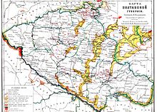 An old map showing the Poltava Governorate. | |||||||||
| Capital | Poltava | ||||||||
| Area | |||||||||
• (1897) | 49,365 km2 (19,060 sq mi) | ||||||||
| Population | |||||||||
• (1897) | 2778151 | ||||||||
| History | |||||||||
| History | |||||||||
• Established | 27 February 1802 | ||||||||
• Disestablished | 1 August 1925 | ||||||||
| Political subdivisions | uezds: 15 (1803) | ||||||||
| |||||||||
The Poltava Governorate (Russian: Полтавская губернія; translit.: Poltavskaya guberniya, Ukrainian: Полтавська Губернія, romanized: Poltavska huberniia) or Government of Poltava was a guberniya in the historical Left-bank Ukraine region of the Russian Empire. It was officially created in 1802 from the disbanded Malorossiya Governorate, which was split between the Chernigov Governorate and Poltava Governorate with an administrative center of Poltava.
It was also known as Piltavshchyna.[1]
Administrative division[]
It was administered by 15 uezds (povits):
- Gadyachsky Uyezd (Gadyach – Гадячъ) (Hadiach)
- Zenkovsky Uyezd (Zenkov – Зеньковъ) (Zinkiv)
- Zolotonoshsky Uyezd (Zolotonosha – Золотоноша)
- Kobelyaksky Uyezd (Kobeliaky – Кобеляки)
- Konstantinogradsky Uyezd (Konstantinograd – Константиноградъ) (modern Krasnohrad)
- Kremenchugsky Uyezd (Kremenchug – Кременчугъ) (Kremenchuk)
- Lokhvitsky Uyezd (Lokhvytsia – Лохвица) (Lokhvytsia)
- Lubensky Uyezd (Lubny – Лубны)
- Mirgorodsky Uyezd (Mirgorod – Миргородъ) (Myrhorod)
- Pereyaslavsky Uyezd (Pereiaslav – Переяславъ)
- Piryatinsky Uyezd (Pyriatyn – Пирятинъ) (Pyriatyn)
- Poltavsky Uyezd (Poltava – Полтава)
- Priluksky Uyezd (Pryluky – Прилуки) (Pryluky)
- Romensky Uyezd (Romny – Ромны)
- Khorolsky Uyezd (Khorol – Хороль)
Most of these ended up in the modern Poltava Oblast of Ukraine, although some: Zolotonosha, Konstantinograd, Pereyaslav and Romny are now part of Cherkasy, Kharkiv, Kiev and Sumy Oblasts respectively.
The Poltava Governorate covered a total area of 49,365 km2, and had a population of 2,778,151 according to the 1897 Russian Empire census. It was bordering the following Russian Governorates: Chernigov Governorate and Kursk Governorate to the north, Kiev Governorate to the west, Kharkov Governorate to the east, Kherson Governorate and Yekaterinoslav Governorate to the south. In 1914, the population was 2,794,727. After the formation of the Ukrainian SSR, the territory was wholly included into the new Soviet Republic. Initially the governorate system was retained although variations included the which was temporarily formed on its territory (August 1920 – December 1922), and the passing of the Pereyaslav uezd to the Kiev Governorate. However, on Third of June 1925 the guberniya was liquidated and replaced by five okrugs (which already were the uyezd subdivision as of seventh of March 1923): Kremenchutsky, Lubensky, Poltavsky, Prylutsky and Romensky (the rest two okrugs existed within the guberniya, Zolotonoshsky and Krasnohradsky, were also liquidated).
Principal cities[]

Russian Census of 1897, the cities of more than 10,000 people. In bold are the cities of over 50,000.
- Kremenchug – 63,007 (Jewish – 29,577, Ukrainian – 18,980, Russian – 12,130)
- Poltava – 53,703 (Ukrainian – 30,086, Russian – 11,035, Jewish – 10,690)
- Romny – 22,510 (Ukrainian – 13,856, Jewish – 6,341, Russian – 1,933)
- Priluki – 18,532 (Ukrainian – 11,850, Jewish – 5,719, Russian – 821)
- Pereyaslav – 14,614 (Ukrainian – 8,348, Jewish – 5,737, Russian – 468)
- Kobeliaki – 10,487 (Ukrainian – 7,708, Jewish – 2,115, Russian – 564)
- Zenkov – 10,443 (Ukrainian – 8,957, Jewish – 1,261, Russian – 187)
- Lubny – 10,097 (Ukrainian – 5,975, Jewish – 3,001, Russian – 960)
- Mirgorod – 10,037 (Ukrainian – 8,290, Jewish – 1,248, Russian – 427)
Language[]
By the Imperial census of 1897,[2] in bold are languages spoken by more people than the state language.

| Language | Number | percentage (%) | males | females |
|---|---|---|---|---|
| Ukrainian | 2,583,133 | 92.98 | ||
| Yiddish | 110,352 | 3.97 | ||
| Russian | 72 941 | 2.63 | ||
| German | 4 579 | 0.16 | ||
| Polish | 3 891 | 0.14 | ||
| Belorussian | 1 344 | 0.05 | ||
| Persons that did not identify their native language |
92 | <0.01 | ||
| Other[note 1] | 1 819 | 0.07 |
Religion[]
By the Imperial census of 1897,[3] the major religion in the region that was virtually the state religion was the Eastern Orthodox with some population following Judaism. Other religions in the governorate were much less common.
| Religion | Number | percentage (%) | males | females |
|---|---|---|---|---|
| Eastern Orthodox | 2,654,645 | 95.55 | ||
| Judaism | 110,944 | 3.99 | ||
| Other[note 2] (Roman Catholics, Lutherans, Old Believers) | 12 562 | 0.45 |
Notes[]
References[]
- ^ Mikhail Levchenko. Hanshchyna (Ганьщина Україна). Opyt russko-ukrainskago slovari︠a︡. Tip. Gubernskago upravlenii︠a︡, 1874.
- ^ Language Statistics of 1897 (in Russian)
- ^ Religion Statistics of 1897 (in Russian)
External links[]
- Poltava Guberniya – Article in Brockhaus and Efron Encyclopedic Dictionary (in Russian)
- Poltava Governorate – Historical coat of arms (in Ukrainian and English)
- Chernihiv gubernia – Article in the Encyclopedia of Ukraine
Coordinates: 49°34′28″N 34°34′07″E / 49.5744°N 34.5686°E

- States and territories established in 1802
- States and territories disestablished in 1925
- Poltava Governorate
- Governorates of the Russian Empire
- Governorates of Ukraine
- 1802 establishments in the Russian Empire
- 1802 establishments in Ukraine
- 1925 disestablishments in Ukraine