Hunucmá
Hunucmá | |
|---|---|
Municipal Seat | |
 Principal Church of Hunucmá | |
 Coat of arms | |
 | |
 Hunucmá | |
| Coordinates: 21°00′55″N 89°52′28″W / 21.01528°N 89.87444°WCoordinates: 21°00′55″N 89°52′28″W / 21.01528°N 89.87444°W | |
| Country | |
| State | Yucatán |
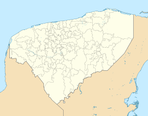
| Municipality | Hunucmá |
| Elevation | 6 m (20 ft) |
| Population (2020) | |
| • Total | 28,412[1] |
| Time zone | UTC-6 (Central Standard Time) |
| • Summer (DST) | UTC-5 (Central Daylight Time) |
| Postal code | 97350 |
| Area code(s) | 988 |

Hunucmá is a town and the municipal seat of the Hunucmá Municipality, Yucatán in Mexico. As of 2020, the town has a population of 28,412.[1]

Municipal headquarters

Park of Hunucmá
Demographics[]
Climate[]
| ||||||||||||||||||||||||||||||||||||||||||||||||||||||||||||||||||||||||||||||||||||||||||||||||||||||||||||||||||||||||||||
References[]
- ^ a b "Censo de Población y Vivienda 2020 - SCITEL" (in Spanish). INEGI. Retrieved 2021-01-27.
- ^ "NASA Earth Observations Data Set Index". NASA. Retrieved 30 January 2016.
- ^ Peel, M C; Finlayson, B L. "Updated world map of the Köppen-Geiger climate classification". Hydrology and Earth System Sciences. 11: 1633–1644. doi:10.5194/hess-11-1633-2007. Retrieved 30 January 2016.
Mérida (capital) | |||||||||||||||
| Topics |  | ||||||||||||||
| Metros | |||||||||||||||
| Larger cities | |||||||||||||||
| Smaller cities | |||||||||||||||
| Municipalities |
| ||||||||||||||
This article about a location in the state of Mexico is a stub. You can help Wikipedia by . |
Categories:
- Populated places in Yucatán
- Municipality seats in Yucatán
- State of Mexico geography stubs