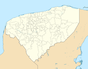
Oxkutzcab
Oxkutzcab | |
|---|---|
Municipal Seat | |
 City hall in April 2021 | |
 Coat of arms | |
 | |
 Oxkutzcab | |
| Coordinates: 20°18′20″N 89°25′06″W / 20.30556°N 89.41833°WCoordinates: 20°18′20″N 89°25′06″W / 20.30556°N 89.41833°W | |
| Country | |
| State | Yucatán |
| Municipality | Oxkutzcab |
| Elevation | 23 m (75 ft) |
| Population (2015) | |
| • Total | 21,508[1] |
| Time zone | UTC-6 (Central Standard Time) |
| Postal code | 97880 |
| Area code(s) | 997 |
| Demonym | Oxkutzcabense |
Oxkutzcab is a town and the municipal seat of the Oxkutzcab Municipality, Yucatán in Mexico. As of 2015, the town has a population of 33,854.[1]

Demographics[]
Climate[]
| ||||||||||||||||||||||||||||||||||||||||||||||||||||||||||||||||||||||||||||||||||||||||||||||||||||||||||||||||||||||||||||
References[]
- ^ a b Oxkutzkab sa Geonames.org (cc-by); post updated 2015-06-22; database download sa 2016-10-22
- ^ "NASA Earth Observations Data Set Index". NASA. Retrieved 30 January 2016.
- ^ Peel, M C; Finlayson, B L. "Updated world map of the Köppen-Geiger climate classification". Hydrology and Earth System Sciences. 11: 1633–1644. doi:10.5194/hess-11-1633-2007. Retrieved 30 January 2016.
Categories:
- Populated places in Yucatán
- Municipality seats in Yucatán
- State of Mexico geography stubs

