Temozón Municipality
Temozón | |
|---|---|
Municipality | |
 | |
 Temozón Location of the Municipality in Mexico | |
| Coordinates: 20°55′N 87°55′W / 20.917°N 87.917°WCoordinates: 20°55′N 87°55′W / 20.917°N 87.917°W | |
| Country | |
| State | |
| Mexico Ind. | 1821 |
| Yucatan Est. | 1824 |
| Municipality Est. | 1915[1] |
| Government | |
| • Type | PRI |
| • Municipal President | Carlos Manuel Aguilar Loria[1] |
| Area | |
| • Total | 1,087.06 km2 (419.72 sq mi) |
| [1] | |
| Elevation | 22 m (72 ft) |
| Population | |
| • Total | 14,008 |
| • Demonym | Temozonense |
| Time zone | UTC-6 (Central Standard Time) |
| • Summer (DST) | UTC-5 (Central Daylight Time) |
| INEGI Code | 085 |
| Major Airport | Merida (Manuel Crescencio Rejón) International Airport |
| IATA Code | MID |
| ICAO Code | MMMD |

Temozón Municipality is one of the 106 subdivisions of the State of Yucatán in Mexico. Its municipal seat is located in the City of Temozón.
Location[]
This municipality is located in the eastern region of the state. It is between latitudes 20° 48 'and 20° 57' north and longitudes 87° 47' and 88 ° 16' west.[1]
Its northern border is Calotmul - Tizimín, to the south is Valladolid, on the east Chemax and the west Espita and Uayma.[1]
Communities[]
The municipality is made up of 99 different communities, of which the most important are:[1]
- Temozón (Municipal Center)
- Hunuku
- Nahbalam
- Yokdzonot Presentado
- Santa Rita
Landmarks[]
Architectural[]
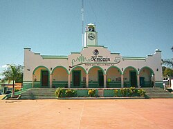
San Roman Church, built during the colonial period (probably in the eighteenth century). The church of San Antonio de Padua, and the municipal building.[1]
Archeological[]
References[]
- ^ a b c d e f g h i "Nuestros municipios - Temozón". Archived from the original on 2009-07-24. Retrieved 2009-11-11.
- ^ "Encyclopedia of the Municipalities of Mexico: Yucatan". Archived from the original on 2008-11-20. Retrieved 2009-11-01.
- ^ Census Results by Locality, 2005 Archived 2011-07-22 at the Wayback Machine INEGI.
Mérida (capital) | |||||||||||||||
| Topics |  | ||||||||||||||
| Metros | |||||||||||||||
| Larger cities | |||||||||||||||
| Smaller cities | |||||||||||||||
| Municipalities |
| ||||||||||||||
Categories:
- Municipalities of Yucatán