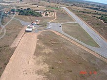
Iguatu Airport
Dr. Francisco Tomé da Frota Airport Aeroporto Dr. Francisco Tomé da Frota | |||||||||||
|---|---|---|---|---|---|---|---|---|---|---|---|
 | |||||||||||
| Summary | |||||||||||
| Airport type | Public | ||||||||||
| Serves | Iguatu | ||||||||||
| Time zone | Time in Brazil (UTC−03:00) | ||||||||||
| Elevation AMSL | 213 m / 699 ft | ||||||||||
| Coordinates | 06°20′52″S 039°17′55″W / 6.34778°S 39.29861°WCoordinates: 06°20′52″S 039°17′55″W / 6.34778°S 39.29861°W | ||||||||||
| Map | |||||||||||
 QIG Location in Brazil | |||||||||||
| Runways | |||||||||||
| |||||||||||

Dr. Francisco Tomé da Frota Airport (IATA: QIG, ICAO: SNIG), is the airport serving Iguatu, Brazil.
Airlines and destinations[]
No scheduled flights operate at this airport.
Access[]
The airport is located 2 km (1 mi) from downtown Iguatu.
See also[]
References[]
- ^ "Aeródromos". ANAC (in Portuguese). 29 June 2020. Retrieved 17 May 2021.
External links[]
- Airport information for SNIG at Great Circle Mapper. Source: DAFIF (effective October 2006).
- Current weather for SNIG at NOAA/NWS
- Accident history for SNIG at Aviation Safety Network
Categories:
- Airports in Ceará