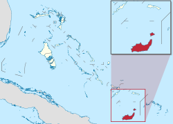
Inagua
District of Inagua | |
|---|---|
District | |
|
Coat of arms | |
 | |
| Country | |
| Island | Great Inagua |
| Established | 1800 |
| Government | |
| • Type | District Councils |
| • Sr. Chief Councillor | Ronald Roker |
| • Jr.Deputy Chief Councillor | Nirel Moultrie |
| • Jr.Treasurer | Perontay Fawkes |
| Area | |
| • Total | 1,679 km2 (648 sq mi) |
| Population (2010) | |
| • Total | 913 |
| • Density | 0.54/km2 (1.4/sq mi) |
| Time zone | UTC−5 (EST) |
| • Summer (DST) | UTC−4 (EDT) |
| Area code(s) | 242 |
Inagua is the southernmost district of the Bahamas, comprising the islands of Great Inagua and Little Inagua. The headquarters for the district council are in Matthew Town.[1]
History[]
The original settler name Heneagua was derived from a Spanish expression meaning 'water is to be found there'.[2] Two names of apparent Lucayan origin, Inagua (meaning "Small Eastern Island") and Baneque (meaning "Big Water Island"), were used by the Spanish to refer to Great Inagua.[3]
Between the years of 1500 and 1825, many documented treasure laden ships were destroyed on Inaguan reefs. The two most valuable wrecks lost off the Inaguas were treasure-laden Spanish galleons: the Santa Rosa in 1599; and the Infanta in 1788. Other ships of considerable value that were wrecked there include the French Le Count De Paix in 1713,[4] the British HMS Lowestoffe in 1801,[5][6] and the British HMS Statira in 1815.[7]
As early as the 1600s, salt was being produced and shipped to Spanish colonies,[8] and its extraction was a going business by 1803.[8]
Henri Christophe, king of northern Haiti from 1811 to 1820, built[when?] a summer retreat at the Northeast Point of Great Inagua.[8] Local legend has it that he also buried a cache of gold there.[9]
By 1918, after the end of World War I, lower salt prices and competition had driven the small producers on Great Inagua out of business, and the salt works were abandoned except for incidental local use.[10]
In 1935, the Erickson brothers from Massachusetts founded West India Chemicals Ltd., purchasing the abandoned salt works from the British government.[11] They drilled test holes, set up offices, and began restoration of the buildings, but the locals[12] felt threatened, fearing changes to the power structure status quo.[13] In August 1937, a riot broke out, an employee was killed, and the Ericksons were forced to flee.[14][15] They soon returned, and full-scale development resumed.[16]
In the mid-1950s, Morton Salt bought the Great Inagua saltworks,[17] which includes over 80 salt ponds,[18][self-published source] now the second largest such operation in North America.[16] Morton is the major employer on the island.[19][20][21]
Islands[]
Great Inagua[]
Great Inagua is the second largest island in the Bahamas at 596 sq mi (1544 km2) and lies about 55 miles (89 kilometres) from the eastern tip of Cuba. The island is about 55 by 19 mi (89 by 31 km) in extent and mostly flat with some sand hills, the highest points being East Hill at 132 ft (40 m), Salt Pond Hill at 102 ft (31 m), and James Hill at 90 ft (27 m).[2] It encloses several lakes, most notably the 12-mile (19 km) long Lake Windsor (also called Lake Rosa) which occupies nearly a quarter of the interior. The population of Great Inagua is 913 (2010 census).[22]
The island's capital and only harbour is Matthew Town, named after , a 19th-century Governor of the Bahamas. This town houses the Morton Salt Company’s main facility, producing one million tonnes of sea salt a year — the second largest solar saline operation in North America and Inagua's main industry.[citation needed]
Great Inagua Airport (IATA: IGA, ICAO: MYIG) is located nearby.[citation needed]
A large bird sanctuary in the centre of the island has a population of more than 80,000 West Indian flamingoes and many other bird species, including the Bahama parrot, Inagua woodstar, Bahama pintail, brown pelican, tricolored heron, snowy egret, reddish egret, stripe-headed tanager, double-crested cormorant, Neotropic cormorant, roseate spoonbill, American kestrel, and burrowing owl. The Union Creek National Reserve is specially set aside for the study of green sea turtles (Chelonia mydas).[23][24]
Little Inagua[]
The neighbouring Little Inagua, 8 km (5 mi; 4 nmi) to the northeast, is uninhabited and occupied by a large Land and Sea Park.[23] It has an area of 30 sq mi (78 km2), with herds of feral donkeys and goats (descendants of stock introduced by the French). Various species of endangered sea turtles breed on the island.[23] Little Inagua has a large protective reef extending up to 1 mile (1,600 m) away from the island in all directions, which prevents boats from coming too close.[citation needed]
Gallery[]

Main Guest House in Matthew Town, Great Inagua
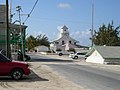
Downtown Matthew Town, Great Inagua

Old disused prison, Matthew Town, Great Inagua

Window in old prison, Matthew Town, Great Inagua
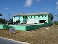
Modern police station, Matthew Town, Great Inagua

Grocery store in Matthew Town, Great Inagua

Part of the Morton Salt facilities on the north shore of Great Inagua

Northern rocky shore of Great Inagua exposing Pleistocene reef limestones


Notes[]
- ^ In 2012 $20,000 was contracted for repairs to the government complex in Matthew Town, including repairs to the clock tower rooftop, the post office area and the upstairs district council area. McCartney, Juan (13 June 2012). "Minister's contract claims disputed". The Nassau Guardian. Archived from the original on 3 February 2017.
- ^ Jump up to: a b Saunders, Gail (1993). The Bahamas: A Family of Islands (second ed.). London: Macmillan. p. 180. ISBN 978-0-333-59212-0.
- ^ Julian Granberry and Gary S. Vescelius. (2004) Languages of the Pre-Columbian Antilles. The University of Alabama Press. ISBN 0-8173-5123-X p. 83
- ^ Brooks, Baylus C. (2016). Quest for Blackbeard: The True Story of Edward Thache and His World. Lake City, Florida: Lulu. pp. 225–226. ISBN 978-1-365-32821-3. citing "America and West Indies: July 1716," Calendar of State Papers; "Journal, July 1716: Journal Book S," Journals of the Board of Trade and Plantations, Volme 3; March 1715 – October 1718 (1924), pp. 159–173
- ^ Goodwin, Peter (2002). Nelson's Ships: A History of the Vessels in which he Served: 1771–1805. Mechanicsburg, Pennsylvania: Stackpole Books. p. 63. ISBN 978-0-8117-1007-7.
- ^ Colledge, J. J.; Warlow, Ben (2006) [1969]. Ships of the Royal Navy: The Complete Record of all Fighting Ships of the Royal Navy (Rev. ed.). London: Chatham Publishing. p. 205. ISBN 978-1-86176-281-8.
- ^ The Statira Shoal, just southeast of Great Inagua, is named after it and is where the ship wrecked. Barnett, Edward; et al. (1887). "The Bahamas general description, population, exports and imports: Great Inagua". The West India Pilot, Volume II (Fourth ed.). London: HM Hydrographic Office. p. 486.
- ^ Jump up to: a b c Pavlidis, Stephen J. (2002). On and off the beaten path: The central and southern Bahamas guide from south Florida to the Turks and Caicos (second ed.). Port Washington, Wisconsin: Seaworthy Publications. p. 300. ISBN 978-0-9639566-9-9.
- ^ Hannau, Hans W.; Mock, Bernd H. (1973). Beneath the Seas of the West Indies: Caribbean, Bahamas, Florida, Bermuda. New York: Hastings House. p. 47. OCLC 253266419., reprinted in 1984 in London by Robert Hale Ltd. ISBN 978-0-7090-2064-6
- ^ Erickson 1987, p. 25.
- ^ Erickson 1987, p. 27
- ^ Notably George and Willis Duvalier who were sentenced to hang as a result of the riot. "2 Brothers Doomed in Bahamas Slaying". The New York Times. 4 November 1937. p. 7.
- ^ "Blames Gang in Inagua". The New York Times. 9 September 1937. p. 8.
- ^ "One Slain, 15 exiled in Great Inagua Riot". The New York Times. 15 August 1937. p. 9.
- ^ Erickson 1987, pp. 113–114
- ^ Jump up to: a b "Morton Salt Factory". The Bahamas Ministry of Tourism. Archived from the original on 20 March 2016.
- ^ Kurlansky, Mark (2003). "Chapter Twentysix: Big Salt Little Salt". Salt: A World History. London: Penquin. p. 350. ISBN 978-0-14-200161-5.
- ^ Johnson, Patricia (2012). The Bahama Islands Some Facts You Should Know. Bloomington, Indiana: Xlibris. p. 25. ISBN 978-1-4797-0521-4.
- ^ In 2008 Morton employed about 60% of the island's working population. "Workers at Bahamas' Morton Salt plant end strike". The San Diego Union-Tribune. Associated Press. 27 August 2008. Archived from the original on 3 February 2017. Retrieved 3 February 2017.
- ^ Scavella, Nico (20 April 2016). "Morton Salt Signs Five-Year Deal With Workers". The Tribune. The Bahamas. Archived from the original on 21 April 2016.
- ^ Morton Salt’s Inagua facility damaged by Irma. The Nassau Gardian. 11 September 2017. Retrieved 7 August 2019.
- ^ "Inagua Population by Settlement and Total Number of Occupied Dwellings: 2010 Census" (PDF). Bahamas Department of Statistics. Archived (PDF) from the original on 30 June 2016.
- ^ Jump up to: a b c "Ecotourism In Inagua". The Bahamas Ministry of Tourism. Archived from the original on 3 February 2017.
- ^ "National Park or Protected Area: Union Creek Reserve". National Geographic. Archived from the original on 3 February 2017.
Further reading[]
- Erickson, Margery O. (1987). Great Inagua. Garrison, New York: Capriole Press. OCLC 16662171.
- Klingel, Gilbert C. (1940). The Ocean Island (Inagua). New York: Dodd, Mead. OCLC 1540989. Also published under the title: Inagua: Which is the Name of a Very Lonely and Nearly Forgotten Island. (Natural History of the island)
- Stark, James H. (1891). Stark's History and Guide to the Bahama Islands. Boston: Boston Photo Electrotype Co. pp. 158-9. OCLC 1071967476.
External links[]
- Great Inagua Photos, January 2006
- The Nassau Guardian
Coordinates: 21°13′04″N 73°15′05″W / 21.21778°N 73.25139°W

- Inagua
- Islands of the Bahamas
- Districts of the Bahamas