Indragiri Hulu Regency
Upper Indragiri Regency
(Kabupaten Indragiri Hulu) | |
|---|---|
 Flag  Coat of arms | |
| Motto(s): kota bersejarah | |
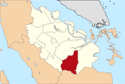 | |
| Country | Indonesia |
| Province | Riau |
| Regency seat | Rengat |
| Area | |
| • Total | 8,198.21 km2 (3,165.35 sq mi) |
| Population (2020 Census)[1] | |
| • Total | 444,548 |
| • Density | 54/km2 (140/sq mi) |
| Time zone | UTC+7 (WIB) |
| Website | www.inhu.go.id |
Indragiri Hulu ( or Upper Indragiri) is a regency (kabupaten) of Riau, Indonesia. It is located on the island of Sumatra. The regency has an area of 8,198.71 km² and had a population of 363,442 at the 2010 Census, 408,704 at the 2015 Census and 444,548 at the 2020 Census.[2]
The seat of the regency is located at Rengat.
Administrative districts[]
The regency is divided into fourteen districts (kecamatan), listed below with their areas and their populations at the 2010 Census[3] and the 2020 Census.[4] The table also includes the locations of the district administrative centres, and the number of villages (rural desa and urban keluraham) in each district.
| Name | Area in km2 |
Population Census 2010 |
Population Census 2020 |
Admin centre |
No. of villages |
|---|---|---|---|---|---|
| Peranap | 1,700.98 | 28,231 | 35,161 | Peranap | 12 |
| Batang Peranap | (a) | 8,980 | 13,252 | Selunak | 10 |
| Seberida | 960.29 | 46,155 | 56,571 | Pangkalan Kasai | 11 |
| Batang Cenaku | 970.00 | 28,393 | 40,736 | Aur Cina | 20 |
| Batang Gansal | 950.00 | 26,890 | 33,272 | Seberida | 10 |
| Kelayang | 879.84 | 21,288 | 24,542 | Simpang Kelayang | 17 |
| Rakit Kulim | (a) | 19,833 | 23,836 | Petonggan | 19 |
| Pasir Penyu | 372.50 | 31,116 | 36,234 | Air Molek | 13 |
| Lirik | 233.60 | 23,418 | 27,624 | Lirik Area | 17 |
| Sungai Lala | (a) | 12,938 | 16,608 | Kelawat | 12 |
| Lubuk Batu Jaya | (a) | 18,560 | 22,981 | Lubuk Batu Tinggal | 9 |
| Rengat Barat (West Rengat) |
921.00 | 39,819 | 48,573 | Pematang Reba | 18 |
| Rengat | 1,210.50 | 46,049 | 50,603 | Rengat | 16 |
| Kuala Cenaku | (a) | 11,772 | 14,555 | Kuala Cenaku | 10 |
| Totals | 8,198.71 | 363,442 | 444,548 | Rengat | 194 |
Note: (a) the area of this district is still included in the figures for the district from which it was cut out.
References[]
| show Authority control |
|---|
Coordinates: 0°21′00″S 102°31′59″E / 0.35000°S 102.53306°E

This Riau location article is a stub. You can help Wikipedia by . |
- Indragiri Hulu Regency
- Regencies of Riau
- Sumatra geography stubs