Pelalawan Regency
Pelalawan Regency
(Kabupaten Pelalawan) | |
|---|---|
 The Pelalawan palace | |
 Flag Coat of arms | |
 | |
| Country | Indonesia |
| Province | Riau |
| Regency seat | Pangkalan Kerinci |
| Area | |
| • Total | 13,067.29 km2 (5,045.31 sq mi) |
| Population (2020 Census)[1] | |
| • Total | 390,046 |
| • Density | 30/km2 (77/sq mi) |
| Time zone | UTC+7 (WIB) |
| Website | pelalawankab.go.id |
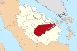
Pelalawan is a regency (kabupaten) of Riau Province, Indonesia. It is located on the island of Sumatra. The regency has an area of 13,067.29 km² and had a population of 301,829 at the 2010 Census and 390,046 at the 2020 Census, including 201,685 male and 188,361 female.[2] The administrative centre is at the town of Pangkalan Kerinci.
Administrative districts[]
The regency is divided into twelve districts (kecamatan), listed below with their areas and their populations at the 2010 Census[3] and the 2020 Census.[4] The table also includes the locations of the district administrative centres, and the number of villages (rural desa and urban kelurahan) in each district; of the 14 kelurahan, one (the district administrative centre) was in each district, except that Pangkalan Kerinci had 3 kelurahan.
| Name | Area in km2 |
Population Census 2010 |
Population Census 2020 |
Admin centre |
No. of villages |
|---|---|---|---|---|---|
| Langgam | 1,476.29 | 21,968 | 32,997 | Langgam | 8 |
| Pangkalan Kerinci | 217.26 | 69,444 | 94,585 | Pangkalan Kerinci | 7 |
| Bandar Sei Kijang | 325.03 | 17,175 | 21,481 | Sekijang | 5 |
| Pangkalan Kuras | 1,224.55 | 45,072 | 61,123 | Sorek Satu | 17 |
| Ukui | 1,337.47 | 32,293 | 40,298 | Ukui Satu | 12 |
| Pangkalan Lesung | 438.08 | 25,251 | 29,832 | Pangkalan Lesung | 10 |
| Bunut | 444.65 | 11,754 | 15,465 | Pangkalan Bunut | 10 |
| Pelalawan (district) | 1,469.38 | 15,388 | 19,120 | Pelalawan | 9 |
| Bandar Petalangan | 361.85 | 12,635 | 16,447 | Rawang Empat | 11 |
| Kuala Kampar | 683.39 | 17,622 | 17,837 | Teluk Dalam | 10 |
| Kerumutan | 976.31 | 19,115 | 24,420 | Kerumutan | 10 |
| Teluk Meranti (Meranti Bay) |
4,113.03 | 14,112 | 16,441 | Teluk Meranti | 9 |
| Totals | 12,067.29 | 301,829 | 390,046 | Pangkalan Kerinci | 118 |
References[]
Capital: Pekanbaru | ||
| Regencies | ||
| Cities | ||
| Towns | ||
| Islands |
| |
Coordinates: 0°16′00″N 101°40′01″E / 0.26667°N 101.66694°E

 | This Riau location article is a stub. You can help Wikipedia by . |
- Regencies of Riau
- Sumatra geography stubs