Ingeniero Juan Guillermo Villasana National Airport
Ingeniero Juan Guillermo Villasana National Airport Aeropuerto Nacional Ingeniero Juan Guillermo Villasana | |||||||||||
|---|---|---|---|---|---|---|---|---|---|---|---|
 | |||||||||||
| Summary | |||||||||||
| Airport type | Public | ||||||||||
| Operator | Ayuntamiento de Pachuca de Soto | ||||||||||
| Serves | Pachuca | ||||||||||
| Elevation AMSL | 7,958 ft / 2,316 m | ||||||||||
| Coordinates | 20°04′38″N 98°46′58″W / 20.07722°N 98.78278°WCoordinates: 20°04′38″N 98°46′58″W / 20.07722°N 98.78278°W | ||||||||||
| Map | |||||||||||
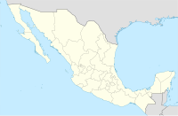 TPQ Location of airport in Mexico | |||||||||||
| Runways | |||||||||||
| |||||||||||
Source: Aeropuertos y Servicios Auxiliares | |||||||||||

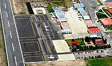
Ingeniero Juan Guillermo Villasana National Airport (IATA: PCA, ICAO: MMPC)[1] is a national airport located in Pachuca, Pachuca, Mexico. The airport handles the national traffic of the city of Pachuca.
Information[]
Inaugurated in 1975 and named in honor of the engineer and aviator , the airport deals with the local and national air traffic of Pachuca. It has aviation school and air taxi services.[2]
See also[]
References[]
- ^ "Estadística Operativa Regional". Secretaría de Comunicaciones y Transportes. March 2017. Retrieved 2 August 2017.
- ^ Gabriela Porter, Rosa. "Amplían la vigencia del aeropuerto en Pachuca". Periódico La Crónica de Hoy. Archived from the original on 9 January 2015. Retrieved 9 January 2015.
External links[]
This article about a Mexican airport is a stub. You can help Wikipedia by . |
Categories:
- Airports in Mexico
- Pachuca
- Transportation in Hidalgo
- Mexican airport stubs