Jackson Township, Clay County, Indiana
Jackson Township | |
|---|---|
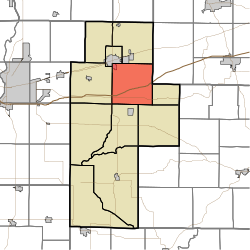 Location of Jackson Township in Clay County | |
| Coordinates: 39°28′51″N 87°04′24″W / 39.48083°N 87.07333°WCoordinates: 39°28′51″N 87°04′24″W / 39.48083°N 87.07333°W | |
| Country | United States |
| State | Indiana |
| County | Clay |
| Government | |
| • Type | Indiana township |
| Area | |
| • Total | 35.68 sq mi (92.4 km2) |
| • Land | 35.09 sq mi (90.9 km2) |
| • Water | 0.59 sq mi (1.5 km2) |
| Elevation | 623 ft (190 m) |
| Population (2010) | |
| • Total | 2,739 |
| • Density | 78.1/sq mi (30.2/km2) |
| FIPS code | 18-36864[2] |
| GNIS feature ID | 453436 |

Jackson Township is one of eleven townships in Clay County, Indiana. As of the 2010 census, its population was 2,739 and it contained 1,144 housing units.[3]
History[]
Jackson Township was established about 1832. It was named for Andrew Jackson, who was then serving as President of the United States.[4]
Geography[]
According to the 2010 census, the township has a total area of 35.68 square miles (92.4 km2), of which 35.09 square miles (90.9 km2) (or 98.35%) is land and 0.59 square miles (1.5 km2) (or 1.65%) is water.[3]
Cities and towns[]
- Brazil (southeast quarter)
Unincorporated towns[]
(This list is based on USGS data and may include former settlements.)
Adjacent townships[]
- Van Buren Township (north)
- Washington Township, Putnam County (northeast)
- Cass Township (east)
- Washington Township (southeast)
- Sugar Ridge Township (south)
- Perry Township (southwest)
- Posey Township (west)
- Brazil Township (northwest)
Major highways[]
Cemeteries[]
The township contains five cemeteries: Kealber, Neidlinger, Poplar, Wesley Chapel and Zenor.
References[]
- "Jackson Township, Clay County, Indiana". Geographic Names Information System. United States Geological Survey. Retrieved 2009-09-24.
- United States Census Bureau cartographic boundary files
- ^ "US Board on Geographic Names". United States Geological Survey. 2007-10-25. Retrieved 2008-01-31.
- ^ "U.S. Census website". United States Census Bureau. Retrieved 2008-01-31.
- ^ a b "Population, Housing Units, Area, and Density: 2010 - County -- County Subdivision and Place -- 2010 Census Summary File 1". United States Census. Archived from the original on 2020-02-12. Retrieved 2013-05-10.
- ^ Blanchard, Charles (1884). Counties of Clay and Owen, Indiana: Historical and Biographical. F.A. Battey & Company. pp. 83.
External links[]
Municipalities and communities of Clay County, Indiana, United States | ||
|---|---|---|
| City | ||
| Towns | ||
| Townships | ||
| CDP | ||
| Other unincorporated communities |
| |
| Ghost towns | ||
| Footnotes | ‡This populated place also has portions in an adjacent county or counties | |
| ||
Categories:
- Townships in Clay County, Indiana
- Terre Haute metropolitan area
- Townships in Indiana