Jenkintown, Pennsylvania
Borough of Jenkintown | |
|---|---|
Borough | |
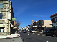
 View entering Jenkintown from Wyncote | |
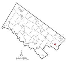 Location of Jenkintown in Montgomery County, Pennsylvania. | |
 Jenkintown Location of Jenkintown in Pennsylvania | |
| Coordinates: 40°05′46″N 75°07′46″W / 40.09611°N 75.12944°WCoordinates: 40°05′46″N 75°07′46″W / 40.09611°N 75.12944°W | |
| Country | United States |
| State | Pennsylvania |
| County | Montgomery |
| Incorporated | December 8, 1874 |
| Government | |
| • Type | Council-manager |
| • Mayor | Allyson Dobbs |
| Area | |
| • Total | 0.58 sq mi (1.50 km2) |
| • Land | 0.58 sq mi (1.50 km2) |
| • Water | 0.00 sq mi (0.00 km2) |
| Elevation | 322 ft (98 m) |
| Population (2010) | |
| • Total | 4,422 |
| • Estimate (2019)[2] | 4,420 |
| • Density | 7,633.85/sq mi (2,949.94/km2) |
| Time zone | UTC-5 (EST) |
| • Summer (DST) | UTC-4 (EDT) |
| ZIP code | 19046 |
| Area code(s) | 215, 267 and 445 |
| FIPS code | 42-38000 |
| Website | www |


Jenkintown is a borough in Montgomery County, Pennsylvania, about 10 miles (16 km) north of Center City Philadelphia.
History[]
This section relies largely or entirely on a single source. (April 2016) |
The community was named for Stephen Jenkins, a Welsh pioneer settler.[3]
The Borough of Jenkintown is located just outside Philadelphia along the Route 611 corridor between Abington and Cheltenham Townships. The Borough was settled in about 1697 and incorporated on December 8, 1874 when approximately 248 acres (1.00 km2) was taken from Abington Township. Today, the Borough is approximately 0.58 square miles and is home to 4,500 residents.
The Borough is a mostly residential community that is separated into East and West by the Business District that runs along and surrounds Old York Road (Route 611) corridor. On the east side of Old York Road, residential development is predominantly characterized by larger detached single-family homes on lots larger than the Borough average. On the southeast side of York Road, there is a small mixed concentration of row homes, duplexes, and single-family residences. The majority of the residential development, however, is located to the west of York Road. This area consists of a traditional small town mix of detached single-family homes, duplexes, and row homes. Located throughout this area are several multi-family apartment buildings that are residential rental properties. At the center of this residential area are the Jenkintown Elementary School and the Jenkintown High School.
The Jenkintown Fire Department consists of two fire companies founded more than 125 years ago. The Jenkintown Fire Department is a totally volunteer department consisting of the Pioneer Fire Company #1 and the Independent Fire Company #2. The Pioneer Company was organized in 1884 and the Independent Company was organized in 1889, an artifact of the historical split between Catholics and Protestants in the population of the borough. The two fire companies have a total membership of approximately 150 with 50 members composing the active firefighting crew.
Elements of the British army passed through Jenkintown en route to the Battle of White Marsh in early December 1777.
The Jenkins' Town Lyceum Building, Jenkintown-Wyncote station, and Strawbridge and Clothier Store are listed on the National Register of Historic Places.[4]
Geography[]
Jenkintown borough is located at 40°5′46″N 75°7′46″W / 40.09611°N 75.12944°W (40.096060, -75.129415).[5] According to the United States Census Bureau, the borough has a total area of 0.6 square miles (1.6 km2), all land. Pennsylvania Route 611 passes through the center of the borough. Jenkintown is surrounded by Abington Township to the north, west, and east, and borders Cheltenham Township to the south.
Education[]
The Jenkintown School District includes Jenkintown Elementary School and Jenkintown Middle/High School. The district has an enrollment of over 700 students.[6]
St. Joseph the Protector Regional Catholic School in Glenside and Abington Township is the area Catholic school. It was formed in 2012 by the merger of Immaculate Conception School in Jenkintown and St. Luke the Evangelist School in Glenside.[7]
Abington Friends School is an independent Quaker school in Jenkintown, Pennsylvania, serving students from age 3 to grade 12. Abington Friends School has stood on its original campus in the Abington Township neighborhood of Jenkintown since 1697.
Demographics[]
| Historical population | |||
|---|---|---|---|
| Census | Pop. | %± | |
| 1880 | 810 | — | |
| 1890 | 1,609 | 98.6% | |
| 1900 | 2,091 | 30.0% | |
| 1910 | 2,968 | 41.9% | |
| 1920 | 3,366 | 13.4% | |
| 1930 | 4,797 | 42.5% | |
| 1940 | 5,024 | 4.7% | |
| 1950 | 5,130 | 2.1% | |
| 1960 | 5,017 | −2.2% | |
| 1970 | 5,404 | 7.7% | |
| 1980 | 4,942 | −8.5% | |
| 1990 | 4,574 | −7.4% | |
| 2000 | 4,478 | −2.1% | |
| 2010 | 4,422 | −1.3% | |
| 2019 (est.) | 4,420 | [2] | 0.0% |
| Sources:[8][9][10] | |||
As of the 2010 census, the borough was 87.5% White, 5.7% Black or African American, 2.0% Asian, and 1.8% were two or more races. 3.0% of the population were of Hispanic or Latino ancestry.[11]
As of the census[9] of 2000, there were 4,478 people, 2,035 households, and 1,088 families residing in the borough. The population density was 7,844.0 people per square mile (3,033.3/km2). There were 2,085 housing units at an average density of 3,652.2 per square mile (1,412.3/km2). The racial makeup of the borough was 93.61% White, 4.00% African American, 0.04% Native American, 0.94% Asian, 0.02% Pacific Islander, 0.49% from other races, and 0.89% from two or more races. Hispanic or Latino of any race were 1.30% of the population.
There were 2,035 households, out of which 24.3% had children under the age of 18 living with them, 42.2% were married couples living together, 8.6% had a female householder with no husband present, and 46.5% were non-families. 40.6% of all households were made up of individuals, and 19.3% had someone living alone who was 65 years of age or older. The average household size was 2.19 and the average family size was 3.08.
The age distribution of the borough's population is spread out, with 22.9% under the age of 18, 5.6% from 18 to 24, 27.0% from 25 to 44, 23.5% from 45 to 64, and 21.0% who were 65 years of age or older. The median age was 42 years. For every 100 females, there were 78.9 males. For every 100 females age 18 and over, there were 73.2 males.
The median income for a household in the borough was $47,743, and the median income for a family was $72,902. Males had a median income of $41,970 versus $35,625 for females. The per capita income for the borough was $29,834. About 1.9% of families and 5.1% of the population were below the poverty line, including 3.6% of those under age 18 and 7.2% of those age 65 or over.
Transportation[]
Pennsylvania Route 611 heads north–south through Jenkintown along Old York Road, heading south to Philadelphia and north to Willow Grove, where it has an interchange with the Pennsylvania Turnpike, and Doylestown. Pennsylvania Route 73 passes east–west along the southern edge of Jenkintown along Washington Lane and Township Line Road, heading west to Wyncote and east to Northeast Philadelphia. Greenwood Avenue runs east–west through the center of Jenkintown, heading west to Wyncote.[12]
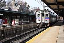
The Jenkintown-Wyncote station is one of SEPTA's major Regional Rail stops; the Lansdale/Doylestown Line, Warminster Line, and West Trenton Line regional rail services all stop there.[13] Jenkintown-Wyncote station is the busiest SEPTA Regional Rail station outside the city of Philadelphia.[14] The Jenkintown-Wyncote station building with its Queen Anne-style architecture was designed by famous Philadelphia architect Horace Trumbauer. SEPTA provides City Bus service to Jenkintown along Route 55, which follows PA 611 south to Olney Transportation Center in North Philadelphia and north to Willow Grove and Doylestown, and Route 77, which heads west to the Chestnut Hill section of Philadelphia and east to Northeast Philadelphia.[13]
Politics and government[]
| Year | Republican | Democratic |
|---|---|---|
| 2020 | 19.7% 619 | 79.1% 2,481 |
| 2016 | 20.6% 563 | 74.9% 2,052 |
| 2012 | 27.1% 724 | 71.4% 1,905 |
| 2008 | 25.1% 708 | 73.8% 2,079 |
| 2004 | 28.6% 832 | 71.0% 2,068 |
| 2000 | 29.9% 791 | 65.7% 1,734 |
Jenkintown has a city manager form of government with a mayor and a twelve-member borough council. The current mayor is Allyson Dobbs. Deborra Sines Pancoe is the President of Borough Council, and Jay Conners is vice president.
The borough is part of the Fourth Congressional District, represented by Madeleine Dean. At the state level, Jenkintown is part of the Pennsylvania's 154th Representative District, represented by Napoleon Nelson, and the 4th Senatorial District, represented by Arthur L. Haywood III. All are Democrats. Jenkintown, like its surroundings of Abington and Cheltenham and their included towns, votes overwhelmingly Democratic.
In popular culture[]
The television sitcom The Goldbergs is set in Jenkintown; it is based on the 1980s childhood of show creator Adam F. Goldberg, a Jenkintown native.
Notable people[]

- Jim Bidlack, professor at the University of Central Oklahoma
- Bryan Cohen (born 1989), American-Israeli basketball player
- Bradley Cooper, actor and filmmaker[16]
- Lawrence Curry, educator and politician
- Adam F. Goldberg, television and film producer; creator of The Goldbergs, which is set in Jenkintown
- George Low Jr., professional golfer
- George Low Sr., professional golfer
- Ezra Pound, poet and critic[17]
- Lessing J. Rosenwald, businessman, collector of rare books and art, chess patron, and philanthropist; chairman and president of Sears, Roebuck and Company
- Max Ritter, Olympic swimmer
- Allyson Schwartz, politician
Gallery[]
References[]
- ^ "2019 U.S. Gazetteer Files". United States Census Bureau. Retrieved July 28, 2020.
- ^ Jump up to: a b "Population and Housing Unit Estimates". United States Census Bureau. May 24, 2020. Retrieved May 27, 2020.
- ^ "Historic Jenkintown". Jenkintown Community Alliance. Archived from the original on October 6, 2008. Retrieved April 27, 2009.
- ^ "National Register Information System". National Register of Historic Places. National Park Service. July 9, 2010.
- ^ "US Gazetteer files: 2010, 2000, and 1990". United States Census Bureau. 2011-02-12. Retrieved 2011-04-23.
- ^ "About Us". The School District of Jenkintown. May 13, 2015.
- ^ "2012 Catholic grade school consolidations/closings". Catholicphilly.com. 2012-07-15. Retrieved 2020-04-22.
- ^ "Census of Population and Housing". U.S. Census Bureau. Retrieved 11 December 2013.
- ^ Jump up to: a b "U.S. Census website". United States Census Bureau. Retrieved 2008-01-31.
- ^ "Incorporated Places and Minor Civil Divisions Datasets: Subcounty Resident Population Estimates: April 1, 2010 to July 1, 2012". Population Estimates. U.S. Census Bureau. Archived from the original on 11 June 2013. Retrieved 11 December 2013.
- ^ https://www.usatoday.com/news/nation/census/profile/PA#locality-tab
- ^ Montgomery County, Pennsylvania (Map) (18th ed.). 1"=2000'. ADC Map. 2006. ISBN 0-87530-775-2.
- ^ Jump up to: a b SEPTA Official Transit & Street Map Suburban (PDF) (Map). SEPTA. Retrieved May 2, 2016.
- ^ "SEPTA (May 2014). Fiscal Year 2015 Annual Service Plan. p. 61" (PDF). Archived from the original (PDF) on 2014-08-12. (539 KB)
- ^ "Montgomery County Election Results". Montgomery County, Pennsylvania. Retrieved January 16, 2017.
- ^ https://www.youtube.com/watch?v=jnCiUYpPvjM
- ^ Neil Stook, The Life of Ezra Pound (2011), page 5
External links[]
| Wikimedia Commons has media related to Jenkintown, Pennsylvania. |
| show Places adjacent to Jenkintown, Pennsylvania |
|---|
| show Municipalities and communities of Montgomery County, Pennsylvania, United States |
|---|

| show Authority control |
|---|
- Jenkintown, Pennsylvania
- Populated places established in 1697
- Boroughs in Montgomery County, Pennsylvania
- 1874 establishments in Pennsylvania