Jennings, Michigan
Jennings, Michigan | |
|---|---|
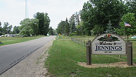 Welcome sign along S. La Chance Road | |
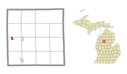 Location within Missaukee County | |
 Jennings Location within the state of Michigan | |
| Coordinates: 44°19′58″N 85°17′53″W / 44.33278°N 85.29806°WCoordinates: 44°19′58″N 85°17′53″W / 44.33278°N 85.29806°W | |
| Country | United States |
| State | Michigan |
| County | Missaukee |
| Townships | Caldwell and Lake |
| Established | 1885 |
| Area | |
| • Total | 0.76 sq mi (2.0 km2) |
| • Land | 0.76 sq mi (2.0 km2) |
| • Water | 0.00 sq mi (0.0 km2) |
| Elevation | 1,306 ft (398 m) |
| Population | |
| • Total | 264 |
| • Density | 347.4/sq mi (134.1/km2) |
| Time zone | UTC-5 (Eastern (EST)) |
| • Summer (DST) | UTC-4 (EDT) |
| ZIP code(s) | 49651 (Lake City) |
| Area code(s) | 231 |
| GNIS feature ID | 629259[2] |


Jennings is an unincorporated community and census-designated place (CDP) in Missaukee County in the U.S. state of Michigan. The population was 264 at the 2010 census.[1] The CDP is located mostly in Lake Township with a small portion extending north into Caldwell Township.
History[]
Jennings was a lumbering center founded by Austin and William Mitchell, who named it for William Jennings Bryan. A post office opened on March 8, 1883, with J. Frank Schryer as the first postmaster. The office was discontinued on July 31, 1956. Jennings was a terminus of the Missukee spur of the Grand Rapids and Indiana Railroad, with a junction on the main line named Round Lake.[3][4]
The community of Jennings was listed as a newly-organized census-designated place for the 2010 census, meaning it now has officially defined boundaries and population statistics for the first time.[5]
Geography[]
According to the United States Census Bureau, Jennings has an area of 0.76 square miles (1.97 km2), all land.
The census-designated place is defined as being within Caldwell and Lake townships. All 264 residents and 0.67 square miles (1.74 km2) of land were within Lake Township, while no residents and 0.09 square miles (0.23 km2) of land are within Caldwell Township to the north.[5]
Demographics[]
This section needs expansion. You can help by . (July 2020) |
References[]
- ^ a b c "2010 Census Gazetteer Files - Places: Michigan". U.S. Census Bureau. Retrieved May 6, 2018.
- ^ "Jennings". Geographic Names Information System. United States Geological Survey.
- ^ U.S. Geological Survey Geographic Names Information System: Jennings Post Office (historical)
- ^ Romig, Walter (1986) [1973]. Michigan Place Names. Detroit, Michigan: Wayne State University Press. ISBN 0-8143-1838-X.
- ^ a b "Michigan: 2010 Population and Housing Unit Counts 2010 Census of Population and Housing" (PDF). 2010 United States Census. United States Census Bureau. September 2012. p. 34 Michigan. Retrieved July 22, 2020.
Municipalities and communities of Missaukee County, Michigan, United States | ||
|---|---|---|
| Cities |  | |
| Civil townships | ||
| CDPs | ||
| Other communities |
| |
| ||
This Missaukee County, Michigan location article is a stub. You can help Wikipedia by . |
- Unincorporated communities in Missaukee County, Michigan
- Unincorporated communities in Michigan
- Census-designated places in Missaukee County, Michigan
- Census-designated places in Michigan
- Populated places established in 1885
- 1885 establishments in Michigan
- Cadillac micropolitan area
- Lower Peninsula, Michigan geography stubs