Lake City, Michigan
Lake City, Michigan | |
|---|---|
| City of Lake City | |
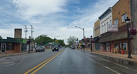 Looking north along Main Street (M-66) | |
| Nickname(s): Christmas Tree Capitol | |
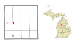 Location within Missaukee County | |
 Lake City Location within the state of Michigan | |
| Coordinates: 44°19′57″N 85°12′47″W / 44.33250°N 85.21306°WCoordinates: 44°19′57″N 85°12′47″W / 44.33250°N 85.21306°W | |
| Country | United States |
| State | Michigan |
| County | Missaukee |
| Settled | 1868 |
| Incorporated | 1889 (village) 1932 (city) |
| Government | |
| • Type | Mayor–council |
| • Mayor | Brad Seger |
| Area | |
| • Total | 1.05 sq mi (2.71 km2) |
| • Land | 1.05 sq mi (2.71 km2) |
| • Water | 0.0 sq mi (0.0 km2) |
| Elevation | 1,250 ft (381 m) |
| Population | |
| • Total | 836 |
| • Estimate (2019)[3] | 837 |
| • Density | 798.66/sq mi (308.36/km2) |
| Time zone | UTC-5 (Eastern (EST)) |
| • Summer (DST) | UTC-4 (EDT) |
| ZIP code(s) | 49651 |
| Area code(s) | 231 |
| FIPS code | 26-44480[4] |
| GNIS feature ID | 0629968,[5] 1626581[6] |
| Website | City website |


Lake City is a city in and the county seat of Missaukee County in the U.S. state of Michigan. As of the 2010 census, the city population was 836. Lake City is locally known as the "Christmas Tree Capitol" because of the millions of Christmas trees produced annually.[7][8][9]
History[]
The community's first settler, Daniel Reeder, built his cabin on Muskrat Lake, now Lake Missaukee, in 1868. On January 22, 1872, Reeder was the name of post office open and the last name of its first postmaster, Daniel. The county selected Reeder by a one-vote margin as the county seat in 1873. The community became a station of the Grand Rapids and Indiana Railroad. The community was renamed on January 25, 1877 to Lake City. Lake City was incorporated as a village and platted in 1889. [10] The village became a city in 1932.[7]
Much of Missaukee County grew in the early 20th century because of the region's timber industry. The community continues to thrive because of local lumber mills.[9]
Geography[]
According to the United States Census Bureau, the city has a total area of 1.05 square miles (2.72 km2), all land[11]
Lake City derives its name from the numerous lakes within the vicinity, of which Lake Missaukee forms the western boundary of the city limits. Other large lakes nearby include Crooked Lake and Sapphire Lake.[7]
Climate[]
| Climate data for Lake City, Michigan (1991–2020 normals, extremes 1896–present) | |||||||||||||
|---|---|---|---|---|---|---|---|---|---|---|---|---|---|
| Month | Jan | Feb | Mar | Apr | May | Jun | Jul | Aug | Sep | Oct | Nov | Dec | Year |
| Record high °F (°C) | 61 (16) |
60 (16) |
86 (30) |
87 (31) |
93 (34) |
103 (39) |
106 (41) |
100 (38) |
97 (36) |
86 (30) |
76 (24) |
64 (18) |
106 (41) |
| Average high °F (°C) | 27.3 (−2.6) |
30.3 (−0.9) |
40.5 (4.7) |
53.2 (11.8) |
66.3 (19.1) |
76.2 (24.6) |
80.4 (26.9) |
78.6 (25.9) |
71.1 (21.7) |
57.3 (14.1) |
43.4 (6.3) |
32.6 (0.3) |
54.8 (12.7) |
| Daily mean °F (°C) | 18.6 (−7.4) |
19.9 (−6.7) |
28.9 (−1.7) |
41.3 (5.2) |
53.6 (12.0) |
63.4 (17.4) |
67.5 (19.7) |
65.7 (18.7) |
57.9 (14.4) |
46.1 (7.8) |
34.8 (1.6) |
25.0 (−3.9) |
43.6 (6.4) |
| Average low °F (°C) | 9.9 (−12.3) |
9.6 (−12.4) |
17.3 (−8.2) |
29.4 (−1.4) |
40.9 (4.9) |
50.7 (10.4) |
54.5 (12.5) |
52.8 (11.6) |
44.7 (7.1) |
35.0 (1.7) |
26.2 (−3.2) |
17.5 (−8.1) |
32.4 (0.2) |
| Record low °F (°C) | −37 (−38) |
−41 (−41) |
−37 (−38) |
−11 (−24) |
17 (−8) |
24 (−4) |
32 (0) |
27 (−3) |
20 (−7) |
11 (−12) |
−13 (−25) |
−25 (−32) |
−41 (−41) |
| Average precipitation inches (mm) | 1.88 (48) |
1.45 (37) |
1.88 (48) |
3.53 (90) |
3.47 (88) |
3.48 (88) |
3.11 (79) |
3.42 (87) |
3.04 (77) |
3.67 (93) |
2.52 (64) |
1.94 (49) |
33.39 (848) |
| Average snowfall inches (cm) | 18.7 (47) |
13.9 (35) |
9.4 (24) |
5.2 (13) |
0.3 (0.76) |
0.0 (0.0) |
0.0 (0.0) |
0.0 (0.0) |
0.0 (0.0) |
1.4 (3.6) |
9.0 (23) |
16.1 (41) |
74.0 (188) |
| Average precipitation days (≥ 0.01 in) | 16.2 | 12.2 | 11.1 | 12.5 | 13.0 | 11.6 | 11.1 | 11.2 | 12.1 | 14.9 | 13.6 | 15.1 | 154.6 |
| Average snowy days (≥ 0.1 in) | 14.8 | 11.5 | 7.8 | 3.8 | 0.2 | 0.0 | 0.0 | 0.0 | 0.0 | 1.0 | 6.5 | 13.2 | 58.8 |
| Source: NOAA[12][13] | |||||||||||||
Education[]
Lake City is served by the district. High school students are served by Lake City High School.
Transportation[]
Demographics[]
| Historical population | |||
|---|---|---|---|
| Census | Pop. | %± | |
| 1880 | 61 | — | |
| 1890 | 663 | 986.9% | |
| 1900 | 816 | 23.1% | |
| 1910 | 740 | −9.3% | |
| 1920 | 582 | −21.4% | |
| 1930 | 610 | 4.8% | |
| 1940 | 693 | 13.6% | |
| 1950 | 719 | 3.8% | |
| 1960 | 718 | −0.1% | |
| 1970 | 704 | −1.9% | |
| 1980 | 843 | 19.7% | |
| 1990 | 858 | 1.8% | |
| 2000 | 923 | 7.6% | |
| 2010 | 836 | −9.4% | |
| 2019 (est.) | 837 | [3] | 0.1% |
| U.S. Decennial Census[14] | |||
2010 census[]
As of the census[2] of 2010, there were 836 people, 337 households, and 216 families living in the city. The population density was 796.2 inhabitants per square mile (307.4/km2). There were 489 housing units at an average density of 465.7 per square mile (179.8/km2). The racial makeup of the city was 95.2% White, 1.2% African American, 1.7% Native American, 0.7% Asian, and 1.2% from two or more races. Hispanic or Latino of any race were 2.9% of the population.
There were 337 households, of which 28.8% had children under the age of 18 living with them, 45.4% were married couples living together, 12.2% had a female householder with no husband present, 6.5% had a male householder with no wife present, and 35.9% were non-families. 32.0% of all households were made up of individuals, and 17% had someone living alone who was 65 years of age or older. The average household size was 2.35 and the average family size was 2.89.
The median age in the city was 40.5 years. 23.4% of residents were under the age of 18; 8.6% were between the ages of 18 and 24; 21.2% were from 25 to 44; 27.5% were from 45 to 64; and 19.3% were 65 years of age or older. The gender makeup of the city was 51.2% male and 48.8% female.
2000 census[]
As of the census[4] of 2000, there were 923 people, 381 households, and 238 families living in the city. The population density was 854.9 per square mile (330.0/km2). There were 493 housing units at an average density of 456.6 per square mile (176.2/km2). The racial makeup of the city was 97.72% White, 0.11% African American, 0.43% Native American, 0.76% Asian, 0.43% from other races, and 0.54% from two or more races. Hispanic or Latino of any race were 1.63% of the population.
There were 381 households, out of which 29.1% had children under the age of 18 living with them, 46.7% were married couples living together, 12.9% had a female householder with no husband present, and 37.3% were non-families. 33.1% of all households were made up of individuals, and 15.7% had someone living alone who was 65 years of age or older. The average household size was 2.32 and the average family size was 2.93.
In the city, the population was spread out, with 24.1% under the age of 18, 9.6% from 18 to 24, 22.5% from 25 to 44, 23.6% from 45 to 64, and 20.2% who were 65 years of age or older. The median age was 41 years. For every 100 females, there were 89.9 males. For every 100 females age 18 and over, there were 86.4 males.
The median income for a household in the city was $28,864, and the median income for a family was $34,286. Males had a median income of $27,361 versus $19,044 for females. The per capita income for the city was $17,067. About 10.7% of families and 13.1% of the population were below the poverty line, including 13.7% of those under age 18 and 17.2% of those age 65 or over.
Notable people[]
- Albert J. Engel, former politician
- Albert J. Engel Jr., former judge for the United States Court of Appeals for the Sixth Circuit
- Bruce Rendon, politician
- Burt Reynolds, Oscar-nominated and Golden Globe award-winning actor, film and television star
- James Wieghart, former newspaper editor
References[]
- ^ "2019 U.S. Gazetteer Files". United States Census Bureau. Retrieved July 25, 2020.
- ^ a b "U.S. Census website". United States Census Bureau. Retrieved 2012-11-25.
- ^ a b "Population and Housing Unit Estimates". United States Census Bureau. May 24, 2020. Retrieved May 27, 2020.
- ^ a b "U.S. Census website". United States Census Bureau. Retrieved 2008-01-31.
- ^ U.S. Geological Survey Geographic Names Information System: Lake City, Michigan
- ^ U.S. Geological Survey Geographic Names Information System: City of Lake City
- ^ a b c "The 18 tiniest cities in Michigan". Flint Journal. Mlive Media Group. December 4, 2016. p. 9. Retrieved December 5, 2016.
- ^ "Find a County". National Association of Counties. Retrieved 2011-06-07.
- ^ a b "Lake City Area History". Lake City Area Chamber of Commerce. 2015-12-07. Retrieved 2017-08-16.
- ^ Romig 1986, pp. 312.
- ^ "Michigan: 2010 Population and Housing Unit Counts 2010 Census of Population and Housing" (PDF). 2010 United States Census. United States Census Bureau. September 2012. p. 34 Michigan. Retrieved July 22, 2020.
- ^ "NowData - NOAA Online Weather Data". National Oceanic and Atmospheric Administration. Retrieved September 2, 2021.
- ^ "Station: Lake City EXP Farm, MI". U.S. Climate Normals 2020: U.S. Monthly Climate Normals (1991-2020). National Oceanic and Atmospheric Administration. Retrieved September 2, 2021.
- ^ "Census of Population and Housing". Census.gov. Retrieved June 4, 2015.
Sources[]
- Romig, Walter (October 1, 1986) [1973]. Michigan Place Names: The History of the Founding and the Naming of More Than Five Thousand Past and Present Michigan Communities. Great Lakes Books Series (Paperback). Detroit, Michigan: Wayne State University Press. ISBN 081431838X.
External links[]
Municipalities and communities of Missaukee County, Michigan, United States | ||
|---|---|---|
| Cities |  | |
| Civil townships | ||
| CDPs | ||
| Other communities |
| |
| ||
- Cities in Missaukee County, Michigan
- County seats in Michigan
- Cadillac micropolitan area
- 1889 establishments in Michigan
- Populated places established in 1889