Newberry, Michigan
Newberry, Michigan | |
|---|---|
| Village of Newberry | |
 Downtown looking north along M-123 | |
| Nickname(s): The Moose Capital of Michigan | |
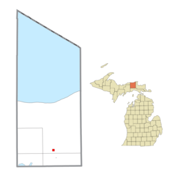 Location within Luce County | |
 Newberry Location within the state of Michigan | |
| Coordinates: 46°21′08″N 85°30′38″W / 46.35222°N 85.51056°WCoordinates: 46°21′08″N 85°30′38″W / 46.35222°N 85.51056°W | |
| Country | United States |
| State | Michigan |
| County | Luce |
| Township | McMillan |
| Founded | 1882 |
| Government | |
| • Type | Village council |
| • President | Catherine Freese |
| • Manager | Allison Watkins |
| • Clerk | Terese Schummer |
| Area | |
| • Total | 0.98 sq mi (2.54 km2) |
| • Land | 0.98 sq mi (2.54 km2) |
| • Water | 0.00 sq mi (0.00 km2) |
| Elevation | 771 ft (235 m) |
| Population | |
| • Total | 1,519 |
| • Estimate (2019)[6] | 1,397 |
| • Density | 1,424.06/sq mi (549.55/km2) |
| Time zone | UTC−5 (Eastern (EST)) |
| • Summer (DST) | UTC−4 (EDT) |
| ZIP code(s) | 49868 |
| Area code(s) | 906 |
| FIPS code | 26-57140[4] |
| GNIS feature ID | 0633350[5] |
| Website | Official website |


Newberry is a village and county seat of Luce County in the U.S. state of Michigan.[7] The village is located within McMillan Township and is the only incorporated community in Luce County. The population was 1,519 at the 2010 census.
Newberry is surrounded by state and national forests and is considered the southern gateway to the Tahquamenon Falls area, which the other being Paradise to the northeast. Newberry was designated as "the Moose Capital of Michigan" by the state legislature. It is also home to the Newberry Correctional Facility.
History[]
Newberry was founded in 1882 and became the county seat when Luce County was separated from Chippewa County in 1887. Its first courthouse was completed in 1890.[8]
The village was named in honor of John Stoughton Newberry, a U.S. Representative and industrialist from the state of Michigan.
Historic preservationists lost the 1970s fight to save the county's Victorian courthouse, but managed to keep the elaborate sheriff's house, now the Luce County Historical Museum.[citation needed]
Wildfires[]
The Newberry area was the location of two major wildfires. The Sleeper Lakes Fire took place in August 2007 and burned approximately 29 square miles (75.1 km2) just north of Newberry. In May 2012, the Duck Lake Fire burned approximately 34 square miles (88.1 km2) of forests near Tahquamenon Falls State Park to the northeast. Both wildfires were caused by lightning strikes. While the village itself was not threatened, firefighting efforts were coordinated in Newberry.
Geography[]
According to the United States Census Bureau, the village has a total area of 0.98 square miles (2.54 km2), all of it land.[9]
Transportation[]
Highways[]
 M-28 travels east–west and passes about 3 miles (4.8 km) south of the village limits.
 M-123 runs north–south through the center of Newberry.
Bus service[]
- Indian Trails provides daily intercity bus service between St. Ignace and Ironwood.[10]
Rail[]
- Canadian National Railway provides freight rail service with a small depot located in Newberry.[11]
Airport[]
 Luce County Airport is a county-owned public-use general aviation airport that serves Newberry. It is located in Pentland Township about 3 miles (4.8 km) to the southeast.
Demographics[]
| Historical population | |||
|---|---|---|---|
| Census | Pop. | %± | |
| 1890 | 1,115 | — | |
| 1900 | 1,015 | −9.0% | |
| 1910 | 1,182 | 16.5% | |
| 1920 | 2,172 | 83.8% | |
| 1930 | 2,465 | 13.5% | |
| 1940 | 2,732 | 10.8% | |
| 1950 | 2,802 | 2.6% | |
| 1960 | 2,612 | −6.8% | |
| 1970 | 2,334 | −10.6% | |
| 1980 | 2,120 | −9.2% | |
| 1990 | 1,873 | −11.7% | |
| 2000 | 1,686 | −10.0% | |
| 2010 | 1,519 | −9.9% | |
| 2019 (est.) | 1,397 | [6] | −8.0% |
| U.S. Decennial Census[12] | |||
2010 census[]
As of the census[3] of 2010, there were 1,519 people, 652 households, and 380 families residing in the village. The population density was 1,550.0 inhabitants per square mile (598.5/km2). There were 796 housing units at an average density of 812.2 per square mile (313.6/km2). The racial makeup of the village was 89.3% White, 0.4% African American, 6.3% Native American, 0.3% Asian, 0.1% Pacific Islander, and 3.6% from two or more races. Hispanic or Latino of any race were 2.8% of the population.
There were 652 households, of which 30.1% had children under the age of 18 living with them, 39.1% were married couples living together, 14.3% had a female householder with no husband present, 4.9% had a male householder with no wife present, and 41.7% were non-families. 37.6% of all households were made up of individuals, and 15.7% had someone living alone who was 65 years of age or older. The average household size was 2.26 and the average family size was 2.93.
The median age in the village was 41.1 years. 25.9% of residents were under the age of 18; 5.8% were between the ages of 18 and 24; 23.3% were from 25 to 44; 25.1% were from 45 to 64; and 19.8% were 65 years of age or older. The gender makeup of the village was 47.9% male and 52.1% female.
2000 census[]
As of the census[4] of 2000, there were 1,686 people, 717 households, and 456 families residing in the village. The population density was 2,737.1 per square mile (1,058.2/km2). There were 824 housing units at an average density of 839.7 per square mile (324.6/km2). The racial makeup of the village was 69.92% White, 19.29% African American, 4.95% Native American, 0.67% Asian, 0.04% Pacific Islander, 1.01% from other races, and 4.13% from two or more races. Hispanic or Latino of any race were 3.69% of the population.
There were 717 households, of which 32.6% had children under the age of 18 living with them, 46.7% were married couples living together, 12.4% had a female householder with no husband present, and 36.4% were non-families. 32.5% of all households were made up of individuals, and 18.0% had someone living alone who was 65 years of age or older. The average household size was 2.36 and the average family size was 2.95.
In the village, the population was spread out, with 18.2% under the age of 18, 12.5% from 18 to 24, 39.4% from 25 to 44, 16.4% from 45 to 64, and 13.6% who were 65 years of age or older. The median age was 34 years. For every 100 females, there were 181.0 males. For every 100 females age 18 and over, there were 215.7 males.
The median income for a household in the village was $29,052, and the median income for a family was $36,607. Males had a median income of $29,286 versus $20,956 for females. The per capita income for the village was $17,224. About 15.6% of families and 18.1% of the population were below the poverty line, including 27.5% of those under age 18 and 8.4% of those age 65 or over.
Education[]

The village is served by Tahquamenon Area Schools, which contains a single main campus within Newberry. The school district serves all of Luce County.[13] The district also serves Hulbert Township to the east in Chippewa County, as well as Seney Township to the west in Alger County.[14][15] Most of Portage Township to the south in Mackinac County is also served by Tahquamenon Area Schools.[16][17]
The school district serves an area of 1,524 square miles (3,950 km2), which ranks it as the largest public school district in the state by area. It is also noted as the largest school district in the country east of the Mississippi River.[18] The district enrolled 573 students for the 2019–2020 school year.[19]
Climate[]
According to the Köppen Climate Classification system, Newberry has a humid continental climate, abbreviated "Dfb" on climate maps. A humid continental climate (Köppen prefix D and a third letter of a or b) is a climatic region defined by large seasonal temperature differences, with warm to hot (and often humid) summers and cold (sometimes severely cold in the northern areas) winters. Precipitation is usually distributed throughout the year. The definition of this climate regarding temperature is as follows: the mean temperature of the coldest month must be below −3 °C (26.6 °F) and there must be at least four months whose mean temperatures are at or above 10 °C (50 °F). In addition, the location in question must not be semi-arid or arid. The Dfb, Dwb and Dsb subtypes are also known as hemiboreal.[20]
| hideClimate data for Newberry Correctional Facility, Michigan (1991–2020 normals, extremes 1896–present) | |||||||||||||
|---|---|---|---|---|---|---|---|---|---|---|---|---|---|
| Month | Jan | Feb | Mar | Apr | May | Jun | Jul | Aug | Sep | Oct | Nov | Dec | Year |
| Record high °F (°C) | 51 (11) |
56 (13) |
74 (23) |
84 (29) |
93 (34) |
99 (37) |
103 (39) |
98 (37) |
96 (36) |
82 (28) |
71 (22) |
60 (16) |
103 (39) |
| Average high °F (°C) | 23.3 (−4.8) |
26.3 (−3.2) |
35.3 (1.8) |
48.4 (9.1) |
62.3 (16.8) |
72.6 (22.6) |
76.7 (24.8) |
75.5 (24.2) |
67.7 (19.8) |
53.8 (12.1) |
39.9 (4.4) |
29.0 (−1.7) |
50.9 (10.5) |
| Daily mean °F (°C) | 16.5 (−8.6) |
18.0 (−7.8) |
26.5 (−3.1) |
38.6 (3.7) |
51.1 (10.6) |
61.1 (16.2) |
65.7 (18.7) |
64.9 (18.3) |
57.9 (14.4) |
45.5 (7.5) |
33.7 (0.9) |
22.8 (−5.1) |
41.9 (5.5) |
| Average low °F (°C) | 9.7 (−12.4) |
9.8 (−12.3) |
17.8 (−7.9) |
28.8 (−1.8) |
39.9 (4.4) |
49.6 (9.8) |
54.8 (12.7) |
54.2 (12.3) |
48.1 (8.9) |
37.2 (2.9) |
27.4 (−2.6) |
16.6 (−8.6) |
32.8 (0.4) |
| Record low °F (°C) | −30 (−34) |
−32 (−36) |
−23 (−31) |
−3 (−19) |
0 (−18) |
24 (−4) |
28 (−2) |
28 (−2) |
18 (−8) |
4 (−16) |
−10 (−23) |
−22 (−30) |
−32 (−36) |
| Average precipitation inches (mm) | 2.19 (56) |
1.33 (34) |
1.99 (51) |
2.56 (65) |
2.77 (70) |
3.03 (77) |
3.28 (83) |
3.03 (77) |
3.95 (100) |
4.31 (109) |
2.91 (74) |
2.49 (63) |
33.84 (860) |
| Source: NOAA[21][22] | |||||||||||||
Media[]
In addition to radio stations broadcasting directly from Newberry, radio stations from the Sault Ste. Marie market can also be heard in the community.
- 1450 AM - WNBY-AM (Classic country)
- 88.7 FM - W204AQ (Christian adult contemporary)
- 93.9 FM - WNBY-FM (Oldies)
- 96.7 FM - WMJT (Classic hits)
- 97.9 FM - WIHC (Christian talk)
- 99.7 FM - W259AD (Christian talk & music)
Notable people[]
- Terry O'Quinn, who plays John Locke on Lost, is from Newberry.
- Rob Rubick, former Detroit Lion and analyst for Fox Sports Detroit, is from Newberry.
- Len St. Jean, a former Boston Patriot, is from Newberry.
Images[]

Luce County Government Building 
Newberry village office 
U.S. Post Office in Newberry


References[]
- ^ Village of Newberry (2020). "Newberry Contact Information". Retrieved April 15, 2020.
- ^ "2019 U.S. Gazetteer Files". United States Census Bureau. Retrieved July 25, 2020.
- ^ Jump up to: a b "U.S. Census website". United States Census Bureau. Retrieved 2012-11-25.
- ^ Jump up to: a b "U.S. Census website". United States Census Bureau. Retrieved 2008-01-31.
- ^ U.S. Geological Survey Geographic Names Information System: Newberry, Michigan
- ^ Jump up to: a b "Population and Housing Unit Estimates". United States Census Bureau. May 24, 2020. Retrieved May 27, 2020.
- ^ "Find a County". National Association of Counties. Retrieved 2011-06-07.
- ^ Fedynksy, John (2010). Michigan's County Courthouses, p. 107. The University of Michigan Press.
- ^ "US Gazetteer files 2010". United States Census Bureau. Archived from the original on 2012-01-25. Retrieved 2012-11-25.
- ^ "ST. IGNACE-SAULT STE. MARIE-IRONWOOD" (PDF). Indian Trails. January 15, 2013. Archived from the original (PDF) on July 4, 2014. Retrieved 2013-02-28.
- ^ Michigan Department of Transportation (March 2017). "Michigan's Railroad System: Railroads Operating in Michigan" (PDF). Retrieved August 14, 2021.
- ^ "Census of Population and Housing". Census.gov. Retrieved June 4, 2015.
- ^ Michigan Geographic Framework (15 November 2013). "Luce County School Districts" (PDF). Retrieved July 4, 2021.
- ^ Michigan Geographic Framework (15 November 2013). "Chippewa County School Districts" (PDF). Retrieved July 4, 2021.
- ^ Michigan Geographic Framework (15 November 2013). "Alger County School Districts" (PDF). Retrieved July 4, 2021.
- ^ Michigan Geographic Framework (15 November 2013). "Mackinac County School Districts" (PDF). Retrieved July 4, 2021.
- ^ State of Michigan (2021). "Michigan Schools and Districts". Retrieved August 3, 2021.
- ^ Tahquamenon Area Schools (2021). "Tahquamenon Area Schools: About". Retrieved August 11, 2021.
- ^ National Center for Educational Statistics (2021). "Tahquamenon Area Schools: District Directory Information". Retrieved August 12, 2021.
- ^ "Newberry, Michigan Köppen Climate Classification (Weatherbase)". Weatherbase.
- ^ "NowData - NOAA Online Weather Data". National Oceanic and Atmospheric Administration. Retrieved September 2, 2021.
- ^ "Station: Newberry Correctional Facility, MI". U.S. Climate Normals 2020: U.S. Monthly Climate Normals (1991-2020). National Oceanic and Atmospheric Administration. Retrieved September 2, 2021.
External links[]
| Wikimedia Commons has media related to Newberry, Michigan. |
| Wikivoyage has a travel guide for Newberry. |
- Village of Newberry official website
- McMillan Township official website
- Newberry Area Chamber of Commerce
- Newberry Area Tourism Association
| show Municipalities and communities of Luce County, Michigan, United States |
|---|

| show Authority control |
|---|
- Villages in Luce County, Michigan
- Villages in Michigan
- County seats in Michigan
- Populated places established in 1882
- 1882 establishments in Michigan