West Branch, Michigan
West Branch, Michigan | |
|---|---|
| City of West Branch | |
 Downtown West Branch along Houghton Avenue | |
| Nickname(s): "The City with a Smile" | |
| Motto(s): "Up North. Down Home." | |
 Location within Ogemaw County | |
 West Branch Location within the state of Michigan | |
| Coordinates: 44°16′32″N 84°14′07″W / 44.27556°N 84.23528°WCoordinates: 44°16′32″N 84°14′07″W / 44.27556°N 84.23528°W | |
| Country | United States |
| State | Michigan |
| County | Ogemaw |
| Incorporated | 1885 (village) 1905 (city) |
| Government | |
| • Type | Mayor–council |
| • Mayor | Paul Frechette |
| • Manager | John Dantzer |
| Area | |
| • Total | 1.53 sq mi (3.97 km2) |
| • Land | 1.53 sq mi (3.97 km2) |
| • Water | 0.00 sq mi (0.00 km2) |
| Elevation | 955 ft (291 m) |
| Population | |
| • Total | 2,139 |
| • Estimate (2019)[3] | 2,050 |
| • Density | 1,338.99/sq mi (517.00/km2) |
| Time zone | UTC-5 (Eastern (EST)) |
| • Summer (DST) | UTC-4 (EDT) |
| ZIP code(s) | 48661 |
| Area code(s) | 989 |
| FIPS code | 26-85580[4] |
| GNIS feature ID | 1627248[5] |
| Website | Official website |


West Branch is a city in the U.S. state of Michigan. As of the 2010 census, the city population was 2,139. It is the county seat of Ogemaw County.[6] West Branch is mostly surrounded by West Branch Township, but the two are administered autonomously.
Geography[]
According to the U.S. Census Bureau, the city has a total area of 1.53 square miles (3.96 km2), all land.[1]
Climate[]
This climatic region is typified by large seasonal temperature differences, with warm to hot (and often humid) summers and cold (sometimes severely cold) winters. According to the Köppen Climate Classification system, West Branch has a humid continental climate, abbreviated "Dfb" on climate maps.[7]
| Climate data for West Branch, Michigan (1991–2020 normals, extremes 1900–present) | |||||||||||||
|---|---|---|---|---|---|---|---|---|---|---|---|---|---|
| Month | Jan | Feb | Mar | Apr | May | Jun | Jul | Aug | Sep | Oct | Nov | Dec | Year |
| Record high °F (°C) | 62 (17) |
62 (17) |
86 (30) |
91 (33) |
96 (36) |
105 (41) |
107 (42) |
103 (39) |
97 (36) |
89 (32) |
77 (25) |
68 (20) |
107 (42) |
| Average high °F (°C) | 27.4 (−2.6) |
30.4 (−0.9) |
40.9 (4.9) |
53.7 (12.1) |
67.0 (19.4) |
76.3 (24.6) |
80.3 (26.8) |
78.5 (25.8) |
71.4 (21.9) |
57.8 (14.3) |
43.6 (6.4) |
32.7 (0.4) |
55.0 (12.8) |
| Daily mean °F (°C) | 18.9 (−7.3) |
20.3 (−6.5) |
29.9 (−1.2) |
42.0 (5.6) |
54.6 (12.6) |
64.2 (17.9) |
68.3 (20.2) |
66.5 (19.2) |
58.9 (14.9) |
46.9 (8.3) |
35.3 (1.8) |
25.5 (−3.6) |
44.3 (6.8) |
| Average low °F (°C) | 10.4 (−12.0) |
10.1 (−12.2) |
18.9 (−7.3) |
30.3 (−0.9) |
42.2 (5.7) |
52.2 (11.2) |
56.4 (13.6) |
54.5 (12.5) |
46.4 (8.0) |
36.0 (2.2) |
26.9 (−2.8) |
18.2 (−7.7) |
33.5 (0.8) |
| Record low °F (°C) | −30 (−34) |
−36 (−38) |
−33 (−36) |
−11 (−24) |
15 (−9) |
25 (−4) |
30 (−1) |
30 (−1) |
21 (−6) |
5 (−15) |
15 (−9) |
−27 (−33) |
−36 (−38) |
| Average precipitation inches (mm) | 2.05 (52) |
1.61 (41) |
1.83 (46) |
3.40 (86) |
3.48 (88) |
3.53 (90) |
3.48 (88) |
3.44 (87) |
2.73 (69) |
3.31 (84) |
2.55 (65) |
2.15 (55) |
33.56 (852) |
| Average snowfall inches (cm) | 14.7 (37) |
11.7 (30) |
6.9 (18) |
2.9 (7.4) |
0.1 (0.25) |
0.0 (0.0) |
0.0 (0.0) |
0.0 (0.0) |
0.0 (0.0) |
0.3 (0.76) |
3.8 (9.7) |
12.6 (32) |
53.0 (135) |
| Average precipitation days (≥ 0.01 in) | 13.1 | 9.5 | 9.0 | 11.4 | 12.3 | 11.4 | 10.6 | 10.5 | 11.0 | 13.4 | 11.8 | 13.3 | 137.3 |
| Average snowy days (≥ 0.1 in) | 10.7 | 8.8 | 5.0 | 1.6 | 0.1 | 0.0 | 0.0 | 0.0 | 0.0 | 0.1 | 3.3 | 9.4 | 39.0 |
| Source: NOAA[8][9] | |||||||||||||
Major highways[]
Demographics[]
| Historical population | |||
|---|---|---|---|
| Census | Pop. | %± | |
| 1880 | 139 | — | |
| 1890 | 1,302 | 836.7% | |
| 1900 | 1,412 | 8.4% | |
| 1910 | 1,276 | −9.6% | |
| 1920 | 1,105 | −13.4% | |
| 1930 | 1,164 | 5.3% | |
| 1940 | 1,962 | 68.6% | |
| 1950 | 2,098 | 6.9% | |
| 1960 | 2,025 | −3.5% | |
| 1970 | 1,912 | −5.6% | |
| 1980 | 1,785 | −6.6% | |
| 1990 | 1,914 | 7.2% | |
| 2000 | 1,926 | 0.6% | |
| 2010 | 2,139 | 11.1% | |
| 2019 (est.) | 2,050 | [3] | −4.2% |
| U.S. Decennial Census[10] | |||
2010 census[]
As of the census[2] of 2010, there were 2,139 people, 1,006 households, and 489 families living in the city. The population density was 1,445.3 inhabitants per square mile (558.0/km2). There were 1,147 housing units at an average density of 775.0 per square mile (299.2/km2). The racial makeup of the city was 96.9% White, 0.5% African American, 0.6% Native American, 0.7% Asian, 0.2% from other races, and 1.1% from two or more races. Hispanic or Latino of any race were 1.7% of the population.
There were 1,006 households, of which 24.1% had children under the age of 18 living with them, 28.9% were married couples living together, 15.7% had a female householder with no husband present, 4.0% had a male householder with no wife present, and 51.4% were non-families. 45.2% of all households were made up of individuals, and 23.3% had someone living alone who was 65 years of age or older. The average household size was 1.99 and the average family size was 2.74.
The median age in the city was 44.3 years. 20.7% of residents were under the age of 18; 8.8% were between the ages of 18 and 24; 21% were from 25 to 44; 25.2% were from 45 to 64; and 24.3% were 65 years of age or older. The gender makeup of the city was 42.9% male and 57.1% female.
2000 census[]
As of the census[4] of 2000, there were 1,926 people, 833 households, and 475 families living in the city. The population density was 1,447.6 per square mile (559.1/km2). There were 916 housing units at an average density of 688.5 per square mile (265.9/km2). The racial makeup of the city was 95.17% White, 0.10% African American, 0.52% Native American, 2.60% Asian, 0.16% from other races, and 1.45% from two or more races. Hispanic or Latino of any race were 0.73% of the population.
There were 833 households, out of which 29.7% had children under the age of 18 living with them, 38.8% were married couples living together, 14.5% had a female householder with no husband present, and 42.9% were non-families. 37.9% of all households were made up of individuals, and 18.1% had someone living alone who was 65 years of age or older. The average household size was 2.24 and the average family size was 2.95.
In the city, the population was spread out, with 25.6% under the age of 18, 8.6% from 18 to 24, 30.5% from 25 to 44, 19.7% from 45 to 64, and 15.6% who were 65 years of age or older. The median age was 35 years. For every 100 females, there were 89.6 males. For every 100 females age 18 and over, there were 82.4 males.
The median income for a household in the city was $30,132, and the median income for a family was $35,385. Males had a median income of $30,677 versus $21,343 for females. The per capita income for the city was $17,852. About 9.9% of families and 14.0% of the population were below the poverty line, including 18.4% of those under age 18 and 15.7% of those age 65 or over.
Education[]
West Branch-Rose City Area Schools is a local public school district. Residents are served by Surline Elementary and Middle Schools, as well as by Ogemaw Heights High School, which serves both West Branch and Rose City. The high school's mascot is the falcon.[11] Saint Joseph Catholic School is a private parochial elementary school in West Branch, serving students from preschool through eighth grade.[12] It is affiliated with the Diocese of Gaylord of the Roman Catholic Church, and is a member of the National Catholic Educational Association. Post-secondary education in the area is provided by Kirtland Community College.
Medical[]
MidMichigan Medical Center – West Branch (formerly West Branch Regional Medical Center before April 2, 2018) is located on 2463 S. M-30.[13] They offer many different specialties such as rehabilitation programs, condition-specific educational sources, and a revolutionary wound care center.[14] The rehabilitation programs offered range from neurological to physical. The three main programs offered are physical therapy, occupational therapy, and speech therapy. A couple of the physical therapy treatments offered are post-surgical hip rehabilitation and even a weight management program. Their occupational therapy program offers functional capacity evaluations and shoulder pain and post-surgical shoulder rehabilitation. Speech therapy programs help with speech and cognitive disorders and also swallowing disorders.[15]
The Wound Care Center at West Branch Regional Medical Center offers many opportunities to patients who suffer from non-healing wounds or from chronic pain related to a wound. This program offers cutting-edge treatment, including but not limited to debridement, specialized wound dressings, compression therapy, bio-engineered skin grafts, and hyperbaric oxygen therapy. This gives patients hope that maybe their wounds really will heal. Non-healing wounds can be caused by poor circulation to the wound or if the patient is unable to move shortly after surgery or a serious wound. The Wound Care Center is a place that gives patients that they will one day heal from their serious wounds.[16]
On July 1, 2010, West Branch Regional Medical Center closed its obstetrics ward, no longer serving expectant mothers in the community. No other units were anticipated to close at the time, and expectant mothers were referred to nearby hospitals in cities like Tawas, Saginaw, Midland, or Bay City for delivery, after consulting with their physician.[17] On Monday, March 1, 2021, at 10 a.m, MidMichigan Medical Center – West Branch reopened its obstetrics ward with a virtual grand reopening.[18]
Activities[]
West Branch contains Irons Park, a city park named for former landowner Archie Irons; it was established in 1955. Many events are held in the park yearly. These include the Easter egg hunt, Humane Society Mutt March, Summer Music Series, Victorian Art Fair, fishing derby, and duck races, to name a few. The park is the home of Fort Austin, in memory of Austin Clark. It consists of a large, complex, modern, wooden play-scape. The park has many activities available, including biking, fishing, bird-watching, and many children's activities. The park also has two tennis courts, basketball courts, picnic tables, grills, and two bathroom facilities. In the winter, Irons Park is often used for sledding. In 2014, the John Tolfree Hospital installed the Tolfree Wellness Park on the West Branch Regional Medical Center’s campus. This was the first step to WBRMC’s Go Outside! project to address childhood obesity in poverty-stricken families. The park houses a 3.3 mile trail, gardens, a greenhouse, and a pavilion. The park also sponsors the Soles For Cardio Run/Walk. The purpose of this is to promote fun and healthy lifestyles. All proceeds go to health and wellness programs at the medical center and to help maintain the Tolfree Wellness Park.[19] West Branch also has two bowling alleys, Ogemaw Lanes and Hi-Skore. The movie theater, West Branch Cinema 3, is located in the downtown Victorian district. Special seasonal activities also abound in the area. Kirtland Community College hosts R.O.A.R. (Rock Out Against Rape) Battle of the Bands for Grayling's River House shelter. In February, West Branch is home to the Ogemaw County Winterfest. The Ogemaw County Fair is held on the third week in August on Rifle River Trail, just 8 miles east of the city.[20] West Branch hosts Relay for Life during the last week of July in Irons Park. Relay for Life supports the fight against breast cancer and raises money for charities, as well as increasing awareness of supporting breast cancer.[21]
Notable people[]
- Alex Rose, athlete who represented Samoa at the 2016 and 2020 Summer Olympics.
- Dave Walter, former NFL quarterback for the Cincinnati Bengals
- Daniel Way, comic book writer, known for his work on Wolverine: Origins and Deadpool
- Joy Williams, singer and songwriter who performed as half of the duo The Civil Wars
- Anthony Zettel, NFL defensive end who played for several teams and is currently a free agent
Images[]
U.S. Post Office in West Branch 
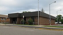
West Branch Library and City Hall 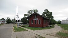
Former West Branch train depot


References[]
- ^ a b "2019 U.S. Gazetteer Files". United States Census Bureau. Retrieved July 25, 2020.
- ^ a b "U.S. Census website". United States Census Bureau. Retrieved 2012-11-25.
- ^ a b "Population and Housing Unit Estimates". United States Census Bureau. May 24, 2020. Retrieved May 27, 2020.
- ^ a b "U.S. Census website". United States Census Bureau. Retrieved 2008-01-31.
- ^ U.S. Geological Survey Geographic Names Information System: West Branch, Michigan
- ^ "Find a County". National Association of Counties. Retrieved 2011-06-07.
- ^ "West Branch, Michigan Köppen Climate Classification (Weatherbase)". Weatherbase.
- ^ "NowData - NOAA Online Weather Data". National Oceanic and Atmospheric Administration. Retrieved September 2, 2021.
- ^ "Station: W Branch 3SE, MI". U.S. Climate Normals 2020: U.S. Monthly Climate Normals (1991-2020). National Oceanic and Atmospheric Administration. Retrieved September 2, 2021.
- ^ "Census of Population and Housing". Census.gov. Retrieved June 4, 2015.
- ^ "West Branch Rose City Area Schools > Home". wbrc.k12.mi.us.
- ^ "St Joseph Catholic School > Home". wbstjoseph.com.
- ^ "Chronology - MidMichigan Health". www.midmichigan.org. Retrieved 2021-06-05.
- ^ "West Branch Regional Medical Center | West Branch Michigan". www.wbrmc.com. Retrieved 2021-06-05.
- ^ "Rehabilitation Services | West Branch Regional Medical Center | Michigan". www.wbrmc.com. Retrieved 2021-06-05.
- ^ "Wound Care Services | West Branch Regional Medical Center". www.wbrmc.com. Retrieved 2021-06-05.
- ^ "WBRMC not planning to suspend additional services - Ogemaw County Herald". ogemawherald.com. Retrieved 2016-04-27.
- ^ 2021. "New maternity unit opens | Ogemaw County Herald". www.ogemawherald.com. Retrieved 2021-06-05.CS1 maint: numeric names: authors list (link)
- ^ "West Branch Regional Medical Center: Go Outside! – MiCare Matters". Retrieved 2021-06-05.
- ^ "West Branch Visitors Bureau". visitwestbranch.com.
- ^ "Relay For Life of Ogemaw County". acsevents.org.
External links[]
Municipalities and communities of Ogemaw County, Michigan, United States | ||
|---|---|---|
| Cities |  | |
| Village | ||
| Civil townships | ||
| CDPs | ||
| Other unincorporated communities |
| |
| ||
Authority control | |
|---|---|
| General | |
| National libraries | |
- Cities in Ogemaw County, Michigan
- County seats in Michigan
- Populated places established in 1885
- 1885 establishments in Michigan