Rose City, Michigan
Rose City, Michigan | |
|---|---|
| City of Rose City | |
 Looking north along M-33 toward Main Street | |
 Location within Ogemaw County | |
 Rose City Location within the state of Michigan | |
| Coordinates: 44°25′16″N 84°06′55″W / 44.42111°N 84.11528°WCoordinates: 44°25′16″N 84°06′55″W / 44.42111°N 84.11528°W | |
| Country | United States |
| State | Michigan |
| County | Ogemaw |
| Settled | 1875 |
| Incorporated | 1910 |
| Government | |
| • Type | Mayor–council |
| • Mayor | Dave Reasner |
| • Clerk | Cindy Rosebrugh |
| Area | |
| • Total | 1.09 sq mi (2.82 km2) |
| • Land | 1.08 sq mi (2.80 km2) |
| • Water | 0.01 sq mi (0.03 km2) |
| Elevation | 958 ft (292 m) |
| Population | |
| • Total | 653 |
| • Estimate (2019)[3] | 632 |
| • Density | 586.82/sq mi (226.62/km2) |
| Time zone | UTC-5 (Eastern (EST)) |
| • Summer (DST) | UTC-4 (EDT) |
| ZIP code(s) | 48654 |
| Area code(s) | 989 |
| FIPS code | 26-69680[4] |
| GNIS feature ID | 636193[5] |
| Website | Official website |

Rose City is a city in Ogemaw County in the U.S. state of Michigan. The population was 653 at the 2010 census, which ranks it as the seventh-smallest city by population in the state.
History[]
Churchill was the original name of this lumbering town, which was located 0.5 miles (0.8 km) from its present spot.[6][7] Hiram Hodge was the first resident of the community. He built a hotel, but later left. The Rose family, including Allan S. Rose, his father and two brothers, came from New York State in 1875. They built a general store with space for a post office.[7] A post office opened with the name Churchill on September 8, 1875.
On July 23, 1892, the settlement was moved to the east, and the post office's name was changed to Rose City.[7][8] Rose City was incorporated as a city in 1905. In 1910, the city suffered a major fire that destroyed the business section within an hour.
In 2002, the city of Rose City and its historic fire were designated as Michigan State Historic Sites with a double-sided historic marker erected in Rose City Park.[9] Near Rose City Park is the Cleveland Park Pavilion, which is also a registered historic site.[10]
Geography[]
According to the United States Census Bureau, the city has a total area of 1.09 square miles (2.82 km2), of which 1.08 square miles (2.80 km2) is land and 0.01 square miles (0.03 km2) (0.74%) is water.[1]
Houghton Creek, a tributary of the Rifle River, runs through part of the city limits. The Rifle River State Recreation Area is about 3 miles (4.8 km) to the east.
Demographics[]
| Historical population | |||
|---|---|---|---|
| Census | Pop. | %± | |
| 1910 | 542 | — | |
| 1920 | 331 | −38.9% | |
| 1930 | 338 | 2.1% | |
| 1940 | 355 | 5.0% | |
| 1950 | 446 | 25.6% | |
| 1960 | 435 | −2.5% | |
| 1970 | 530 | 21.8% | |
| 1980 | 661 | 24.7% | |
| 1990 | 686 | 3.8% | |
| 2000 | 721 | 5.1% | |
| 2010 | 653 | −9.4% | |
| 2019 (est.) | 632 | [3] | −3.2% |
| U.S. Decennial Census[11] | |||
2010 census[]
At the 2010 census there were 653 people in 238 households, including 154 families, in the city. The population density was 604.6 inhabitants per square mile (233.4/km2). There were 288 housing units at an average density of 266.7 per square mile (103.0/km2). The racial makeup of the city was 96.9% White, 0.2% African American, 1.2% Native American, 0.3% Asian, 0.5% from other races, and 0.9% from two or more races. Hispanic or Latino of any race were 1.7%.[2]
Of the 238 households 35.7% had children under the age of 18 living with them, 36.1% were married couples living together, 21.4% had a female householder with no husband present, 7.1% had a male householder with no wife present, and 35.3% were non-families. 30.7% of households were one person and 14.3% were one person aged 65 or older. The average household size was 2.36 and the average family size was 2.87.
The median age was 44.6 years. 23.3% of residents were under the age of 18; 7.4% were between the ages of 18 and 24; 19.6% were from 25 to 44; 25% were from 45 to 64; and 24.8% were 65 or older. The gender makeup of the city was 48.4% male and 51.6% female.
2000 census[]
At the 2000 census there were 721 people in 241 households, including 155 families, in the city. The population density was 665.7 per square mile (257.8/km2). There were 283 housing units at an average density of 261.3 per square mile (101.2/km2). The racial makeup of the city was 96.26% White, 0.14% African American, 0.83% Native American, 0.97% from other races, and 1.80% from two or more races. Hispanic or Latino of any race were 1.39%.[4]
Of the 241 households 35.3% had children under the age of 18 living with them, 40.7% were married couples living together, 21.2% had a female householder with no husband present, and 35.3% were non-families. 30.7% of households were one person and 13.3% were one person aged 65 or older. The average household size was 2.51 and the average family size was 3.16.
The age distribution was 26.4% under the age of 18, 6.8% from 18 to 24, 23.3% from 25 to 44, 17.2% from 45 to 64, and 26.4% 65 or older. The median age was 39 years. For every 100 females, there were 82.1 males. For every 100 females age 18 and over, there were 75.2 males.
The median household income was $25,192 and the median family income was $31,042. Males had a median income of $24,861 versus $18,417 for females. The per capita income for the city was $10,684. About 18.3% of families and 24.7% of the population were below the poverty line, including 33.5% of those under age 18 and 3.1% of those age 65 or over.
Images[]

U.S. Post Office in Rose City 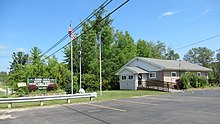
Rose City City Hall 
Ogemaw District Library 
Rose City Police and Fire Department 
Rose City state historic marker 
The Big Fire state historic marker


References[]
- ^ a b "2019 U.S. Gazetteer Files". United States Census Bureau. Retrieved July 25, 2020.
- ^ a b "U.S. Census website". United States Census Bureau. Retrieved 2012-11-25.
- ^ a b "Population and Housing Unit Estimates". United States Census Bureau. May 24, 2020. Retrieved May 27, 2020.
- ^ a b "U.S. Census website". United States Census Bureau. Retrieved 2008-01-31.
- ^ U.S. Geological Survey Geographic Names Information System: Rose City, Michigan
- ^ "The 18 tiniest cities in Michigan". Flint Journal. Mlive Media Group. December 4, 2016. p. 14. Retrieved December 5, 2016.
- ^ a b c Romig, Walter (October 1, 1986) [1973]. Michigan Place Names: The History of the Founding and the Naming of More Than Five Thousand Past and Present Michigan Communities (Paperback). Great Lakes Books Series. Detroit, Michigan: Wayne State University Press. p. 485. ISBN 081431838X.
- ^ U.S. Geological Survey Geographic Names Information System: Rose City Post Office
- ^ MichMarkers.com (2021). "Rose City / The Big Fire: Registered Site L2107". Retrieved August 22, 2021.
- ^ MichMarkers.com (2021). "Cleveland Park Pavilion: Registered Site L2092". Retrieved August 22, 2021.
- ^ "Census of Population and Housing". Census.gov. Retrieved June 4, 2015.
External links[]
Municipalities and communities of Ogemaw County, Michigan, United States | ||
|---|---|---|
| Cities |  | |
| Village | ||
| Civil townships | ||
| CDPs | ||
| Other unincorporated communities |
| |
| ||
- Cities in Ogemaw County, Michigan
- Populated places established in 1875
- 1875 establishments in Michigan
- Michigan State Historic Sites