Jhelum Valley (Kashmir)
This article has multiple issues. Please help or discuss these issues on the talk page. (Learn how and when to remove these template messages)
|
Jhelum Valley
وادی جہلم | |
|---|---|
Valley | |
 | |
 Jhelum Valley | |
| Coordinates: 34°10′09″N 73°44′36″E / 34.1691°N 73.7432°ECoordinates: 34°10′09″N 73°44′36″E / 34.1691°N 73.7432°E | |
| Country | Pakistan |
| Territory | Azad Kashmir |
| District | Hattian Bala |
| Languages | |
| • Official | Urdu |
| Time zone | UTC+05:00 (PST) |
| Website | http://jvc.ajku.edu.pk/Jhelum.php |
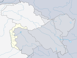
Jhelum Valley (Urdu: وادی جہلم ) is a valley in Jhelum Valley District of Azad Kashmir. It is a 50 kilometers (31 mi) long valley located along with Jhelum river surrounded by lush green mountains.[1] Hattian Bala is the main town and district headquarters of the valley.
Etymology[]
The Nilamata Purana describes the Valley's origin from the waters, a fact corroborated by prominent geologists, and shows how the very name of the land was derived from the process of desiccation - Ka means "water" and Shimir means "to desiccate". Hence, Kashmir stands for "a land desiccated from water". There is also a theory which takes Kashmir to be a contraction of Kashyap-mira or Kashyapmir or Kashyapmeru, the "Sea or Mountain of Kashyapa", the sage who is credited with having drained the waters of the primordial Lake Satisar, that Kashmir was before it was reclaimed. The Nilamata Purana gives the name Kashmira to the (Kashmir Valley includes the Wular Lake) Mira" which means the sea lake or the mountain of Sage Kashyapa. Mira in Sanskrit means Ocean or boundary, considering it to be an embodiment of Uma and it is the Kashmir that the world knows today. The Kashmiris, however, call it Kashir, which has been derived phonetically from Kashmir. The Ancient Greeks called it as Kasperia. Kashyapa-pura, which has been identified with Kaspapyros of Hecataeus[disambiguation needed] (apud Stephanus[disambiguation needed] of Byzantium) and of Herodotus (3.102, 4.44); In classical literature Herodotus also called it Kaspatyrol.[2] Kashmir is also believed to be the country meant by Ptolemy's Kaspeiria. Xuanzang, the Chinese monk who visited Kashmir in 631 AD called it Kia-shi-mi-lo, the Tibetans called it Khachal, meaning "snowy mountain".[2] It is and has been a land of rivers, lakes and wildflowers. Cashmere is an archaic spelling of present-Kashmir, and in some countries it is still spelled this way. A tribe of Semitic origin, named Kash (which means a deep slash in the native dialect), is believed to have founded the cities of Kashan and Kashgar, not to be confused with the tribe from Caspian. The land and the people were known as 'Kashir' from which 'Kashmir' was also derived from therein.[3]
Tourist attractions[]
Some popular tourist attractions are Garhi Dupatta, Awan Patti, Chinari, Chakothi, and Chikkar.[4] The valley is connected by a metalled road from Muzaffarabad.[5]
Hotels and rest houses with basic facilities are located in towns and villages in valley. Health facilities, education institutes, post offices and land-line phone service are also available.

See also[]
References[]
- ^ "Jhelum Valley". Azad Jammu & Kashmir Council. Retrieved 7 July 2013.
- ^ a b P. N. K. Bamzai, Culture and Political History of Kashmir, Vol. 1 (New Delhi: M.D. Publications, 1994), pp. 4–6
- ^ https://freepresskashmir.news/2021/01/10/myths-and-misconception-origins-of-name-kashmir/
- ^ "Jehlum Valley- AJ&K Tourism & Archaeology Department". ajktourism.gov.pk. Retrieved 17 August 2019.
- ^ "Jhelum valley". jhelumvalley.com. Archived from the original on 7 July 2013. Retrieved 7 July 2013.
- Populated places in Jhelum Valley District
- Tourist attractions in Azad Kashmir
- Valleys of Azad Kashmir
