Kľačany
Kľačany | |
|---|---|
Municipality | |
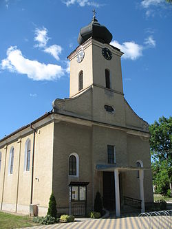 Church in Kľačany | |
 Kľačany Location of Kľačany in the Trnava Region | |
| Coordinates: 48°23′19″N 17°52′25″E / 48.38861°N 17.87361°ECoordinates: 48°23′19″N 17°52′25″E / 48.38861°N 17.87361°E | |
| Country | Slovakia |
| Region | Trnava |
| District | Hlohovec |
| First mentioned | 1256 |
| Area | |
| • Total | 10.105 km2 (3.902 sq mi) |
| Elevation | 170 m (560 ft) |
| Population | |
| • Total | 976 |
| • Density | 97/km2 (250/sq mi) |
| Postal code | 920 64 |
| Area code(s) | +421-33 |
| Car plate | HC |
| Website | www.obec-klacany.sk |


Kľačany is a village and municipality in Hlohovec District in the Trnava Region of western Slovakia.
Etymology[]
Slovak Kľačane – settlers living near "kľak" ("bended wood", typically a floodplain forest or knee timber).[1]
History[]
In historical records the village was first mentioned in 1256.[citation needed]
Geography[]
The municipality lies at an altitude of 170 metres and covers an area of 10.105 km². It has a population of about 976 people.
Genealogical resources[]
The records for genealogical research are available at the state archive "Statny Archiv in Nitra, Slovakia"
- Roman Catholic church records (births/marriages/deaths): 1756-1895 (parish B)
- Lutheran church records (births/marriages/deaths): 1783-1919 (parish B)
See also[]
References[]
- ^ Krajčovič, Rudolf (2010). "Z lexiky stredovekej slovenčiny s výkladmi názvov obcí a miest (44)". Kultúra slova (in Slovak). Martin: Vydavateľstvo Matice slovenskej (3): 147.
External links[]
- https://web.archive.org/web/20080111223415/http://www.statistics.sk/mosmis/eng/run.html
- Surnames of living people in Klacany
| hide Municipalities of Hlohovec District | ||
|---|---|---|
This Trnava Region geography article is a stub. You can help Wikipedia by . |
Categories:
- Villages and municipalities in Hlohovec District
- Trnava Region geography stubs