Kōfu, Tottori
Kōfu
江府町 | |
|---|---|
Town | |
 , Kōfu, Tottori Prefecture | |
 Flag  Seal | |
 Location of Kōfu in Tottori Prefecture | |
 Kōfu | |
| Coordinates: 35°17′N 133°29′E / 35.283°N 133.483°ECoordinates: 35°17′N 133°29′E / 35.283°N 133.483°E | |
| Country | Japan |
| Region | Chūgoku San'in |
| Prefecture | Tottori Prefecture |
| District | Hino |
| Government | |
| • Mayor | Toshirō Takeuchi (elected 2004) |
| Area | |
| • Total | 124.52 km2 (48.08 sq mi) |
| Population (October 1, 2016) | |
| • Total | 2,950 |
| • Density | 24/km2 (61/sq mi) |
| Time zone | UTC+9 (Japan Standard Time) |
| - Tree | Japanese Beech (Buna) |
| - Flower | Iris |
| Phone number | 0859-75-2211 |
| Address | 475 Ebi, Kōfu-chō, Tottori-ken 1689-4401 |
| Website | Town of Kōfu, Official Site(in Japanese) |

Kōfu (江府町, Kōfu-chō) is a town located in the northeast of Hino District, Tottori Prefecture, Japan. As of October 2016, the town has an estimated population of 2,950, with a population density of 24 persons per km².[1] The total area of Kōfu is 124.66 square kilometres (48.13 sq mi).[2][3]
Etymology[]
The name of the town of Kōfu was chosen in a referendum by its residents. In the Japanese language it is formed from two kanji characters. The first, 江, means "water", and the second, 府 means "center" or "core".[3]
Geography[]
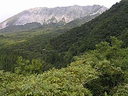
Kōfu is located in the Chūgoku Mountains. The northeast part of the town is on a plateau composed of pyroclastic soil. at the southern foot of Mount Daisen. The Hino River flows through the western part of the town. The southern part of the town, which borders Okayama Prefecture, is at a high altitude and is dominated by (1,110 metres (3,640 ft)), (1,009.8 metres (3,313 ft)), and Mount Kenashi (1,218.4 metres (3,997 ft)).[3]
Neighboring municipalities[]
History[]
The town of Kōfu was formed in 1953 by the merger of , , and .[2]
Every August 17, there is a festival held in Kōfu called, "Juushichiya" (十七夜).[4] Yatai (food stalls) of various kinds come and set up shop along the main road in Ebi, and people from all over come to participate in this festival. There is a sumo tournament in the early morning among the men who live in the town, and there is even a tournament for the school children as well. The kindergarten students play Japanese drums, taiko, in the evening along with other members of the town.[4] There are fireworks as well in the evening. A 500-year-old traditional dance is also performed through the town and in the town's park; the dance is called "Kodaiji".[4] The dance has been passed down for 500 years since the death of the lord who ruled over the town, and it is done in remembrance of him and to also wish for a plentiful harvest and successful year. The pinnacle of the festival occurs when townspeople light the hill facing the park on fire, spelling out the festival's name (十七夜) on the side of the hill.[4]
Transportation[]
Rail[]
Highway[]
- Japan National Route 180
- Route 482 (Japan)
- Yonago Expressway, [2]
References[]
- ^ 江府町の人口 [Population of Kōfu] (in Japanese). Kōfu, Tottori Prefecture: Kōfu Town Office. 2012. Retrieved July 1, 2012.
- ^ Jump up to: a b c d "江府(町)" [Kōfu]. Nihon Daihyakka Zensho (Nipponika) (in Japanese). Tokyo: Shogakukan. 2012. OCLC 153301537. Archived from the original on 2007-08-25. Retrieved 2012-07-01.
- ^ Jump up to: a b c "江府町" [Kōfu]. Nihon Rekishi Chimei Taikei (in Japanese). Tokyo: Shogakukan. 2012. OCLC 173191044. dlc 2009238904. Archived from the original on 2007-08-25. Retrieved 2012-07-01.
- ^ Jump up to: a b c d "500 Year Old Dance: Ebi Juushichiya Story". (in Japanese). Kōfu: Tottori Prefecture: Kōfu Town Office. 2011. Retrieved May 1, 2014
External links[]
 Media related to Kōfu, Tottori at Wikimedia Commons
- Town of Kōfu, Official Site(in Japanese)
| show Authority control |
|---|
- Towns in Tottori Prefecture