Kaga, Ishikawa
Kaga
加賀市 | |
|---|---|
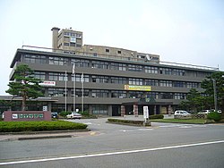 Kaga City Hall | |
 Flag  Emblem | |
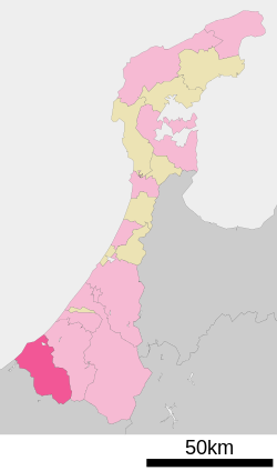 Location of Kaga in Ishikawa Prefecture | |
 Kaga | |
| Coordinates: 36°18′10″N 136°18′54.1″E / 36.30278°N 136.315028°ECoordinates: 36°18′10″N 136°18′54.1″E / 36.30278°N 136.315028°E | |
| Country | Japan |
| Region | Chūbu (Hokuriku) |
| Prefecture | Ishikawa Prefecture |
| Government | |
| • Mayor | Riku Miyamoto |
| Area | |
| • Total | 305.87 km2 (118.10 sq mi) |
| Population (March 1, 2018) | |
| • Total | 67,793 |
| • Density | 220/km2 (570/sq mi) |
| Time zone | UTC+9 (Japan Standard Time) |
| City symbols | |
| -Tree | Pine |
| -Flower | Iris |
| -Bird | Duck |
| Phone number | 0761-72-1111 |
| Address | 2–41 Minami-chō, Daishōji, Kaga-shi, Ishikawa-ken 922-8622 |
| Website | Official website |

Kaga (加賀市, Kaga-shi) is a city located in southwestern Ishikawa Prefecture, Japan. As of 1 March 2018, the city had an estimated population of 67,793 in 29054 households, and a population density of 290 persons per km².[1] The total area of the city was 305.87 square kilometres (118.10 sq mi).
Geography[]
Kaga is located in the extreme southwestern corner of Ishikawa Prefecture in the Hokuriku region of Japan and is bordered by the Sea of Japan to the west and Fukui Prefecture to the south. Parts of the coastal areas of the city are within the borders of the Echizen-Kaga Kaigan Quasi-National Park.
Neighbouring municipalities[]
Demographics[]
Per Japanese census data,[2] the population of Kaga has remained stable over the past 40 years.
| Census Year | Population |
|---|---|
| 1970 | 69,664 |
| 1980 | 77,335 |
| 1990 | 80,714 |
| 2000 | 79,653 |
| 2010 | 71,887 |
Climate[]
Kaga has a humid continental climate (Köppen Cfa) characterized by mild summers and cold winters with heavy snowfall. The average annual temperature in Kaga is 14.2 °C. The average annual rainfall is 2499 mm with September as the wettest month. The temperatures are highest on average in August, at around 26.8 °C, and lowest in January, at around 2.8 °C.[3]
| hideClimate data for Port Kaga | |||||||||||||
|---|---|---|---|---|---|---|---|---|---|---|---|---|---|
| Month | Jan | Feb | Mar | Apr | May | Jun | Jul | Aug | Sep | Oct | Nov | Dec | Year |
| Record high °C (°F) | 20.5 (68.9) |
22.3 (72.1) |
25.9 (78.6) |
30.1 (86.2) |
34.2 (93.6) |
39.3 (102.7) |
37.6 (99.7) |
36.7 (98.1) |
30.9 (87.6) |
26.9 (80.4) |
22.5 (72.5) |
21.7 (71.1) |
39.3 (102.7) |
| Daily mean °C (°F) | −4.6 (23.7) |
−2.2 (28.0) |
3.7 (38.7) |
7.1 (44.8) |
12.7 (54.9) |
16.8 (62.2) |
20.2 (68.4) |
22.7 (72.9) |
17.2 (63.0) |
10.6 (51.1) |
4.3 (39.7) |
−1.3 (29.7) |
8.9 (48.1) |
| Record low °C (°F) | −29.7 (−21.5) |
−29.1 (−20.4) |
−22.8 (−9.0) |
−14.4 (6.1) |
−7.4 (18.7) |
0.0 (32.0) |
3.8 (38.8) |
11.1 (52.0) |
1.8 (35.2) |
−9.4 (15.1) |
−21.1 (−6.0) |
−27.5 (−17.5) |
−29.7 (−21.5) |
| Average precipitation mm (inches) | 232 (9.1) |
219 (8.6) |
206 (8.1) |
166 (6.5) |
134 (5.3) |
127 (5.0) |
177 (7.0) |
198 (7.8) |
272 (10.7) |
321 (12.6) |
349 (13.7) |
308 (12.1) |
2,709 (106.5) |
| [citation needed] | |||||||||||||
History[]
The area around Kaga was part of ancient Kaga Province. The area became part Daishōji Domain under the Edo period Tokugawa shogunate. Following the Meiji restoration, the area was organised into Enuma District, Ishikawa. The town of Daishōji was established with the creation of the modern municipalities system on April 1, 1889. On January 1, 1958, Daishōji merged with the towns of Yamashiro, Katayamazu, Iburihashi, Hashitate and the villages of Miki, Mitani, Nangō and Shioya (all from Enuma District) to form the city of Kaga. the city expanded on October 1, 2005 through a merger with the town of Yamanaka (from Enuma District).
Government[]
Kaga has a mayor-council form of government with a directly elected mayor and a unicameral city legislature of 18 members.
Economy[]
Kaga was traditionally known for its production of Kutani ware ceramics and a type of silk fabric known as Kaga habutae.[4] It is also an important tourist city with a number of temples and hot-springs.
Education[]
Kaga has 21 public elementary schools and seven middle schools operated by the city government, and four public high schools operated by the Ishikawa Prefectural Board of Education. The prefecture also operates a special education school.
Transportation[]
Railway[]
![]() West Japan Railway Company – Hokuriku Main Line
West Japan Railway Company – Hokuriku Main Line
Highway[]
Local attractions[]
Sister city relations[]
 Dundas, Ontario, Canada, since 1968[5]
 Tainan, Taiwan, friendship city
Notable people[]
- Masanobu Tsuji, war criminal, army officer and politician.
- Rokusaburo Michiba, Japanese cuisine chef, known as the first Japanese Iron Chef of television series Iron Chef
- Shoji Tabuchi, fiddler and entertainer resident in Branson, Missouri
References[]
- ^ Official statistics page
- ^ Kaga population statistics
- ^ Kaga climate data
- ^ Campbell, Allen; Nobel, David S (1993). Japan: An Illustrated Encyclopedia. Kodansha. p. 708. ISBN 406205938X.
- ^ Official Site of Kids for Kaga – History
External links[]
![]() Media related to Kaga, Ishikawa at Wikimedia Commons
Media related to Kaga, Ishikawa at Wikimedia Commons
| Wikivoyage has a travel guide for Kaga. |
- Kaga City official website (in Japanese)
- katayamazu onsen
| show Authority control |
|---|
This Ishikawa Prefecture location article is a stub. You can help Wikipedia by . |
- Kaga, Ishikawa
- Cities in Ishikawa Prefecture
- Populated coastal places in Japan
- Ishikawa geography stubs