Branson, Missouri
Branson, Missouri | |
|---|---|
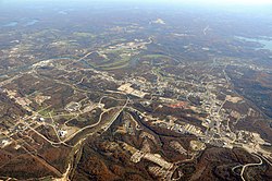 Aerial view from northwest | |
| Nickname(s): | |
 Interactive map of Branson | |
| Coordinates: 36°38′37″N 93°13′07″W / 36.64361°N 93.21861°WCoordinates: 36°38′37″N 93°13′07″W / 36.64361°N 93.21861°W[3] | |
| Country | United States |
| State | Missouri |
| Counties | Taney, Stone |
| Founded | 1882 |
| Government | |
| • Mayor | Larry Milton [4] |
| Area | |
| • City | 21.32 sq mi (55.22 km2) |
| • Land | 21.17 sq mi (54.83 km2) |
| • Water | 0.15 sq mi (0.39 km2) |
| Elevation | 774 ft (236 m) |
| Population | |
| • City | 10,520 |
| • Estimate (2019)[8] | 11,630 |
| • Density | 549.36/sq mi (212.11/km2) |
| • Urban | 14,359 |
| Time zone | UTC-6 (CST) |
| • Summer (DST) | UTC-5 (CDT) |
| ZIP codes | 65615-65616 |
| Area code | 417 |
| FIPS code | 29-07966 [7] |
| GNIS feature ID | 0739970 [3] |
| Website | cityofbranson.org |


Branson is a city in Taney and Stone counties in the U.S. state of Missouri. Most of the city is in Taney County, with a small portion in the west extending into Stone County. Branson is in the Ozark Mountains. The community was named after Reuben Branson, postmaster and operator of a general store in the area in the 1880s.[9] The population was 10,520 at the 2010 census.
Branson has long been a popular destination for vacationers from Missouri and around the country. The collection of entertainment theaters along 76 Country Boulevard (and to a lesser extent along Shepherd of the Hills Expressway), including Dolly Parton's Stampede, has increased Branson's popularity as a tourist destination.
History[]
In 1882, Reuben Branson opened a general store and post office in the area.[10] Branson was formally incorporated in 1912, and construction of the Powersite Dam nearby on the White River which would form Lake Taneycomo was completed.
In 1894, William Henry Lynch bought Marble Cave (renamed "Marvel Cave") and began charging visitors to tour it. Hugo and Mary Herschend leased the cave for 99 years in 1950 and began hosting square dances in it. The Herschend Family modernized the cave with electricity and concrete staircases, and in 1960 the Herschends opened Silver Dollar City, a re-creation of a frontier town that featured five shops, a church, and a log cabin, with actors that played out the feud between the Hatfields and the McCoys.
Harold Bell Wright published his novel about the Ozarks, The Shepherd of the Hills, in 1907. The novel became an international best seller, making Wright the first millionaire author and established Branson and Southwest Missouri as a tourist destination. The Old Mill Theater began its first outdoor production based on the novel in 1960. The show, known as The Shepherd of the Hills Outdoor Drama continues in its 61st season for 2021. The historic farm is also the home of Inspiration Tower, the #1 rated Shepherd of the Hills Adventure Park as well as numerous other shows and attractions.
The Harold Bell Wright Museum is located within The World's Largest Toy Museum complex. Mayor of Branson for 12 years and entrepreneur Jim Owen built the first theater in 1934 on Commercial Street, originally called "The Hillbilly Theater", which began to attract people from far and wide to tour the area. 1959 saw the completion of Table Rock Dam on the White River, which created Table Rock Lake. In 1959, the Mabe Brothers started a band that, in 1961, would become the first music show in Branson. Taking their name from the parts they played in the Shepherd of the Hills Outdoor Drama, they became known as the Baldknobber Hillbilly Jamboree.
In 1962, Paul Henning, inspired by a Boy Scout camping trip to the Ozarks, created The Beverly Hillbillies, which ran on first-run television until 1971. Henning later donated 1,534 acres (6.21 km2) for the Ruth and Paul Henning Conservation Area near Branson. He also donated the modified 1921 Oldsmobile truck used as the vehicle in the series to the College of the Ozarks, where it is on display in the Ralph Foster Museum.
The Presley family became the first to move their show (Presleys' Country Jubilee) to Highway 76 in 1967, followed a year later by the Baldknobbers. Eventually Branson would have more than 50 theaters, most of them located on Highway 76.
In the early 1980s, Chisai Child's Starlite Theater (not to be confused with the current theater by the same name) was one of the first to introduce stage sets, horn section, elaborate costume changes, and music outside of the traditional country music normally played. It helped to launch the careers of Shoji Tabuchi and many others.[11]
In 1983, Branson began its transformation into a major tourist attraction when the Roy Clark Celebrity Theatre opened and began to bring famous country music stars to Branson. Many of the performers who have had their own theaters in Branson first discovered Branson when they performed at this venue.[citation needed] The Roy Clark Celebrity Theatre at the Lodge of the Ozarks has been called the "birthplace of Branson celebrity theatres".
Also in 1983, the 7,500-seat Swiss Villa Amphitheatre opened in Lampe, southwest of Branson. The outdoor amphitheatre brought in acts like Def Leppard, Lynyrd Skynyrd, REO Speedwagon, Steppenwolf, and Ozzy Osbourne. Closing in the early 2000s, it reopened in 2010 as the Black Oak Mountain Amphitheatre.
In 1987, Boxcar Willie became the first internationally known entertainer to purchase a theater in Branson and have a permanent performance schedule there.
In 1989, Shoji Tabuchi opened his first theater in Branson (converting the Ozarks Auto Museum on West 76 Highway into a theater). He then built a new theater on Shepherd of the Hills Expressway in 1990, while Mel Tillis moved into Shoji's old theater. In 1990-1991 several nationally known stars such as Jim Stafford, Ray Stevens, Mickey Gilley, and Moe Bandy opened their own theaters. Along with these national stars, many home-grown shows also had theaters. The Lowe Family featured their show and hosted nationally known stars like Conway Twitty, Loretta Lynn, Vern Gosdin, Waylon Jennings, and others. 76 Music Hall (now known as the Grand Country Music Hall) became the first theater to have three different shows a day performing in different time slots. In 1991, local producer and entertainer Bob Nichols opened the first morning show and the following year, Buck Trent became the first nationally known star to star in a morning show.
The increasing number of theaters and other attractions opening in Branson drew the attention of 60 Minutes, which aired an episode about Branson on December 8, 1991, and called it the "live music capital of the entire universe".[12]
Andy Williams built his theater in Branson, opening on May 1, 1992, calling it the Moon River Theatre. The Glen Campbell Goodtime Theatre opened in 1994, starring Glen along with his "Goodtime Band", daughter Debbie Campbell, the Matthew Dickens Dancers, and comedian ventriloquist Jim Barber. Also headlining their own theaters were Tony Orlando (Yellow Ribbon Theater) and Bobby Vinton (Blue Velvet Theater). In 1998, the Acrobats of China arrived in Branson, making them one of the first international shows to call Branson home. They opened their theatre, the New Shanghai Theatre, in 2005. In 2006, Dick Clark's American Bandstand Theatre opened and is the most recent new theater to be built on Route 76. Branson has continued to add theaters (the most recent being the Sight & Sound Theatres) and shows; it refers to itself as "the live music show capital of the world".[13]
2012 tornado[]
Just after 1 a.m. on February 29, 2012, the city of Branson sustained damage from an EF-2 tornado in the 2012 Leap Day tornado outbreak. At least 37 injuries were reported, most being cuts and bruises, with the most serious injury being an 80-year-old woman with a head injury.[14][15] Most of the tourist attractions and businesses were undamaged and remained open after the storm, although at least 11 buildings suffered more than $3 million in total damage. As of November 2012, most of the damage was repaired.[16] Mary Jane Rice, a spokeswoman for Branson Area Chamber of Commerce, told the AP that February is generally a slow time for business and most of the damage would be cleaned up in the next few days.[17] The tornado followed a 22-mile-long (35 km) path from Kimberling City, Missouri, across Table Rock Lake and along the entertainment strip Missouri Route 76 before hitting the downtown area where it blew out or cracked windows in 219 of the hotel rooms in the 12-story/295 room Hilton Branson Convention Center. The tornado extensively damaged three of Branson's 50-plus theatres — (Americana Theater, Branson Variety Theater and Dick Clark's American Bandstand Theater) and there was damage to portions of Branson Landing on Lake Taneycomo and the Veterans Memorial Museum. Vehicles at the Ride the Ducks water/land attraction were flipped over, but officials said they were not damaged enough to be put out of service.[18][19][20]
Attractions and events[]
The two closest, most convenient commercial airports to Branson with practical airline service are the Springfield, MO (SGF) airport and Northwest Arkansas National Airport (XNA), in Highfill, Arkansas, which is about 62 miles away from Branson, MO. Between these two airports, service is offered to cities such as Chicago, Dallas, Houston, Atlanta, and Denver which allows connections to other cities if necessary.


The Branson Airport, opened in May 2009. It is privately owned, and is the largest privately owned commercial airport in the United States. Over the years, the airport has had on-off service from carriers such as AirTran, Sun Country, and Frontier, but these carriers have either ceased operations or have pulled air service from the Branson Airport.
Besides the numerous entertainment theaters for which Branson is known, other local attractions include Hollywood Wax Museum Branson, Silver Dollar City, White Water, Branson Top Ops, Mount Pleasant Winery, Dolly Parton's Stampede, ziplines, cave tours, go-karts, mini golf, and more. Ripley's Odditorium is housed in a building that has been made to look as if it is cracked wide open by an earthquake or other disaster, while the Titanic Museum is a half-scale replica of the famous ship and iceberg.[21]

Branson Landing opened in the summer of 2006[22] on the Lake Taneycomo waterfront in downtown Branson. The lakefront project includes retail space with Bass Pro Shops and Belk as anchors in an outdoor shopping mall of stores and restaurants. It also features a scenic boardwalk along the lakefront with the Branson Landing Fountains at the heart of the property as well as a Hilton Hotel. Branson Landing has been known to host summer concerts and other special events throughout the year. The convention center, situated between Branson Landing and Historic Downtown Branson, opened September 7, 2007. The Branson Scenic Railway is located in the old depot, across from Branson Landing.
Due to Branson being known for family-oriented tourism, casino gambling is frowned upon and it does not exist in this area. However, Branson's neighboring cities do offer those types of entertainments for those who enjoy gambling. [23]
Geography[]
Branson is located at 36°38′16″N 93°15′18″W / 36.63778°N 93.25500°W (36.637706, -93.254965).[24] The White River/Lake Taneycomo forms a bend on the east and southern side of the city.
According to the United States Census Bureau, the city has a total area of 20.80 square miles (53.87 km2), of which 20.63 square miles (53.43 km2) is land and 0.17 square miles (0.44 km2) is water.[25]
Climate[]
Branson has a humid subtropical climate (Cfa) with characteristics of a continental climate. The hardiness zone is 6b. [1]
| hideClimate data for Branson, MO | |||||||||||||
|---|---|---|---|---|---|---|---|---|---|---|---|---|---|
| Month | Jan | Feb | Mar | Apr | May | Jun | Jul | Aug | Sep | Oct | Nov | Dec | Year |
| Record high °F (°C) | 80 (27) |
87 (31) |
90 (32) |
96 (36) |
99 (37) |
105 (41) |
116 (47) |
108 (42) |
106 (41) |
96 (36) |
90 (32) |
81 (27) |
116 (47) |
| Average high °F (°C) | 44 (7) |
50 (10) |
59 (15) |
69 (21) |
77 (25) |
85 (29) |
90 (32) |
89 (32) |
81 (27) |
72 (22) |
58 (14) |
47 (8) |
68 (20) |
| Average low °F (°C) | 21 (−6) |
25 (−4) |
33 (1) |
41 (5) |
50 (10) |
59 (15) |
64 (18) |
62 (17) |
55 (13) |
43 (6) |
34 (1) |
25 (−4) |
43 (6) |
| Record low °F (°C) | −15 (−26) |
−19 (−28) |
0 (−18) |
19 (−7) |
29 (−2) |
40 (4) |
48 (9) |
40 (4) |
30 (−1) |
22 (−6) |
6 (−14) |
−12 (−24) |
−19 (−28) |
| Average precipitation inches (mm) | 2.30 (58) |
2.44 (62) |
3.94 (100) |
3.99 (101) |
4.29 (109) |
4.59 (117) |
3.51 (89) |
3.09 (78) |
4.19 (106) |
2.98 (76) |
4.63 (118) |
3.14 (80) |
43.09 (1,094) |
| Average snowfall inches (cm) | 3.2 (8.1) |
3.4 (8.6) |
2.4 (6.1) |
0.1 (0.25) |
0 (0) |
0 (0) |
0 (0) |
0 (0) |
0 (0) |
0 (0) |
0.7 (1.8) |
1.9 (4.8) |
11.7 (30) |
| Source: [26] | |||||||||||||
Demographics[]
| Historical population | |||
|---|---|---|---|
| Census | Pop. | %± | |
| 1920 | 598 | — | |
| 1930 | 958 | 60.2% | |
| 1940 | 1,011 | 5.5% | |
| 1950 | 1,314 | 30.0% | |
| 1960 | 1,887 | 43.6% | |
| 1970 | 2,175 | 15.3% | |
| 1980 | 2,550 | 17.2% | |
| 1990 | 3,706 | 45.3% | |
| 2000 | 6,050 | 63.2% | |
| 2010 | 10,520 | 73.9% | |
| 2019 (est.) | 11,630 | [8] | 10.6% |
| U.S. Decennial Census | |||
The Branson Micropolitan Statistical Area encompasses Taney and Stone counties.
2010 census[]
As of the census[27] of 2010, there were 10,520 people, 4,688 households, and 2,695 families living in the city. The population density was 509.9 inhabitants per square mile (196.9/km2). There were 8,599 housing units at an average density of 416.8 per square mile (160.9/km2). The racial makeup of the city was 89.0% White, 2.0% African American, 0.9% Native American, 1.5% Asian, 0.1% Pacific Islander, 3.9% from other races, and 2.6% from two or more races. Hispanic or Latino of any race were 8.8% of the population.
There were 4,688 households, of which 23.2% had children under the age of 18 living with them, 42.8% were married couples living together, 10.7% had a female householder with no husband present, 3.9% had a male householder with no wife present, and 42.5% were non-families. 32.8% of all households were made up of individuals, and 13.5% had someone living alone who was 65 years of age or older. The average household size was 2.20 and the average family size was 2.77.
The median age in the city was 41.2 years. 18.8% of residents were under the age of 18; 10.2% were between the ages of 18 and 24; 25.7% were from 25 to 44; 25.6% were from 45 to 64; and 19.6% were 65 years of age or older. The gender makeup of the city was 47.9% male and 52.1% female.
2000 census[]
As of the census[7] of 2000, there were 6,050 people, 2,701 households, and 1,661 families living in the city. The population density was 374.0 people per square mile (144.4/km2). There were 3,366 housing units at an average density of 208.1 per square mile (80.3/km2). The racial makeup of the city was 94.50% White, 0.84% African American, 0.86% Native American, 0.71% Asian, 0.03% Pacific Islander, 1.47% from other races, and 1.59% from two or more races. Hispanic or Latino of any race were 4.26% of the population.
There were 2,701 households, out of which 24.3% had children under the age of 18 living with them, 48.9% were married couples living together, 9.4% had a female householder with no husband present, and 38.5% were non-families. 31.9% of all households were made up of individuals, and 14.1% had someone living alone who was 65 years of age or older. The average household size was 2.21 and the average family size was 2.76.
In the city, the population was spread out, with 20.3% under the age of 18, 8.2% from 18 to 24, 24.4% from 25 to 44, 27.0% from 45 to 64, and 20.2% who were 65 years of age or older. The median age was 43 years. For every 100 females, there were 86.7 males. For every 100 females age 18 and over, there were 83.2 males.
The median income for a household in the city was $31,997, and the median income for a family was $43,145. Males had a median income of $31,769 versus $21,223 for females. The per capita income for the city was $20,461. 12.1% of the population and 9.7% of families were below the poverty line. 15.6% of those under the age of 18 and 17.0% of those 65 and older were living below the poverty line.
Education[]
operates four elementary schools, Branson Jr. High School and Branson High School.[28]
The town has a lending library, the Taneyhills Community Library.[29]
Notable people[]
- Kim Boyce, Miss Florida 1983
- John Burkhalter, businessman; born in Branson
- Janet Dailey, author
- Ray Stevens, country/pop singer-songwriter-musician-producer-arranger-comedian
- Barbara Fairchild, country and gospel singer
- Jack Hamilton, baseball player
- Dino Kartsonakis, pianist
- The Moffatts, teen country music band
- Tony Orlando, popular music singer
- The Petersens, bluegrass family band
- Yakov Smirnoff, Ukrainian comedian
- Jim Stafford, comedian, singer, master guitar player
- Shoji Tabuchi, country music fiddler and singer
- Andy Williams, popular music singer
- Barry Williams, singer and actor
- Boxcar Willie, country music singer
Media[]
- Branson Tri-Lakes News – A twice-weekly newspaper that traces its origins back more than 100 years to the oldest publications in the Branson area.
Healthcare[]
Branson is served by the 165 bed full-service hospital and emergency department Cox Regional Medical Center and the Mercy Health System multi-specialty clinic.[30][31][32]
Transportation[]
Highways[]
U.S. Route 65 runs north and south, connecting Branson to Springfield to the north, and Little Rock to the south.
Air[]
Branson is served primarily by Branson Airport, the closest commercial airport. Prior to the opening of Branson Airport, Branson was served by the larger Springfield-Branson National Airport located in Springfield Missouri. M. Graham Clark Field is a general aviation airport located in Branson that serves mainly single engine aircraft.
References[]
- ^ "60 Minutes Branson". Youtube. 60 Minutes.
- ^ Wilcox, Lauren (March 25, 2007). "Big Time in Tune Town". Washington Post. Washington Post.
- ^ Jump up to: a b c U.S. Geological Survey Geographic Names Information System: Branson, Missouri
- ^ "Larry Milton - Mayor | Branson, MO - Official Website".
- ^ "2019 U.S. Gazetteer Files". United States Census Bureau. Retrieved July 26, 2020.
- ^ "U.S. Census website". United States Census Bureau. Retrieved 2019-05-23.
- ^ Jump up to: a b "U.S. Census website". United States Census Bureau. Retrieved 2008-01-31.
- ^ Jump up to: a b "Population and Housing Unit Estimates". United States Census Bureau. May 24, 2020. Retrieved May 27, 2020.
- ^ "The Branson Story". Archived from the original on 13 December 2010. Retrieved 30 August 2010.
- ^ Earngey, Bill (1995). Missouri Roadsides: The Traveler's Companion. University of Missouri Press. p. 26. ISBN 9780826210210.
- ^ "Shoji Tabuchi Biography". Musicianguide.com. Retrieved 2012-02-29.
- ^ "History of the Branson Entertainment Phenomenon". Retrieved 10 August 2012.
- ^ "History of the Branson Entertainment Phenomenon". Retrieved 10 August 2012.
- ^ "Leap Day Storm: At least three dead, several injured after tornadoes strike Ozarks; Branson hit hard". Archived from the original on 2013-06-15.
- ^ "Powerful storms sweep Midwest, damaging Branson theater district and killing at least 9". Archived from the original on 6 March 2012. Retrieved 29 February 2012.
- ^ "Tornado injures at least 33 in Branson, causes major damage". Archived from the original on 2 March 2012. Retrieved 29 February 2012.
- ^ "Tornado tears through country music town of Branson, Mo". USA Today. 29 February 2012. Retrieved 29 February 2012.
- ^ Ashley (2011-12-30). "Branson, Missouri Travel Guide: Branson Takes Hit from Major Storm; Many Businesses Unaffected". Travelguide.reservebranson.com. Archived from the original on 2012-05-26. Retrieved 2012-02-29.
- ^ "Nixon touring storm-damaged areas by Branson, Cassville | Springfield News-Leader". News-Leader.com. Archived from the original on 2012-03-02. Retrieved 2012-02-29.
- ^ "EF-2 Tornado Confirmed; Debris Cleanup Begins in Stone, Taney Counties". Ozarksfirst.com. Archived from the original on 2012-03-02. Retrieved 2012-02-29.
- ^ "List of Branson Attractions". Retrieved 23 August 2014.
- ^ "Branson Mall Info". Retrieved 25 August 2014.
- ^ Coulter, Ronald L.; Hermans, Charles M.; Parker, R. Stephen (1 September 2013). "Religiosity and generational effects on gambling: Support for and opposition to introducing casino gambling in a non-gambling tourist entertainment environment". Journal of Business Research. 66 (9): 1682–1688. doi:10.1016/j.jbusres.2012.12.015.
- ^ "US Gazetteer files: 2010, 2000, and 1990". United States Census Bureau. 2011-02-12. Retrieved 2011-04-23.
- ^ "US Gazetteer files 2010". United States Census Bureau. Archived from the original on 2012-01-25. Retrieved 2012-07-08.
- ^ "Branson climate averages on Intellicast". Archived from the original on 2015-07-22. Retrieved 2015-05-06.
- ^ "U.S. Census website". United States Census Bureau. Retrieved 2012-07-08.
- ^ "Branson R-Iv School District". Greatschools. Retrieved 18 March 2018.
- ^ "Missouri Public Libraries". PublicLibraries.com. Archived from the original on 10 June 2017. Retrieved 18 March 2018.
- ^ "Skaggs Regional Medical Center means quality medical care for Branson visitors and residents alike - Branson, MO". www.branson.com. Retrieved 2018-10-03.
- ^ Finello, Beth (2018-10-31). "New Clinic in Branson Opening to Patients Soon". OZARKSFIRST. Retrieved 2018-11-02.
- ^ Morton, Christine. "Mercy Branson multi-specialty Clinic ribbon cutting ceremony scheduled for Halloween". Retrieved 2018-11-02.
External links[]
| Wikimedia Commons has media related to Branson, Missouri. |
- City of Branson
- Branson/Lakes Area Chamber of Commerce
- Branson Tourism Center
- Branson Tourism Information
- Branson, Missouri at Curlie
 Branson travel guide from Wikivoyage
- Sanborn Maps Collection in [University of Missouri]
| show Municipalities and communities of Stone County, Missouri, United States |
|---|

| show Municipalities and communities of Taney County, Missouri, United States |
|---|

| show Authority control |
|---|
- Branson, Missouri
- Cities in Missouri
- Cities in Stone County, Missouri
- Cities in Taney County, Missouri
- 1882 establishments in Missouri
- Populated places established in 1882