Kansas's congressional districts

Kansas is currently divided into 4 congressional districts, each represented by a member of the United States House of Representatives. The number of districts in Kansas remained unchanged after the 2010 Census. From 2010 to 2018, the state's congressional delegation was composed of all Republicans. However, following the 2018 elections, one incumbent was ousted by a Democratic challenger, changing the state's delegation to a 3-1 Republican majority.
Current (until 2023 inauguration) districts and representatives[]
List of members of the Kansas United States House delegation, their terms, their district boundaries, and the districts' political rating according to the CPVI. For the 116th Congress, the state's congressional delegation consists of 3 Republicans and 1 Democrat.
| Current U.S. representatives from Kansas ()
| |||||
|---|---|---|---|---|---|
| District | Member (Residence)[2] |
Party | Incumbent since | CPVI (2021)[3] |
District map |
| 1st |  Tracey Mann (Salina) |
Republican | January 3, 2021 | R+24 | 
|
| 2nd |  Jake LaTurner (Topeka) |
Republican | January 3, 2021 | R+10 | 
|
| 3rd |  Sharice Davids (Roeland Park) |
Democratic | January 3, 2019 | D+1 | 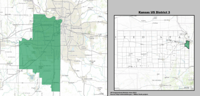
|
| 4th |  Ron Estes (Wichita) |
Republican | April 25, 2017 | R+15 | 
|
History[]
Historically, the state has held as many as eight seats (1893–1933). The number of congressional seats decreased from five to four following the 1990 Census. Between 1990 and 2000, the population of Kansas grew by 8.5% from 2,477,574 to 2,688,418, making it the 32nd most populated state; all four congressional seats were retained.
Historical and present district boundaries[]
Table of United States congressional district boundary maps in the State of Kansas, presented chronologically.[4] All redistricting events that took place in Kansas between 1973 and 2013 are shown.
| Year | Statewide map |
|---|---|
| 1973–1982 | 
|
| 1983–1992 | 
|
| 1993–2002 | 
|
| 2003–2013 | 
|
| Since 2013 | 
|
Obsolete districts[]
- Kansas Territory's at-large congressional district
- Kansas's at-large congressional district
- Kansas's 5th congressional district
- Kansas's 6th congressional district
- Kansas's 7th congressional district
- Kansas's 8th congressional district
See also[]
References[]
- ^ "The national atlas". nationalatlas.gov. Archived from the original on February 22, 2014. Retrieved February 2, 2014.
- ^ "Office of the Clerk, U.S. House of Representatives". clerk.house.gov. Retrieved 2022-01-06.
- ^ "Introducing the 2021 Cook Political Report Partisan Voter Index". Cook Political Report. Retrieved 2022-01-06.
- ^ "Digital Boundary Definitions of United States Congressional Districts, 1789–2012". Retrieved October 18, 2014.
- Kansas Legislative Research Department (June 19, 2001): 1992 Congressional Districts with selected cities and county populations (pdf, 741 kb). "This map is designed to be printed on 11 x 17 inch or larger format paper."
- Kansas Legislative Research Department (July 31, 2002): Guidelines and Criteria for 2002 Kansas Congressional and Legislative Redistricting, 2 pages (pdf).
- National Committee for an Effective Congress (June 22, 2004)[1].
- Congressional districts of Kansas