Karpacz
Karpacz | |
|---|---|
 Vang Stave Church in Karpacz, 13th century | |
 Coat of arms | |
 Karpacz | |
| Coordinates: 50°46′42″N 15°45′26″E / 50.77833°N 15.75722°E | |
| Country | |
| Voivodeship | Lower Silesian |
| County | Jelenia Góra |
| Gmina | Karpacz (urban gmina) |
| Town rights | 1959 |
| Area | |
| • Total | 37.96 km2 (14.66 sq mi) |
| Highest elevation | 885 m (2,904 ft) |
| Lowest elevation | 480 m (1,570 ft) |
| Population (2019-06-30[1]) | |
| • Total | 4,593 |
| • Density | 120/km2 (310/sq mi) |
| Website | http://www.karpacz.pl |
Karpacz [ˈkarpat͡ʂ] (German: Krummhübel) is a spa town and ski resort in Jelenia Góra County, Lower Silesian Voivodeship, south-western Poland, and one of the most important centres for mountain hiking and skiing, including ski jumping. Its population is about 4,500. Karpacz is situated in the Karkonosze Mountains – a resort with increasing importance for tourism as an alternative to the Alps.[2]
Karpacz is located at 480 to 885 metres (1,575–2,904 ft) above sea level. South of Karpacz on the border to the Czech Republic there is Mount Sněžka-Śnieżka (1,602 m (5,256 ft)). Since 2020, the town has been hosting the annual international Economic Forum.
History[]

The first settlements in area of Karpacz are noted by the official website of the city as being of probable Celtic origin and date to the 4th or 3rd century BC[3] when they inhabited the region as part of gold digging taking place in the area. The area was part of medieval Poland, after the establishment of the state in the 10th century. In the early 12th century the area was generally uninhabited, as mentioned in the oldest Polish chronicle Gesta principum Polonorum.[2] The first mention of permanent location within the current boundaries of the town is dated to the beginning of 15th century[3] and connected to the destruction of a village called Broniów, whose inhabitants moved to settle the area currently located at the altitude of town's railway station.[3]
The settlement was mentioned around the year 1599 because of lead and iron mining in the region.[4][5] It was then part of the Habsburg-ruled Bohemian Crown. During the Thirty Years' War, many Czech Protestants settled at the site of today's town.[3]
In 1742 it was annexed by Prussia and, subsequently, it was part of Germany between 1871 and 1945. Since the construction of the settlement's first railway connection in 1895, its history was connected with the development of metallurgy industries and with the progress of tourism. After the defeat of Nazi Germany in World War II, in 1945 it became again part of Poland. In accordance to the Potsdam Agreement, the German population was expelled from the village between 1945 and 1947. The town was subsequently repopulated with Poles, who in turn were expelled from former eastern Poland annexed by the Soviet Union,[5] and eventually renamed Karpacz in 1946. It was granted town rights in 1959.
Tourist attractions[]
In Karpacz Górny a gravity hill is located where bottles appear to roll uphill. There is also a Norwegian stave church, moved here from Vang, Norway in the mid-19th century. Tourists very often choose to go hiking on local mountain trails.[6]
Twin towns – sister cities[]
 Kamenz, Germany
 Pec pod Sněžkou, Czech Republic
 Reichenbach, Germany
 Rewal, Poland
Gallery[]
Visitation Church
"Bachus" tavern
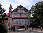
Town centre
"Mieszko" guesthouse

"Samotnia" mountain chalet

A historic villa
"Dom Śląski" mountain chalet

Sacred Heart Church

Museum of Sport and Tourism
Railway Station in Karpacz

Gołębiewski Hotel

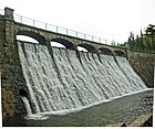
Łomnica dam
Chapel of Saint Lawrence on Sněžka-Śnieżka

Orlinek ski jumping hill
References[]
- ^ "Population. Size and structure and vital statistics in Poland by territorial division in 2019. As of 30th June". stat.gov.pl. Statistics Poland. 2019-10-15. Retrieved 2020-02-14.
- ^ Jump up to: a b "History - Karpacz.pl". www.karpacz.pl.
- ^ Jump up to: a b c d "Historia". Karpacz onLINE, imprezy, wydarzenia, noclegi Karpacz, Interaktywna Baza Noclegowa, mapa miasta KARPACZ. Noclegi w Karpaczu. Archived from the original on 2011-07-09.
- ^ "Karpacz". www.staypoland.com.
- ^ Jump up to: a b "Karpacz (Krummhübel) im Riesengebirge". www.polish-online.com.
- ^ "Mountain Hiking - Karpacz.pl". karpacz.pl. Retrieved 2019-05-08.
- ^ "Miasta Partnerskie". karpacz.pl (in Polish). Karpacz. Retrieved 2020-02-28.
External links[]
| Wikimedia Commons has media related to Karpacz. |
| Wikivoyage has a travel guide for Karpacz. |
- Official website (in Polish)
- Karpacz and wirtual Map (in Polish)
- Karpacz 360 - virtual city (in Polish)
- Karpacz - Krummhübel, Karbacz, Krzywa Góra (1945 r.), Drogosławice (1946 r.) na portalu polska-org.pl (in Polish)
- Karpacz- Gallery (in Polish)
- Cities and towns in Lower Silesian Voivodeship
- Karkonosze County
- Ski areas and resorts in Poland
- Cities in Silesia


