Kashmore District
This article needs additional citations for verification. (February 2012) |
Kashmore District
ضلع ڪشمور | |
|---|---|
 | |
| Coordinates: 28°21′N 69°23′E / 28.350°N 69.383°ECoordinates: 28°21′N 69°23′E / 28.350°N 69.383°E | |
| Country | |
| Province | |
| Division | Larkana |
| Headquarters | Kandhkot |
| Area | |
| • Total | 2,592 km2 (1,001 sq mi) |
| Population (2017)[1] | |
| • Total | 1,089,169 |
| • Density | 420/km2 (1,100/sq mi) |
| Time zone | UTC+5 (PST) |
| Number of Tehsils | 3 |

Kashmore District (Sindhi: ضلو ڪشمور), (Urdu: ضِلع کشمور), previously known as Khizmer or Khizmore, is a district of the province of Sindh, Pakistan. The capital city is Kandhkot. The district has a population of 1,089,169. Kashmore District is a part of Larkana Division. Its old name was Khizmer or Khizmor. The spoken languages are Sindhi and Balochi. Its border is connected with Punjab and Balochistan provinces. Kashmoor city is gateway to Punjab province and Balochistan province From.[2] In 2004, Kashmore became a district after its separation from Jacobabad District.
Administrative divisions[]
Kashmor District is subdivided into three tehsils or talukas:
- Kashmore
- Kandhkot
- Tangwani
The talukas are further subdivided into union councils:
| U.C. No. | U.C. Name | Taluka |
|---|---|---|
| 1 | Line Purani | Kashmore |
| 2 | Khoski | Kashmore |
| 3 | Masowalo | Kashmore |
| 4 | Domiwali | Kashmore |
| 5 | Geehal Pur | Kashmore |
| 6 | Gullan Pur | Kashmore |
| 7 | Sodhi | Kashmore |
| 8 | Noor Pur Pako | Kashmore |
| 9 | Chachar | Kashmore |
| 10 | Badani | Kashmore |
| 11 | Gublo | Kashmore |
| 12 | Mahar | Kashmore |
| 13 | Toj | Kashmore |
| 14 | Kumb | Kashmore |
| 15 | Samao | Kashmore |
| 16 | Kumbiri | Kashmore |
| 17 | Zorgrah | Kashmore |
| 18 | Mulgulzar | Kandhkot |
| 19 | Rasaldar | Kandhkot |
| 20 | Jagirabad | Kandhkot |
| 21 | Dolat Pur | Kandhkot |
| 22 | Wakro | Kandhkot |
| 23 | Akhero | Kandhkot |
| 24 | Malheer | Kandhkot |
| 25 | Haibat | Kandhkot |
| 26 | Dadar | Kandhkot |
| 27 | Mangi | Kandhkot |
| 28 | Jaffar Abad | Tangwani |
| 29 | Cheel | Tangwani |
| 30 | Lashari | Tangwani |
| 31 | Bijarani | Tangwani |
| 32 | Suhliani | Tangwani |
| 33 | Manjhi | Tangwani |
| 34 | Gulwali | Tangwani |
| 35 | Saifal | Tangwani |
| 36 | Saido Kot | Tangwani |
| 37 | Karam Pur | Tangwani |
| 38 | Sher Garh | Tangwani |
| 39 | Dunyapur | Tangwani |
| 40 | Naseer | Tangwani |
| 41 | Bahalkani | Tangwani |
Agriculture[]
Kashmor District has a large cattle market.
Geography[]
Kashmor District is located in the northern part of Sindh, bordering Ghotki, Jacobabad, Shikarpur and Sukkur within Sindh. It also borders Balochistan on one side and Punjab on the other. The Indus river runs through the Eastern side of Kashmor district. The southeastern side of Kashmor District has forest of "Kacha" that support wild animals. The Thar desert falls on the Eastern side of the district, and is home to wild desert animals.
Demography[]
According to the 1998 census, Sindhi was the first language of 45% of the population of the talukas of Kashmore and Kandhkot, while Balochi accounted for 43%.[3]
Kashmor City[]
Kandhkot is the district headquarters of Kashmor, and also an old city that lies on the right side of the Indus river. Kashmore City is a gateway to Punjab Pakistan and Balochistan. In addition, the city’s main electricity comes from the Indus river.
List of Dehs[]
The following is a list of Kashmore District's dehs, organised by taluka:[4]
- Kashmore Taluka (57 dehs)
- Kandhkot Taluka (49 dehs)
- Tangwani Taluka (42 dehs)
References[]
- ^ "DISTRICT WISE CENSUS RESULTS CENSUS 2017" (PDF). www.pbscensus.gov.pk. Archived from the original (PDF) on 2017-08-29.
- ^ "Sindh population surges by 81.5 pc, households by 83.9 pc". Thenews.com.pk. 2 April 2012. Retrieved 2016-12-26.
- ^ PCO 1999, p. 111–12.
- ^ "List of Dehs in Sindh" (PDF). Sindh Zameen. Retrieved 22 March 2021.
Bibliography[]
- 1998 District census report of Jacobabad. Census publication. 17. Islamabad: Population Census Organization, Statistics Division, Government of Pakistan. 1999.
| hide | ||
|---|---|---|
Provincial capital: Karachi | ||
| Banbhore | 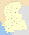 | |
| Hyderabad | ||
| Karachi | ||
| Larkana | ||
| Mirpur Khas |
| |
| Sukkur | ||
| Shaheed Benazir Abad |
| |
| show Authority control |
|---|
- Kashmore District
- Districts of Sindh