Sukkur District
Sukkur District
ضِلع سکّھر | |
|---|---|
 Map of Sindh with Sukkur District highlighted | |
| Coordinates: 27°40′N 69°30′E / 27.667°N 69.500°ECoordinates: 27°40′N 69°30′E / 27.667°N 69.500°E | |
| Country | |
| Province | |
| Division | Sukkur |
| Headquarters | Sukkur |
| Number of Tehsils | 5 |
| Area | |
| • Total | 5,165 km2 (1,994 sq mi) |
| Population (2017)[2] | |
| • Total | 1,487,903 |
| • Density | 290/km2 (750/sq mi) |
| Time zone | UTC+5 (PST) |
| Website | www |

Sukkur District (Sindhi: ضلعو سکر), (Urdu: ضِلع سکّھر), is a district in Sindh Province in Pakistan. It is divided into 5 administrative townships (tehsils, also called "talukas"), namely: Sukkur City, New Sukkur, Rohri, and Pano Aqil. Among them Sukkur City and New Sukkur are urban centres while Pano Aqil is famous for having one of the largest military cantonments of the country. Rohri is the smallest tehsil of Sukkur District, both in area and population, but it has an important railway junction. Two districts have been split off from the territory of Sukkur: Shikarpur in 1977 and Ghotki in 1993.[3]
Administrative subdivisions[]
| Tehsil | Population (2017) |
Area (km²) |
Union Councils |
Villages |
|---|---|---|---|---|
| Sukkur City | 231,589[4] | 150 | 11 | 25 |
| New Sukkur | 319,768[5] | 150 | 09 | 25 |
| Rohri | 371,104 | 1319 | 12 | 400 |
| Saleh Pat | 129,619 | 2339 | 03 | 250 |
| Pano Aqil | 435,823 | 1233 | 12 | 450 |
| Total | 1,487,903 | 5165 | 54 | 1150 |
History[]

This section needs additional citations for verification. (December 2017) |
At the time of Pakistan's independence in 1947, Sukkur district comprised approximately 200,000 inhabitants, mostly engaged in agricultural pursuits and fishing industry. Over time, Sukkur has seen a moderate rise in population (2 to 2.5% per annum) as compared to Pakistan's, except in late 1960s and early 70s when population growth rate reached 4.43% (1972 census) due to internal migration and establishment of some large bridges on river Indus.

Sukkur district is chiefly populated by Muslims that constitute 96% of the total population. The minorities include: Hindus 3.28% and Christians about 0.51%. Hindus are mostly settled in urban areas and are engaged in the trade and services sectors. The independence of Pakistan in 1947 saw the influx of Muslims which include Urdu-speaking Muhajirs, Bandhani-speaking Rajputs from Rajasthan, Memons from Bombay, Gujarat and Kathiawar were migrated from India and settled here, mostly in the aftermath of riots when Pakistan was carved out of India as the result of Muslim vote; the Muslim population of India voted for their separate homeland, the Pakistan. While some of the Bandhani, Memons, and Punjabis were settled here before partition, i.e., the independence of Pakistan in 1947. Traditionally Memons were associated with trade and retail business but during last two decades they have ascended as an active social and economic front. Sukkur is noteworthy in Sindh and Pakistan generally for its comparative tolerance towards religious and ethnic minorities. City is a multi-ethnic and has a mix of Sindhis, Punjabis, Brahuis, Balochis and Pakhtuns. Sindhis are native to the area and speak its various dialects, including, Utradi, Lari, Thari, Dadhki, etc. A large number of Punjabis were attracted to the city after the Indus treaty settlement and are settled around the downtown and chowk Ghantaghar in central part of the city. Most Pakhtuns are distinct and separately living near the railway station and its vicinity. The city therefore has cosmopolitan atmosphere with multiethnic and multicultural communities.[6] Following are the demographic indicators of the district.
Demographics[]
| Year | Pop. | ±% p.a. |
|---|---|---|
| 1951 | 218,320 | — |
| 1961 | 272,270 | +2.23% |
| 1972 | 451,290 | +4.70% |
| 1981 | 560,570 | +2.44% |
| 1998 | 908,370 | +2.88% |
| 2017 | 1,487,903 | +2.63% |
According to official census of 1998, Sukkur has 908370 inhabitants and density of 175.9 persons per square kilometre. It surged by 81.5% in the 2017 census to 1,487,903.[7][8] According to the 2017 Population census estimations, at least 48.398% of the population of Sukkur district is urban, making it the third-most advanced district in Sindh.[9]
Religion[]
According to the 1998 census, the breakdown of the population by religion is as following:[10]
- Islam: 96.13%
- Hinduism: 3.18%
- Christianity: 0.51%
- Ahmaddiya: 0.04%
- Others: 0.14%
The Sukkur district contains two of the holiest Hindu pilgrimage centres- the Kalka Cave Temple[11] and the Sadh Belo[12]
Language[]
The following were the first languages:[13][14]
- Sindhi: 74.07%
- Urdu: 13.82%
- Punjabi: 6.63%
- Pashto: 1.53%
- Baluchi: 1.47%
- Seraiki: 0.99%
- Others: 1.49% (mainly Memoni, Marwari, Gujarati, Bihari, Brahui and Kachi)[citation needed]
List of Dehs[]
The following is a list of Sukkur District's dehs, organised by taluka:[15]
- (1 deh)
- (21 dehs)
- (96 dehs)
- Dadloi
- Pano Aqil
- Rohri Taluka (67 dehs)
- (87 dehs)
References[]
- ^ PCO 1999, p. 1.
- ^ "DISTRICT WISE CENSUS RESULTS CENSUS 2017" (PDF). www.pbscensus.gov.pk. Archived from the original (PDF) on 2017-08-29.
- ^ PCO 1999, p. 11.
- ^ http://www.citypopulation.de/php/pakistan-distr-admin.php?adm2id=81801
- ^ https://www.citypopulation.de/php/pakistan-distr-admin.php?adm2id=81802
- ^ Umair, Bisma (13 July 2013). "Sukkur".
- ^ "Sindh population surges by 81.5 pc, households by 83.9 pc". Thenews.com.pk. 2 April 2012. Retrieved 2013-04-21.
- ^ "Pakistan Bureau of statistics-Summary Population Census-2017". 3 January 2018.
- ^ "Sukkur census tables" (PDF). table 10, p. 34. Retrieved 2017-12-25.
- ^ PCO 1999, p. 32.
- ^ Farooq Soomro (23 December 2014). "Where the city of Aror once stood in glory". Dawn. Retrieved 21 August 2020.
- ^ Kothari, Rita (2007). The burden of refuge: the Sindhi Hindus of Gujarat. Orient Longman. ISBN 9788125031574.
- ^ PCO 1999, p. 34.
- ^ "Sukkur census tables" (PDF). table 10, p. 34. Retrieved 2017-12-25.
- ^ "List of Dehs in Sindh" (PDF). Sindh Zameen. Retrieved 22 March 2021.
Bibliography[]
- 1998 District census report of Sukkur. Census publication. 41. Islamabad: Population Census Organization, Statistics Division, Government of Pakistan. 1999.
| hide | ||
|---|---|---|
Provincial capital: Karachi | ||
| Banbhore | 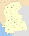 | |
| Hyderabad | ||
| Karachi | ||
| Larkana | ||
| Mirpur Khas |
| |
| Sukkur | ||
| Shaheed Benazir Abad |
| |
| show Authority control |
|---|
- Sukkur District
- Districts of Sindh