Kensal Town
| Kensal Town | |
|---|---|
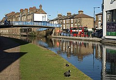 The Grand Union Canal passing through Kensal Town | |
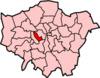
 Kensal Town Location within Greater London | |
| London borough | |
| Ceremonial county | Greater London |
| Region | |
| Country | England |
| Sovereign state | United Kingdom |
| Post town | LONDON |
| Postcode district | W10 |
| Dialling code | 020 |
| Police | Metropolitan |
| Fire | London |
| Ambulance | London |
| UK Parliament | |
| London Assembly | |

Kensal Town is a residential sub-district of Kensal Green in north-west London. It is located at the northern tip of the Royal Borough of Kensington and Chelsea where it meets the City of Westminster. Although local residents generally consider the area to be North Kensington, it is officially and historically an area of Kensal Green.[1] It is included in the W postcode area and was first recorded in 1876 as Kensal New Town.[2] This name had been used since the 1840s to distinguish the area south of the Harrow Road, in between the Grand Union Canal and the Great Western Main Line, where new housing was largely occupied by Irish immigrants. By the late 19th century the area had deteriorated into a run-down slum, though it was much improved when the slums were cleared and replaced with new council housing during the mid-20th century.[3][4]
It was a detached part of the ancient parish of St Luke Chelsea, and was also known as Chelsea-in-the-Wilderness or the Hamlet of Kensal Town.[5]
During the 19th century, the dog dealer Bill George's 'Canine Castle' establishment was on the Kensal Road.
Kensal Town is recorded in the 1861 England Census as the birthplace of a resident of St. Pancras and in the 1851 Census as a village in its own right.
Prominent buildings in the area include the distinctive Trellick Tower, designed by architect Ernő Goldfinger, and Our Lady of the Holy Souls Roman Catholic Church on Bosworth Road. Both buildings are listed by Historic England.[6][7]

References[]
- ^ Willey, Russ. Chambers London Gazetter, p 268.
- ^ Mills, A., Oxford Dictionary of London Place Names, (2001)
- ^ Willey, Russ. Chambers London Gazetter, p 268.
- ^ "Archived copy" (PDF). Archived from the original (PDF) on 22 December 2009. Retrieved 14 May 2009.
{{cite web}}: CS1 maint: archived copy as title (link) - ^ "Page 12: Chelsea-in-the-Wilderness, now Kensal". Virtual Museum – The History of the Royal Borough of Kensington and Chelsea. The Royal Borough of Kensington and Chelsea. Retrieved 10 June 2015.
- ^ "TRELLICK TOWER CHELTENHAM ESTATE, Kensington and Chelsea - 1246688 | Historic England". historicengland.org.uk. Retrieved 6 January 2020.
- ^ "CHURCH OF OUR LADY OF HOLY SOULS, Kensington and Chelsea - 1189274 | Historic England". historicengland.org.uk. Retrieved 6 January 2020.
This London location article is a stub. You can help Wikipedia by . |
- Districts of the Royal Borough of Kensington and Chelsea
- Areas of London
- Districts of the City of Westminster
- London geography stubs