Kenton, London
| Kenton | |
|---|---|
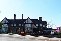 The Beefeater Travellers Rest pub, and its adjoined Premier Inn hotel | |
 Kenton Location within Greater London | |
| Population | 35,600 (2015 data, Kenton ward; Kenton East ward; Kenton West ward.)[1] |
| OS grid reference | TQ175885 |
| London borough |
|
| Ceremonial county | Greater London |
| Region | |
| Country | England |
| Sovereign state | United Kingdom |
| Post town | HARROW |
| Postcode district | HA3 |
| Dialling code | 020 |
| Police | Metropolitan |
| Fire | London |
| Ambulance | London |
| UK Parliament | |
| London Assembly | |

Kenton is an area of northwest London, England, historically in Middlesex. The main road through it, Kenton Road, forms the boundary between the London boroughs of Harrow and Brent.[2]
History[]


The hamlet was recorded as "Keninton" in 1232. The name derives from the personal name of the Saxon "Coena" and the Old English "tun", a farm – and means "the farm of Coena" and his family who once lived on a site near here. Before the 20th century, the tiny settlement was concentrated around in what was Kenton Lane (the easternmost part of which remains as Old Kenton Lane to the east of Kingsbury station) and is now part of the present-day Woodgrange Avenue and Kenton Road.[3]
The Windermere is a Grade II listed public house in Windermere Avenue.[4] It is on the Campaign for Real Ale's National Inventory of Historic Pub Interiors[5] and was built in 1938.[4] The Plough public house was Kenton's first, opening in the early 18th century; the current building is not the original. It is now an Indo-Chinese fusion restaurant and bar called Blue Ginger.
Local Primary Schools include Uxendon Manor on Vista Way and Priestmead Primary School on Hartford Avenue. The local high school is Claremont High School on Claremont Avenue off Kenton Road.
Kenton station was opened by the London and North Western Railway on 15 June 1912. The Metropolitan Railway's Northwick Park and Kenton station (later renamed Northwick Park) followed on 28 June 1923.
Geography[]

From its original location near The Grange, Kenton expanded toward Wealdstone, Wembley and Stanmore after the opening of Kenton station on the Euston to Watford Junction railway in 1912 and grew into a suburb of London from the 1920s.
The South Kenton area is distinct from Kenton, being almost contiguous with North Wembley and Preston.[6] It is entirely within Brent.
Most of the district is part of the HA3 postcode, but the southern part is in HA9 and Northwick Park is in HA1.
Waterways[]
The Wealdstone Brook is the only visible waterway within the area. It has two branches, one originating in Wealdstone and the other in Stanmore; these combine underground near the junction of Kenton Lane and Kenton Road. The Western (Wealdstone) branch is in culvert as far as the south side of the Kenton Recreation Ground; the Eastern (Stanmore) branch is mostly in culvert from near the source on Clamp Hill to where it combines with the Western branch. It functions mainly as a land drain devoid of wildlife until it reaches Woodcock Park and was previously heavily polluted by run-off water and illicit connections from adjacent houses; a 2013 Thames Water project[7] in the vicinity of Woodcock Park identified 140 premises discharging into the Brook.
| hide Neighbouring areas of Kenton | |
|---|---|
Housing[]

The coming of the railways was soon followed by suburban development, most of Kenton being built between the Wars.
The London County Council built the Kenmore Park cottage estate between the wars. There are 654 houses on the 58 acres (23 ha) site, a housing density of 11.3 per acre (28/ha).
Thomas Francis Nash owned building companies which from the 1920s onward built numerous private housing estates in Kenton, Ruislip and other parts of the "Metroland" area of Middlesex. F. & C. Costin was another local building company that built much of Kenton between the wars. Local estate agents still use the term "Nash-built" or "Costin-built" to describe properties built by them in Kenton.
Culture and media[]
Apart from the infamous appearance of several of Kenton's streets in the "Gourmet Night" episode of the BBC-TV comedy series Fawlty Towers starring John Cleese,[8] the only known reference to Kenton in modern popular culture is the song "Kenton Kev",[9] by the Berlin-based punk-jazz band The Magoo Brothers on their album "Beyond Believable", released on the Bouncing Corporation label in 1988. The song refers to the "pleasant valley" high suburban boredom factor then prevalent in the area, and cites local characters and places, some fairly well known. It is said that "Kenton Kev" refers in fact to Kevin Jones, the US-based property magnate, who was actually born in Kenton. The song was written by Paul Bonin, Philip Ulysses Sanders and Melanie Hickford, all of whom grew up and lived in the area.
Demography[]
Kenton is represented by three electoral wards: Kenton East and Kenton West in Harrow, and Kenton in Brent. All together the population was 35,600 as of 2015.[1]
Kenton has a high degree of its population belonging to ethnic minorities, over 70% in all three wards and higher than the Harrow and Brent averages;[1] like much of Harrow and Wembley, there is a particularly large number of people from Indian descent.[6]
The Kenton ward in Brent has a female life expectancy of 91.6 years, which is the third-highest in Greater London. The male expectancy was 83.3 years.[1] The crime rate of Kenton East ward in Harrow was 33.5 in 2014/15, which was one of the lowest out of all wards in Greater London.[1] Kenton East also has the lowest proportion of bicycle commuters in Greater London, amounting to only 0.2% of the population.[1]
Governance[]
Kenton is part of both the Harrow East parliamentary constituency, most recently represented by Bob Blackman (Conservative), and the Brent North constituency which is represented by Barry Gardiner (Labour).
Public services[]

Kenton Library, run by Harrow Council, is located in Kenton Lane. Kenton Ambulance Station is located at the eastern end of Kenton, near Kingsbury Circle. Northwick Park Hospital is located very close by Kenton.
Parks and sports[]
There are three large open spaces in or near Kenton: Woodcock Park, Kenton Recreation Ground, and Northwick Park directly to the west in the northern part of Wembley.
The Kenton Sports Club and its ground is located on Kenton Lane which consists of cricket, tennis and table tennis.[10]
Education[]
Secondary schools in the area are: St Gregory's Catholic Science College, Claremont High School, and JFS.
Religion[]


Kenton has several religious institutions. Churches in the area include the Kenton Methodist Church, Kenton Evangelical Church, Kenton Baptist Church, and further east on Kenton Road are the All Saints Roman Catholic Church, and the St Panteleimon Greek Orthodox Church, one of the capital's few Greek Orthodox churches outside North London.[11] The building of St Panteleimon's dates back to 1932.[12]
There are two Hindu mandirs: Haridham Swaminarayan Temple on Woodcock Hill, and Shree Kutch Satsang Swaminarayan Temple by Kenton Road. Kenton is also home to one of the UK's Derasars on the east side of Kenton Road which serve followers of Jainism.[13] By Woodcock Park is also a United Synagogue.[14] There are no mosques in Kenton itself but the Harrow Central Mosque is quite proximate from some parts.
Transport[]

Buses[]
The following London Bus routes operate through the area:
| Route | Start | End | Operator |
| 114 | Mill Hill Broadway | Ruislip | London Sovereign |
| 183 | Golders Green | Pinner | London Sovereign |
| 223 | Harrow | Wembley | London United |
| H9/H10 Circular | Northwick Park Hospital H9: anticlockwise | Northwick Park Hospital H10: clockwise | London Sovereign |
| H18/H19 Circular | Harrow H18: anticlockwise | Harrow H19: clockwise | London Sovereign |
Tube/trains[]
Stations in the area are:
- Kenton Station (Bakerloo line & Watford DC Line)
- South Kenton Station (Bakerloo line & Watford DC Line)
- Northwick Park Station (Metropolitan line)
Notable people[]
This section does not cite any sources. (June 2012) |
- Actress Michele Austin, best known as PC Yvonne Hemmingway in ITV's The Bill, attended Claremont High School in Kenton
- Baroness Shami Chakrabarti, the human rights lawyer, was born in Kenton
- Cricketer Denis Compton (1918–1997) lived in Kenton
- TV exercise instructor Mr Motivator (Derrick Evans) lived in Kenton
- Mary Millington (1945–1979), 1970s sex symbol, was born in Kenton
- Actress Sophie Okonedo lived in Kenton
- Stuart "Psycho" Pearce, football manager and former player, attended Claremont High School in Kenton[15]
- Actress Pam St. Clement, best known as Pat in BBC soap EastEnders, lived in Kenton
- Journalist and broadcaster John Timpson (1928–2005) was born in Kenton
- Footballer Darren Ward was born in Kenton
- Actress Mary Wimbush (1924–2005), best known as Julia Pargetter in BBC Radio 4's The Archers, was born in Kenton
- Doctor Amieth Yogarajah, best known as Amieth in BBC Three's Junior Doctors, was born and raised in Kenton
- Blogger Nicholas Dean Coker was born and raised in Kenton, attending St Gregory's RC Secondary School which he talks about in his blogs.
Gallery[]

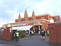
Front entrance to St Mary Church

Front entrance to St Mary Church
Shree Kutch Satsang Swaminarayan, Hindu mandir

Lindsay Drive in Kenton

Abbott's Drive in South Kenton

Kenton Road, near Kenton Park Parade, in 1955; the dome of St Mary's Church on Harrow Hill is visible in the background


References[]
Notes
- ^ Jump up to: a b c d e f "Ward Profiles and Atlas – London Datastore".
- ^ Ordnance Survey pre-1920s mapping
- ^ Ordnance Survey maps, various, from 19th century to 1930s
- ^ Jump up to: a b Historic England. "The Windermere public house (1350348)". National Heritage List for England. Retrieved 22 May 2014.
- ^ Brandwood, Geoff (2013). Britain's best real heritage pubs. St. Albans: CAMRA. p. 89. ISBN 9781852493042.
- ^ "Kenton community transforms Woodcock Park's once boggy sewage-filled Wealdstone Brook". 16 October 2018.
- ^ Torquay: the horrible truth, The Independent, 27 August 1999
- ^ GEMA work no.: 2142940-001
- ^ "Kenton Lawn Tennis Club".
- ^ http://www.st-panteleimon.org/[bare URL]
- ^ "The Parish History".
- ^ http://mahavirfoundation.com/[bare URL]
- ^ https://www.kentonsynagogue.org/[bare URL]
- ^ Jack Royston (31 March 2010). "Claremont High's Cup Glory". Harrow Times. Retrieved 29 March 2016.
Further reading
- Ebdon, John (1985) Ebdon's England David & Charles. ISBN 0-7153-8595-X
External links[]
- Kenton Recreation Ground – Kenton Recreation Ground featuring The Old Bowls Cafe
| show London Borough of Harrow |
|---|

| show London Borough of Brent |
|---|

| Section 9: | Capital Ring Walking Route | Section 10: |
|---|---|---|
| Greenford | South Kenton | Hendon Park |
| Authority control |
|
|---|
- Kenton, London
- Areas of London
- Districts of the London Borough of Harrow
- Districts of the London Borough of Brent
- Places formerly in Middlesex