Kfaraakka
This article needs additional citations for verification. (August 2017) |
Kfarakka | |
|---|---|
City | |
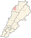
 Kfarakka Location within Lebanon | |
| Coordinates: 34°18′10.8″N 35°50′13.2″E / 34.303000°N 35.837000°E | |
| Country | |
| Governorate | North Governorate |
| District | Koura District |
| Time zone | UTC+2 (EET) |
| • Summer (DST) | UTC+3 (EEST) |
| Dialing code | +961 |

Kfaraakka (Arabic: كفر عقا) is a village in the Koura District of Lebanon. The population is Greek Orthodox and Maronite.[1]
References[]
- ^ "Municipal and ikhtiyariah elections in Northern Lebanon" (PDF). The Monthly. March 2010. p. 23. Archived from the original on 3 June 2016. Retrieved 31 October 2016.CS1 maint: bot: original URL status unknown (link)
External links[]
- Kfar Aaqqa, Localiba
- The municipality of Kafaraka [1]
Capital: Amioun | ||
| Towns and villages |
|  |
| Notable landmarks | ||
Categories:
- Eastern Orthodox Christian communities in Lebanon
- Populated places in the North Governorate
- Koura District
- Maronite Christian communities in Lebanon