Kfarhazir
Kfarhazir
كفرحزير | |
|---|---|
City | |
 | |
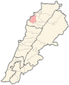
 Kfarhazir Location within Lebanon | |
| Coordinates: 34°18′28″N 35°46′25″E / 34.30778°N 35.77361°ECoordinates: 34°18′28″N 35°46′25″E / 34.30778°N 35.77361°E | |
| Country | |
| Governorate | North Governorate |
| District | Koura District |
| Highest elevation | 350 m (1,150 ft) |
| Lowest elevation | 200 m (700 ft) |
| Time zone | UTC+2 (EET) |
| • Summer (DST) | UTC+3 (EEST) |
| Dialing code | +961 |

Kfarhazir (Arabic: كفر حزير) is a village in the Koura District of Lebanon. It is 350 meters above sea level, and has an area of 12.1 square kilometres (4.69 sq mi) - the largest town in Koura by size, with a population of about 2000.[1] The population are Greek Orthodox and Maronite.[2]
Location and Geography[]
Kfarhazir lies on a strategic hill in Koura, overlooking the Koura fields and towns from the east, and the Mediterranean sea from the west. Kfarhazir is Five minutes away from the sea, 35 minutes away from the mountains, and 55 minutes away from Beirut.
Churches[]
There are 5 Christian Churches in Kfarhazir:
- Church of Saint Jacob(Eastern Orthodox)
- Church of Saint James (Eastern Orthodox)
- Church of Al Sayydeh (Eastern Orthodox)
- Church of Saints Theodoros and George (Eastern Orthodox)
- Church of Saint Elias (Eastern Orthodox)
- Church of Saint Takla (Maronite Catholic)
References[]
- ^ Localiban. "Kfar Hazir - Localiban". www.localiban.org. Retrieved 2020-08-24.
- ^ "Municipal and ikhtiyariah elections in Northern Lebanon" (PDF). The Monthly. March 2010. p. 23. Archived from the original on 3 June 2016. Retrieved 31 October 2016.CS1 maint: bot: original URL status unknown (link)
See also[]
- List of cities in Lebanon
- Eastern Orthodox Christianity in Lebanon
- University of Balamand
Capital: Amioun | ||
| Towns and villages |
|  |
| Notable landmarks |
| |
 | |
| Algeria |
|
| Cyprus | |
| Greece |
|
| Israel |
|
| Italy |
|
| Lebanon |
|
| Libya |
|
| Malta |
|
| Morocco |
|
| Portugal |
|
| Spain |
|
| Syria |
|
| Tunisia | |
| Other |
|
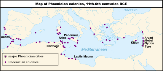
This article about Phoenicia, its colonies and people is a stub. You can help Wikipedia by . |
Categories:
- History stubs
- Phoenicia stubs
- Eastern Orthodox Christian communities in Lebanon
- Maronite Christian communities in Lebanon
- Populated places in the North Governorate
- Koura District
- Amarna letters locations
- Hellenistic colonies
- Phoenician cities
- Coloniae (Roman)