Karak Nuh
Karak
كرك كرك نوح | |
|---|---|
 Karak | |
| Coordinates: 33°51′0″N 35°55′35″E / 33.85000°N 35.92639°ECoordinates: 33°51′0″N 35°55′35″E / 33.85000°N 35.92639°E | |
| Country | Lebanon |
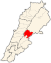
| Governorate | Beqaa |
| District | Zahlé |
| Time zone | GMT +2 |
| • Summer (DST) | +3 |
| Area code(s) | (+961) 8 |

Karak (also Kerak, Karak Nuh or Karak Noah) (Arabic: كرك, romanized: Karak) is a village in the municipality of Zahle in the Zahle District of the Beqaa Governorate in eastern Lebanon.[1] It is located on the Baalbek road close to Zahle. Karak contains a sarcophagus claimed by the locals to be the tomb of Noah.[2] The inhabitants of Karak are Melkites, Maronites and Shia Muslims.[3]
History[]
The town was an important religious site during the Middle Ages, drawing devotion from the local rural village communities.[2] The town was known as al-Karak during the time of the Ayyubid dynasty and changed to Karak Nuh under the Mamluks.[4]
It became known as a centre of learning for Shia Islam and the administrative centre of the southern Beqaa. The Mamluk viceroy of Syria, Tankiz, established the first recorded waqf endowment for the shrine dedicated to Noah in Karak in 1331. A Safavid sheikh and various dignitaries were born in the town. Under the Ottoman Empire, in around 1528 the waqf was increased by the Bedouin emirs who controlled the southern Beqaa Valley. The Hanash confirmed the Shia Muslim Alwan family as responsible for the site, a post that became hereditary. A major earthquake damaged the town's distinguishing minaret in 1705, which required repair.[2]
Tomb of Noah[]
According to tradition mentioned by al-Mukaddasi and Al-Dimashqi, the tomb of Noah existed in the tenth century and can still be seen. The stone tomb measures around 104.8 feet (31.9 m) long, 8.7 feet (2.7 m) wide and 3.2 feet (0.98 m) high and is covered in a worn green cloth. It is housed in a room measuring 10.1 feet (3.1 m) by 8.1 feet (2.5 m).[5][6][7] There is a chapel next to the cenotaph building where several inscriptions (decrees) dating to the fourteenth century were found.[8] There is also a courtyard outside the building with a prayer niche. The size of the monument possibly derives from tales of ancient giants, but is more realistically suggested to be a section of an ancient aqueduct that has been converted to serve as a shrine.[6][9]
Archaeology[]
A Roman inscription in Latin dating to the year 84 CE was found in the basement of a house to the south west of the tomb that called for the long life of the "man with many names".[6]
Locale[]
Near to the town is the spring and lake and marshes that are considered to be the source of the Litani river.[10]
See also[]
References[]
- ^ "Zahleh - Maallaqa - Taanayel". Local Liban. 22 February 2006. Retrieved 5 October 2020.
- ^ a b c Winter, 2010, p. 43 ff
- ^ "Municipal and ikhtiariah elections in the Beqa'a 147 municipalities and 414 mokhtars" (PDF). The Monthly Magazine. February 2010. Archived from the original (PDF) on 4 March 2016.
- ^ Sourdel, D., " Karak Nūḥ." Encyclopaedia of Islam, Second Edition. Brill Online , 2012. Reference. 3 October 2012
- ^ Le Strange, 1890, p. 480
- ^ a b c Royal Anthropological Institute of Great Britain and Ireland (1871). Journal. p. 323.
- ^ Ḥaddād, 1956, p. x
- ^ Sourdel-Thomine, Janine, 'Inscriptions arabes de Karak Nuh', Bulletin d'Etudes Orientates, 13: 71-84, (1949-51)
- ^ Burton, p. 40 ff
- ^ Lipiński, 2000, p. 307 ff
Bibliography[]
- Burton, R. F. A Plain and Literal Translation of the Arabian Nights Entertainments, Vol. 7 of 10: The Book of the Thousand Nights and a Night. Forgotten Books. ISBN 978-1-4400-4321-5.
- Ḥaddād, Jūrj Marʻī (1956). Baalbak, North & South Lebanon: Description, history and touristic guide. Printed by el-Hashimieh Press.
- Le Strange, G. (1890). Palestine Under the Moslems: A Description of Syria and the Holy Land from A.D. 650 to 1500. Committee of the Palestine Exploration Fund.
- Lipiński, E. (2000). The Aramaeans: Their Ancient History, Culture, Religion. Peeters Publishers. p. 307. ISBN 978-90-429-0859-8.
- Winter, S. (2010). The Shiites of Lebanon under Ottoman Rule, 1516-1788. Cambridge University Press. ISBN 978-0-521-76584-8.
External links[]
- Photo of the inside of the Tomb of Noah on Flickr
- Tomb of Noah (with photos) on the blog of John Sanidopoulos
- Photo of Karak Nuh, minaret and the outside of the Tomb of Noah on Photobucket
Capital: Zahlé | ||
| Towns and villages |
|  |
| Other | ||
- Populated places in Zahlé District
- Populated places in Lebanon
- Archaeological sites in Lebanon
- Maronite Christian communities in Lebanon
- Melkite Christian communities in Lebanon
- Shia Muslim communities in Lebanon
- Tourist attractions in Lebanon
- Roman sites in Lebanon
- Tomb of Noah