Khordha district
Khordha district
Khurda | |
|---|---|
District of Odisha | |
 | |
| Nickname(s): Paika District of Odisha[citation needed] | |
 Location in Odisha, India | |
| Coordinates: 20°09′58″N 85°39′58″E / 20.166°N 85.666°ECoordinates: 20°09′58″N 85°39′58″E / 20.166°N 85.666°E | |
| Country | |
| State | |
| Headquarters | Khordha |
| Government | |
| • Collector & District Magistrate | Sanat kumar Mohanty, OAS(SAG) |
| • Superintendent of Police | Raj Kishore Dora, OPS(S) |
| Area | |
| • Total | 2,887.5 km2 (1,114.9 sq mi) |
| Population (2011) | |
| • Total | 2,251,673[1] |
| • Density | 800/km2 (2,000/sq mi) |
| Languages | |
| • Official | Odia, English |
| Time zone | UTC+5:30 (IST) |
| PIN | 751 xxx, 752 xxx |
| Telephone code | 674, 6755, 6756 |
| Vehicle registration | OD-02/OD-33 |
| Nearest city | Bhubaneswar |
| Sex ratio | 1.108 ♂/♀ |
| Literacy | 87.51% |
| Lok Sabha constituency | 2 |
| Vidhan Sabha constituency | 6 |
| Climate | Aw (Köppen) |
| Precipitation | 1,443 millimetres (56.8 in) |
| Avg. summer temperature | 41.4 °C (106.5 °F) |
| Avg. winter temperature | 9.5 °C (49.1 °F) |
| Website | www |

| This article is part of a series on |
| Odisha |
|---|
 |
| Governance |
|
| Topics |
|
Districts Divisions |
|
| GI Products |
|
|
|
Khordha district is an administrative division of the state of Odisha, India. It was formed on April 1, 1993, by the division of former Puri District into Puri, Khordha and Nayagarh districts. In the year 2000 the district name was changed to Khordha. The district headquarters is Khordha Town. The capital city of Bhubaneswar is located in this district.[2] Khordha is the most urbanized of all the districts of Odisha.
Khordha Road, the railway station that serves the town, is also the divisional headquarters of the East Coast Railway of the Indian Railways, and contains its own division. Khordha is known for its brass utensils, cottage industries, railway coach manufacturing and cable manufacturing unit.
History[]
This section does not cite any sources. (August 2021) |
It was the capital of Odisha from 1568 to 1803. It is also known for its fort, often described as the "last independent fort". The commander who kept it free from British East India Company was ), Bakshi Jagabandhu, popularly called 'Paika Bakshi'.
The Savaras tribal group, who are still to be found in the district in some pockets, once heavily populated the area. Khurda came into prominence when the first Rajas of the Khordha dynasty, Ramachandra Deva, made it the capital of his kingdom during the last part of the 16th century. Khurda suffered repeated onslaughts from Muslim and Maratha cavalry but its royal house retained independence till 1804, when the British East India Company dispossessed Raja of his territory following the Second Anglo-Maratha War.
British government took Odisha under its rule in 1803 but could only include Khurda in 1827. The Paikas of Khurda are known for protesting against the British rule in Odisha.
Geography[]
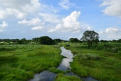
It is also the district headquarters of Khurda district located at 20.11° N 85.40° E. The area of the district is 2,888 km2 (1,115 sq mi).[2] The district is bordered by Cuttack district to the north and east, Puri district to the south, Ganjam district to the west, and Nayagarh district to the northwest. The Daya and Kuakhai Rivers flow through Khurda. The forested area is 618.67 km2 (238.87 sq mi).[3] The district is mainly flat coastal plain, with some hill ranges in the west. It borders the Chilika Lake.
Climate[]
| Bhubaneswar | ||||||||||||||||||||||||||||||||||||||||||||||||||||||||||||
|---|---|---|---|---|---|---|---|---|---|---|---|---|---|---|---|---|---|---|---|---|---|---|---|---|---|---|---|---|---|---|---|---|---|---|---|---|---|---|---|---|---|---|---|---|---|---|---|---|---|---|---|---|---|---|---|---|---|---|---|---|
| Climate chart (explanation) | ||||||||||||||||||||||||||||||||||||||||||||||||||||||||||||
| ||||||||||||||||||||||||||||||||||||||||||||||||||||||||||||
| ||||||||||||||||||||||||||||||||||||||||||||||||||||||||||||
Economy[]
It is renowned for its brass utensils cottage industries, cable factory, spinning mills, watch repairing factory, railway coach repairing factory, oil industries, Coca-Cola bottling plant and small metal industries, or sms group, Iocl gas bottling plant.
Divisions[]
- Parliamentary constituencies: 2
- Assembly constituencies: 6
- Subdivisions: 2[3]
- Villages: 1,561[3]
- Blocks: 10[3]
- Grama panchayat: 168[3]
- Tehsils: 08[3]
- Towns: 6[3]
Tehsils[]

- Balianta
- Balipatna
- Banapur
- Begunia
- Bhubaneswar
- Bolagarh
- Chilika
- Jatni
- Khordha
- Tangi
Subdivisions[]
- Bhubaneswar: consists of 4 blocks, viz. Balianta, Balipatana, Jatni, Bhubaneswar.
- Khurda: consists of 6 blocks, viz. Tangi, Khorda sadara, Banapur, Begunia, Bolgarh and Chilika.
Demographics[]
According to the 2011 census Khordha district has a population of 2,251,673,[4] roughly equal to the nation of Latvia[5] or the US state of New Mexico.[6] This gives it a ranking of 201st in India (out of a total of 640).[4] The district has a population density of 799 inhabitants per square kilometre (2,070/sq mi).[4] Its population growth rate over the decade 2001-2011 was 19.65%.[4] Khordha has a sex ratio of 925 females for every 1000 males,[4] and a literacy rate of 87.51%.[4]
At the time of the 2011 Census of India, 92.13% of the population in the district spoke Odia, 1.98% Urdu, 1.69% Telugu, 1.65% Hindi, 1.38% Bengali and 0.43% Santali as their first language.[7]
Hindus-88.5%, Jain-4.5%, Muslims-2.5, Sikh-2.0%, Christians-1.5%, others-1% (including Buddhists)
| Year | Pop. | ±% p.a. |
|---|---|---|
| 1901 | 470,409 | — |
| 1911 | 479,645 | +0.19% |
| 1921 | 431,482 | −1.05% |
| 1931 | 478,128 | +1.03% |
| 1941 | 516,719 | +0.78% |
| 1951 | 557,718 | +0.77% |
| 1961 | 658,073 | +1.67% |
| 1971 | 858,554 | +2.70% |
| 1981 | 1,132,182 | +2.81% |
| 1991 | 1,502,014 | +2.87% |
| 2001 | 1,877,395 | +2.26% |
| 2011 | 2,251,673 | +1.83% |
| source:[8] | ||
Languages of Khordha district in 2011 census
Politics[]
Vidhan sabha constituencies[]
The following are the eight Vidhan sabha constituencies[9][10] of Khordha district and the elected members[11] of that area
| No. | Constituency | Reservation | Extent of the Assembly Constituency (blocks) | Member of 14th Assembly | Party |
|---|---|---|---|---|---|
| 111 | Jayadev | SC | Balianta, Balipatna | Sashi Bhusan Behera | BJD |
| 112 | Bhubaneswar Central (Madhya) | None | Bhubaneswar MC Ward No. 16 to 29 and 35 to 37 | Bijaya Kumar Mohanty | BJD |
| 113 | Bhubaneswar North (Uttar) | None | Bhubaneswar (MC) (part), Bhubaneswar (part) | Priyadarshi Mishra | BJD |
| 114 | Ekamra-Bhubaneswar | None | Bhubaneswar (MC) (part), Bhubaneswar (part) | Ashok Chandra Panda | BJD |
| 115 | Jatani | None | Jatani (M), Jatani, Khurda (PART), Bhubaneswar (part) | Suresh Kumar Routray | INC |
| 116 | Begunia | None | Begunia, Bologarh | Raja sahoo | BJD |
| 117 | Khurda | None | Khurda (M), Tangi, Khurda (part) | Yotirindra Nath Mitra | BJD |
| 118 | Chilika | None | Balugaon (NAC), Banapur (NAC), Chilika, Banapur, | Prasant Jagdev | BJD |
Lok Sabha constituencies[]
During 1952 general election, Pandit Lingraj Mishra was elected from the Khurda (Lok Sabha constituency). 1957 onwards members were elected from Bhubaneswar (Lok Sabha constituency).[12]
References[]
- ^ http://www.census2011.co.in/census/district/410-khordha.html
- ^ Jump up to: a b Swain, S; et al. (2018). Development of an ARIMA Model for Monthly Rainfall Forecasting over Khordha District, Odisha, India. Recent Findings in Intelligent Computing Techniques (Advances in Intelligent Systems and Computing. Advances in Intelligent Systems and Computing. 708. pp. 325–331). doi:10.1007/978-981-10-8636-6_34. ISBN 978-981-10-8635-9.
- ^ Jump up to: a b c d e f g h i j k "Introduction". Khordha district official website. Archived from the original on 2008-10-02. Retrieved 2008-09-12.
- ^ Jump up to: a b c d e f "District Census 2011". Census2011.co.in. 2011. Retrieved 2011-09-30.
- ^ US Directorate of Intelligence. "Country Comparison: Population". Retrieved 2011-10-01.
Latvia 2,204,708 July 2011 est.
- ^ "2010 Resident Population Data". U. S. Census Bureau. Archived from the original on 2013-10-19. Retrieved 2011-09-30.
New Mexico - 2,059,179
- ^ 2011 Census of India, Population By Mother Tongue
- ^ Decadal Variation In Population Since 1901
- ^ Assembly Constituencies and their EXtent
- ^ Seats of Odisha
- ^ "List of Member in Fourteenth Assembly". ws.ori.nic.in. Archived from the original on 2 May 2007. Retrieved 19 February 2013.
- ^ "First Lok Sabha - State wise Details - Odisha". Retrieved 20 December 2017.
External links[]
| Wikimedia Commons has media related to Khordha district. |
| show Places adjacent to Khordha district |
|---|
| show |
|---|

| show Authority control |
|---|
- Khordha district
- Populated places established in 1993
- 1993 establishments in Orissa
- Districts of Odisha