Gangrel Dam
| Gangrel Dam | |
|---|---|
 | |
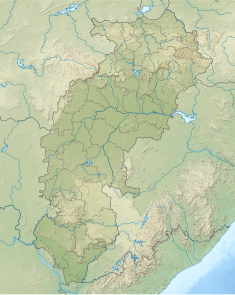 Location of Gangrel Dam in Chhattisgarh | |
| Country | India |
| Location | Dhamtari District |
| Coordinates | 20°37′36″N 81°33′36″E / 20.62667°N 81.56000°ECoordinates: 20°37′36″N 81°33′36″E / 20.62667°N 81.56000°E |
| Status | Operational |
| Opening date | 1979 |
| Dam and spillways | |
| Type of dam | Embankment, earth-fill |
| Impounds | Mahanadi River |
| Height | 30.5 m (100 ft) |
| Length | 1,830 m (6,004 ft) |
| Dam volume | 1,776,000 m3 (2,322,920 cu yd) |
| Spillway capacity | 17,230 m3/s (608,472 cu ft/s) |
| Reservoir | |
| Creates | Ravishankar Reservoir |
| Total capacity | 910,500,000 m3 (1.190889039×10⁹ cu yd) |
| Active capacity | 766,890,000 m3 (1.003054250×10⁹ cu yd) |
| Surface area | 95 km2 (37 sq mi)[1] |
| Normal elevation | 333 m (1,093 ft) |

Gangrel Dam (हिन्दी: गंगरेल बाँध) also known as the Ravishankar Sagar named in the name of Ravishankar Shukla located in Chhattisgarh, India. It is built across the Mahanadi River. It is located in Dhamtari district, about 17 km from Dhamtari and about 90 km from Raipur. It is the longest dam in Chhattisgarh. This dam supplies year round irrigation, allowing farmers to harvest two crops per year and key water supplier of Bhilai Steel Plant. The dam also supplies 10 MW of hydro-electric power capacity.[2]
The chief Engineer of this projet was Mr Dev raj Sikka. The dam consists of 14 gates (spillways) .
References[]
- ^ "National Register for Large Dams" (PDF). India: Central Water Commission. 2009. pp. 194–197. Archived from the original (PDF) on 21 July 2011. Retrieved 30 November 2011.
- ^ Chhattisgarh: Gangrel Dam water released into Mahanadi
External links[]
Categories:
- Dams in Chhattisgarh
- Dams on the Mahanadi River
- Dhamtari district
- Dams completed in 1979
- 1979 establishments in Madhya Pradesh