Jharkhand
Jharkhand | |
|---|---|
State | |
   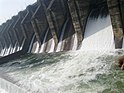     Clockwise from top left: Dalma Wildlife Sanctuary, Birla Institute of Technology, Panchet Dam at Damodar river, Dassam Falls, Samet Shikharji Jain Mahatirth, Mata Chhinnamasta Devi Temple at Rajrappa, Baidyanath Temple, Patratu Highway | |
 Seal | |
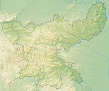
 Location of Jharkhand | |
 Map of Jharkhand | |
| Coordinates (Ranchi): 23°21′N 85°20′E / 23.35°N 85.33°ECoordinates: 23°21′N 85°20′E / 23.35°N 85.33°E | |
| Country | |
| Formation | 15 November 2000 |
| Capital | Ranchi |
| Sub-capital | Dumka |
| Largest city | Dhanbad |
| Districts | 24 |
| Government | |
| • Body | Government of Jharkhand |
| • Governor | Ramesh Bais |
| • Chief Minister | Hemant Soren (JMM) |
| • Legislature | Unicameral (81 seats) |
| • Parliamentary constituency |
|
| • High Court | Jharkhand High Court |
| Area | |
| • Total | 79,714 km2 (30,778 sq mi) |
| Area rank | 15th |
| Population (2011)[1] | |
| • Total | 32,988,134 |
| • Rank | 14th |
| • Density | 414/km2 (1,070/sq mi) |
| Demonym(s) | Jharkhandi |
| GDP (2019–20) | |
| • Total | ₹3.83 lakh crore (US$54 billion) |
| • Per capita | ₹79,873 (US$1,100) |
| Languages | |
| • Official[3] | Hindi |
| • Additional official languages | |
| Time zone | UTC+05:30 (IST) |
| ISO 3166 code | IN-JH |
| Vehicle registration | JH |
| HDI (2018) | |
| Literacy (2011) | 67.6% (31st) |
| Sex ratio (2011) | 948 ♀/1000 ♂ (18th) |
| Website | www |
| Symbols of Jharkhand | |
| Emblem | Emblem of Jharkhand |
| Mammal | |
| Bird |  Koel Koel |
| Flower | |
| Tree | |
| †Formed by the Bihar Reorganisation Act, 2000 | |

Jharkhand (/ˈdʒɑːrkənd/;[6] Hindi: [d͡ʒʱɑːɾkʰəɳɖ]; meaning 'the land of forests') is a state in eastern India.[7] The state shares its border with the states of Bihar to the north, Uttar Pradesh to the northwest, Chhattisgarh to the west, Odisha to the south and West Bengal to the east. It has an area of 79,710 km2 (30,778 sq mi). It is the 15th largest state by area, and the 14th largest by population. Hindi is the official language of the state.[3] The city of Ranchi is its capital and Dumka its sub-capital. The state is known for its waterfalls, hills and holy places;[8] Baidyanath Dham, Parasnath and Rajrappa are major religious sites.[9] The state was formed in 2000, from the territory that had previously been part of Bihar.
Jharkhand suffers from what is sometimes termed a resource curse:[10] it accounts for more than 40% of the mineral resources of India,[11] but 39.1% of its population is below the poverty line and 19.6% of children under five years of age are malnourished.[12] Jharkhand is primarily rural, with about 24% of its population living in cities.[13] It is amongst the leading states in terms of economic growth. In 2017–18, the GDP growth rate of state was at 10.22%.[14]
Etymology[]
The word "Jhar" means 'Forest' and "Khand" means 'land' in various Indo-Aryan languages. Thus "Jharkhand" means 'land of bush or forest'.
History[]
Ancient period[]
The region has been inhabited since the Mesolithic-Chalcolithic period, as shown by several ancient cave paintings.[15][16][17] Stone tools have been discovered from Chota Nagpur plateau region which is from Mesolithic and Neolithic period.[15] There are ancient cave paintings in Isko, Hazaribagh district which are from Meso-chalcolithic period (9000–5000 BCE).[16] During 2nd millennium BCE the use of Copper tools spread in Chota Nagpur Plateau and these find complex are known as the Copper Hoard Culture.[18] In Kabra-Kala mound at the confluence of Son and North Koel rivers in Palamu district various antiquities and art objects have found which are from Neolithic to the medieval period and the pot-sherds of Redware, black and red ware, black ware, black slipped ware and NBP ware are from Chalcolithic to the late medieval period.[19] Several iron slags, microliths, and potsherds have been discovered from Singhbhum district which are from 1400 BCE according to carbon dating age.[17] The region was ruled by many empires and dynasties including Nanda, Maurya and Gupta during ancient period.
During the age of Mahajanpadas around 500 BCE, Jharkhand state was a part of Magadha and Anga.[citation needed] In the Mauryan period, this region was ruled by a number of states, which were collectively known as the Atavika (forest) states. These states accepted the suzerainty of the Maurya empire during Ashoka's reign (c. 232 BCE). Samudragupta, while marching through the present-day Chotanagpur region, directed the first attack against the kingdom of Dakshina Kosala in the Mahanadi valley.[20]
Medieval period[]
In the 7th century, Chinese traveller Xuanzang passed through the region. He described the kingdom as Karnasuvarna and Shashanka as its ruler. To the north of Karn-Suberna was Magadha, Champa was in east, Mahendra in the west and Orissa in the south.[21]
During medieval period, the region ruled by Nagvanshi, Pala, Khayaravala, Ramgarh Raj and Chero ruler.[22][23][24] The Mughal influence reached Palamu during the reign of Emperor Akbar when it was invaded by Raja Mansingh in 1574. Several invasion took place during Mughal rule.[25] During the reign of Nagvanshi King Madhu Singh, Akbar' general invaded Khukhra. Also there was invasion during region of Durjan Sal.[26]
The King Medini Ray, ruled from 1658 to 1674 in Palamau.[27] His rule extended to areas in South Gaya and Hazaribagh. He attacked Navratangarh and defeated the Nagvanshi Maharaja of Chhotanagpur.[28] The Chero rule in Palamu region lasted till 19th CE, until internal conflict between various factions weakened the Cheros and they were defeated by the East India Company. Later Palamu estate was sold by the British.[29]

Jagannath temple at Ranchi built by king Ani Nath Shahdeo
Maluti temples in Dumka

Palamu Forts

Khakparta Temple, a 9th-century Shiva temple in Lohardaga


Colonial Era[]
Region under Kings of Chero dynasty, Nagvanshi dynasty, Ramgarh and Kharagdiha became parts of territories of East India Company. Ramgarh Raj along with estates of other chiefs in the regions was permanently settled as Zamindari estate. The Kharagdiha Rajas were settled as Rajas of Raj Dhanwar in 1809, and the Kharagdiha gadis were separately settled as zamindari estates. Some of the notable Kharagdiha Zamindari estates were Koderma, Gadi Palganj and Ledo Gadi.[30]
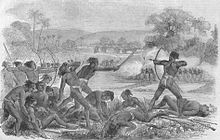
The subjugation and colonisation of Jharkhand region by the British East India Company resulted in spontaneous resistance from the local people. The first revolt against the British East India Company was led by Raghunath Mahato, in 1769.[31]
In 1771, the revolt against the landlords and the British government was led by Tilka Majhi, a Paharia leader in Rajmahal Hills. Soon after in 1779, the Bhumij tribes rose in arms against the British rule in Manbhum. In 1807, the Oraons in Barway murdered their landlord from Srinagar. Munda tribe rose in revolt in 1811 and 1813. Bakhtar Say and Mundal Singh, two landowners, fought against the British East India Company in 1812. [32]
The Princely states in Chota Nagpur Plateau, came within the sphere of influence of the Maratha Empire, but they became tributary states of British East India Company as a result of the Anglo-Maratha Wars known as Chota Nagpur Tributary States.[33]
The Hos in Singhbhum revolted in 1820, Kol revolt in 1832 West Bengal.
The Santhal rebellion broke out in 1855 under the leadership of two brothers Sidhu and Kanhu.
The brothers Nilambar and Pitambar were chiefs of Bhogta clan of the Kharwar tribe, who held ancestral jagirs with many Chero Jagirdars led revolt against British East India company.[25]
Thakur Vishwanath Shahdeo and Pandey Ganpat Rai rebelled against the British East India Company in the 1857 rebellion. In the Battle of Chatra, conflict took place between the rebels and the East India company.[34][35] Tikait Umrao Singh, Sheikh Bhikhari, Nadir Ali and Jai Mangal Singh played pivotal role in the Indian Rebellion of 1857.[36]
After the Indian Rebellion of 1857, the rule of the British East India Company was transferred to the Crown in the person of Queen Victoria,[37] who, in 1876, was proclaimed Empress of India. The Cheros and Kharwars again rebelled against the British in 1882 but the attack was repulsed.[38] Then Birsa Munda revolt,[39] broke out in 1895 and lasted till 1900. The revolt though mainly concentrated in the Munda belt of Khunti, Tamar, Sarwada and Bandgaon.
In October 1905, the exercise of British influence over the predominantly Hindi-speaking states of Chang Bhakar, Jashpur, Koriya, Surguja, and Udaipur was transferred from the Bengal government to that of the Central Provinces, while the two Oriya-speaking states of Gangpur and Bonai were attached to the Orissa Tributary States, leaving only Kharsawan and Saraikela answerable to the Bengal governor.[40]
In 1936, all nine states were transferred to the Eastern States Agency, the officials of which came under the direct authority of the Governor-General of India, rather than under that of any provinces.
In March 1940, INC 53rd Session[41][42] was accomplished under the presidency of Maulana Abul Qalam Azad at Jhanda Chowk, Ramgarh now Ramgarh Cantonment. Mahatma Gandhi,[43] Jawaharlal Nehru, Sardar Patel, Dr. Rajendra Prasad, Sarojini Naidu, Khan Abdul Ghaffar Khan, Acharya J.B. Kripalani, Industrialist Jamnalal Bajaj and others greats leaders[44] of Indian freedom movement attended the Ramgarh Session.[45] Mahatma Gandhi also opened khadi and village Industries Exhibition at Ramgarh.[46]
At that time, under the leadership of Netajee Subhas Chandra Bose conference against Samjhauta was also completed. In Ramgarh, Subhas Chandra Bose was seen as president of All India Forward Block and M.N. Roy was seen as leader of Radical democratic party.

Post Independence[]
After Indian independence in 1947, the rulers of the states chose to accede to the Dominion of India. Changbhakar, Jashpur, Koriya, Surguja and Udaipur later became part of Madhya Pradesh state, but Gangpur and Bonai became part of Orissa state, and Kharsawan and Saraikela part of Bihar state.[47] In 1912, the state of Jharkhand was first proposed by a student of St.Columba's College in Hazaribagh. Initially, in 1928, it was demand of Unnati Samaj, political wing of Christian Tribals Association, which submitted a memorandum to Simon Commission to constitute a tribal state in eastern India. Prominent leader like Jaipal Singh Munda and Ram Narayan Singh demanded a separate state. In 1955, Jharkhand Party led by Jaipal Singh Munda submitted memorandum to States Reorganization Commission for separate Jharkhand state, but it was rejected due to there was many languages and no link language in the region, tribal were not in majority and adverse effects on economy after separation from Bihar. In 1972, Binod Bihari Mahato, Shibu Soren and A. K. Roy founded Jharkhand Mukti Morcha. Nirmal Mahto founded All Jharkhand Students Union. They spearheaded movement for separate state of Jharkhand. The All Jharkhand Students Union introduced elements of violence in the movement and called for boycott of election while Jharkhand Mukti Morcha opposed it. Due to differences these party parted away from each other. There was a provision for limited internal autonomy in the hill area of Assam. Other tribal area were covered by the fifth schedule of the constitution. Chotanagpur and Santal Pargana development board constituted under the chairmanship of then Chief minister of Bihar under the provision of fifth schedule in 1972. It failed to meet desire result.
Jharkhand co-ordination committee led by Ram Dayal Munda, Dr. B.P. Keshri, Binod Bihari Mahato, Santosh Rana and Suraj Singh Besra started fresh initiative in the matter. Dr. B.P. Keshri sent memorandum to form Jharkhand state. Centre government formed a committee on Jharkhand matter in 1989. It stressed the need of greater allocation of the development funds for the area. The Jharkhand Area Autonomous Council bill passed in Bihar legislative assembly in December 1994. The Jharkhand Area Autonomous Council have given charge of 40 subjects including agriculture, rural health, public work, public health and minerals. The council has power to recommend for legislation to the Assembly through the state government and to frames bylaws and regulations.[23][48]
In 1998, when the separate state movement was falling apart, Justice Lal Pingley Nath Shahdeo had led the movement. In 1998, the Union government decided to send the bill concerning formation of Jharkhand state to Bihar Legislative Assembly to which Lalu Prasad Yadav had said that the state would be divided over his dead body. A total of 16 political parties including the Bharatiya Janata Party, Jharkhand Mukti Morcha, All Jharkhand Students Union and Congress came in one platform and formed the 'All Party Separate State Formation Committee' to start the movement. Shahdeo was elected as the convener of the committee. The voting on Jharkhand Act was to be done on 21 September 1998 in Bihar legislation. On that day the committee, under the leadership of Shahdeo called for Jharkhand Bandh and organised a protest march. Thousands of supporters of separate state took to streets in leadership of Shahdeo. He was arrested and detained in police station for hours along with many supporters.[49][50]
After the last Assembly election in the state resulted in a hung assembly, RJD's[clarification needed] dependence on the Congress extended support on the precondition that RJD would not pose a hurdle to the passage of the Bihar reorganisation Bill. Finally, with the support from both RJD and Congress, the ruling coalition at the Centre led by the Bharatiya Janata Party which had made statehood its main poll plank in the region in successive polls earlier, cleared the Bihar reorganisation Bill in the monsoon session of the Parliament that year, thus paving the way for the creation of a separate Jharkhand state comprising Chota Nagpur Division and Santhal Pargana Division of South Bihar.[51] NDA formed the government and Babulal Marandi took the oath of chief minister on 15 November 2000 on the birth anniversary of tribal leader Birsa Munda.[23]
Jharkhand statehood[]
The dynamics of resources and the politics of development still influence the socio-economic structures in Jharkhand, which was carved out of the relatively underdeveloped southern part of Bihar. According to the 1991 census, the state has a population of over 20 million out of which 28% is tribal while 12% of the people belong to scheduled castes. Jharkhand has 24 districts, 260 blocks, and 32,620 villages out of which only 45% have access to electricity while only 8,484 are connected by roads. Jharkhand is the leading producer of mineral wealth in the country after Chhattisgarh state, endowed as it is with a vast variety of minerals like iron ore, coal, copper ore, mica, bauxite, graphite, limestone, and uranium. Jharkhand is also known for its vast forest resources.[52]
Naxal insurgency[]
Jharkhand has been at the centre of the Naxalite-Maoist insurgency. Since the uprising of the Naxalites in 1967, 6,000 people have been killed in fighting between the Naxalites and counter-insurgency operations by the police, and its paramilitary groups such as the Salwa Judum.[53]
Despite having a presence in almost 7.80% of India's geographical area[54] (home to 5.50% of India's population), the state of Jharkhand is part of the "Naxal Belt" comprising 92,000 square kilometres,[54] where the highest concentration of the groups estimated 20,000 combatants fight.[55] Part of this is due to the fact that the state harbours an abundance of natural resources, while its people live in abject poverty and destitution.[56] The impoverished state provides ample recruits for communist insurgents, who argue that they are fighting on behalf of the landless poor that see few benefits from the resource extractions.[56] As the federal government holds a monopoly on sub-surface resources in the state, the tribal population is prevented from staking any claim on the resources extracted from their land.[56] In response, the insurgents have recently begun a campaign of targeting infrastructure related to the extraction of resources vital for Indian energy needs, such as coal.[54]
On 5 March 2007, Sunil Mahato, a member of the national parliament, was shot dead by Naxalite rebels near Kishanpur while watching a football match on the Hindu festival of Holi. His widow, Suman Mahato, the Jharkhand Mukti Morcha candidate, won the Jamshedpur Lok Sabha by-election in September 2007 and served in parliament until 2009.[57]
Geography[]
Jharkhand is located in the eastern part of India and is enclosed by Bihar to the northern side, Chhattisgarh and Uttar Pradesh to the western side, Odisha to the southern part and West Bengal to the eastern part.
Jharkhand envelops a geographical area of 7,970,000 hectare. Much of Jharkhand lies on the Chota Nagpur Plateau. Many rivers pass through the Chota Nagpur plateau. They are: Damodar, North Koel, Barakar, South Koel, Sankh and Subarnarekha rivers. The higher watersheds of these rivers stretch out within the Jharkhand state. Much of the Jharkhand state is still enclosed by forest. Forests sustain the population of Elephants and tigers.
Climate[]
Climate of Jharkhand varies from Humid subtropical in the north to tropical wet and dry in the south-east.[58] The main seasons are summer, rainy, autumn, winter and spring. The summer lasts from mid-April to mid-June. May, the hottest month, characterised by daily high temperatures around 37 °C(98 °F) and low temperatures around 25 °C (77 °F). The southwest monsoon, from mid-June to October, brings nearly all the state's annual rainfall, which ranges from about 40 inches (1,000 mm) in the west-central part of the state to more than 60 inches (1,500 mm) in the southwest. Nearly half of the annual precipitation falls in July and August. The winter season lasts from November to February. The temperatures in Ranchi in December usually vary from about 10 °C (50 °F) to around 24 °C (75 °F). Spring season lasts from mid-February to mid-April.[59]
Hills and mountain ranges[]
- Parasnath: Parasnath Hill is also recognised as Sri Sammed Sikharji. The Parasnath Hill is situated in Giridih district of Jharkhand. It is a chief Jain pilgrimage site and the holy place for Jains. It is believed in the Jain culture that 20 of the 24 Tirthankaras attained Moksha from this place. The height of the hill is 1,365 meters.
- Netarhat: Netarhat is a town in Latehar district. Referred to as the "Queen of Chotanagpur", it is a hill station.
- Rajmahal Hills: These hills are located in Sahibganj and Godda districts of Eastern part of Jharkhand. The Rajmahal hills belong to the Jurassic era. These hills like others also have many waterfalls, lakes and greenery.
- Trikut: Trikut Hill is located ten kilometres away from Deoghar and lies on the way to Dumka in Jharkhand. Trikut hill is also called Trikutchal because there are 3 major peaks on the hill. The height of Trikut hill is 2470 feet.
- Tagore Hill: The Tagore Hill is also recognised as the Morabadi Hill. The Tagore hill is located in Morabadi, Ranchi. The brother of Rabindranath Tagore, Jyotirindranath Tagore had made a tour at Ranchi in the year 1908.[60]
Main Rivers[]
- Ganga River: The holy river Ganga passes through the north-eastern district of Sahebganj. Cities on the banks of Ganga river in Jharkhand: Sahebganj, Pakur
- Son River: Origin of Son River: Amarkantak, Cities on the Shore of Son River: Sidhi, Dehri, Patna
- Subarnarekha River: Origin of Subarnarekha River: (Nagdi Ranchi) Chota Nagpur Plateau, Cities on the Shore of Subarnarekha River: Ranchi, Chandil, Jamshedpur, Ghatshila, Gopiballavpur
- Kharkai River: Origin of Kharkai River: Mayurbhanj District, Odisha; Cities on the Shore of Kharkai River: Rairangpur, Adityapur, and enters the Subarnarekha river in north-western Jamshedpur.
- Damodar River: Origin of Damodar River: Chota Nagpur Plateau (Tori latehar), Cities on the Shore of Damodar River: latehar, lohardaga, hazaribag, Gridih, Dhanbad, Bokaro, Asansol, Raniganj, Durgapur, Bardhaman
- North Koel River: Origin of North Koel River: Chota Nagpur plateau, Cities on Shore of North Koel River: Daltonganj
- South Koel River: Origin of South Koyal River: Chota Nagpur Plateau (Nagdi Ranchi), Cities on the Shore of South Koyal River: Manoharpur, Rourkela
- Lilajan River: Also known as Falgu river. Origin of Lilajan River: Northern Chota Nagpur Plateau, City on the Shore: Gaya
- Ajay River: Origin of Ajay River: Munger, Cities on the Shore of Ajay River: Purulia, Chittaranjan, Ilambazar, Jaydev Kenduli
- Mayurakshi River: Origin of Mayurakshi River: Trikut hill, City on the Shore of Mayurakshi River: Suri
- Barakar River: Origin: Padma in Hazaribagh, Barakar Nadi flows through the districts of Koderma, Giridih, Hazaribagh, etc.
Flora and Fauna[]
Jharkhand has a rich variety of flora and fauna. The national parks and the zoological gardens in the state of Jharkhand present a panorama of this variety.
Part of the reason for the variety and diversity of flora and fauna found in Jharkhand state may be accredited to the Palamau Tiger Reserves under the Project Tiger. This reserve is abode to hundreds of species of flora and fauna,[61] as indicated within brackets: mammals (39), snakes (8), lizards (4), fish (6), insects (21), birds (170), seed bearing plants and trees (97), shrubs and herbs (46), climbers, parasites and semi-parasites (25), and grasses and bamboos (17).
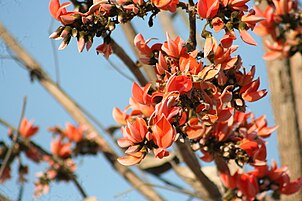
Palash flowers, bright red, pepper the skyline in Jharkhand during fall, also known as forest fire

A crocodile at Muta crocodile breeding centre at Ormanjhi, Ranchi
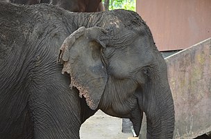
A Female Indian Elephant at Dalma Wildlife Sanctuary in Jharkhand


Demographics[]
| showPopulation Growth |
|---|
According to the 2011 Indian Census, Jharkhand has a population of 32.96 million, consisting of 16.93 million males and 16.03 million females.[63] The sex ratio is 947 females to 1,000 males.[63] The literacy rate of the state was 67.63% with Ranchi district being most educated at 77.13% compared to rural Pakur district being least at 50.17%.[63]
Languages[]
Hindi is the official language in Jharkhand[3] and is spoken by the people of the state, although different regions have their own languages. These include Nagpuri, Khortha, Kurmali, Magahi and Bhojpuri. Jharkhand has accorded second language status to Angika, Bengali, Bhojpuri, Ho, Kharia, Kurukh, Khortha, Kurmali, Magahi, Maithili, Mundari, Nagpuri, Odia, Santali and Urdu.[4][66][3]
Religion[]

Religion in Jharkhand (2011)[67]
As per the 2011 census, Hinduism is the majority religion in the state at 67.8%, followed by Islam at 14.5% and Christianity at 4.3%.[67] Other religions, primarily Sarnaism, constitute 12.8% of the population.[68]
Hindus form majority in 19 out of 24 districts of the Jharkhand. Christianity forms majority in Simdega district[67] (51.04% ). Sarna forms majority in Lohardaga (51.01%), West Singhbhum (62.29%) and plurality in Gumla (44.62%) and Khunti (45.37%).[69] Muslims have highest presence in Pakur district and Sahebganj district of Jharkhand forming 35% and 34% of the population.[70]
Government and administration[]
The constitutional head of the government of Jharkhand is the governor, who is appointed by the President of India. The real executive power rests with the chief minister and the cabinet. The political party or the coalition of political parties having a majority in the Legislative Assembly forms the government.
The head of the bureaucracy of the state is the chief secretary. Under this position, is a hierarchy of officials drawn from the Indian Administrative Service, Indian Police Service, Indian Forest Service and different wings of the state civil services. The judiciary is headed by the Chief Justice. Jharkhand has a High Court which has been functioning since 2000. All the branches of the government are located in the state capital, Ranchi.
Administrative districts[]
The state was formed with 18 districts that were formerly part of south Bihar. Some of these districts were reorganised to form 6 new districts, namely, Latehar, Saraikela Kharsawan, Jamtara, Pakur, Khunti and Ramgarh. At present, the state has 5 Divisions and 24 Districts. One interesting thing about Jharkhand is that all its districts, except Lohardaga and Khunti, share a border with a neighbouring state.[71]
Divisions and districts[]
|
|
|
|
|
Major cities[]
Largest Cities in Jharkhand
(2011 Census of India estimate)[72]
| Rank | City | District | Population | Rank | City | District | Population |
 Jamshedpur  Bokaro |
|---|---|---|---|---|---|---|---|---|
| 01 | Jamshedpur | East Singbhum | 1,339,438 | 06 | Phusro | Bokaro | 186,139 | |
| 02 | Dhanbad | Dhanbad | 1,196,214 | 07 | Hazaribagh | Hazaribagh | 153,595 | |
| 03 | Ranchi | Ranchi | 1,126,741 | 08 | Giridih | Giridih | 143,630 | |
| 04 | Bokaro Steel City | Bokaro | 564,319 | 09 | Ramgarh | Ramgarh | 132,441 | |
| 05 | Deoghar | Deoghar | 203,123 | 10 | Medininagar | Palamu | 120,325 |
Economy[]
The gross domestic product of Jharkhand is estimated at ₹3.83 lakh crore (US$54 billion) in 2020–21. The per capita GDP of Jharkhand in 2018-19 was ₹82,430 (US$1,200).[73]

Jharkhand has several towns and innumerable villages with civic amenities. Urbanization ratio is 24.1%.[74] Jharkhand also has immense mineral resources: minerals ranging from (ranking in the country within bracket) from iron ore (1st), coal (3rd), copper ore (1st), mica (1st), bauxite (3rd), manganese, limestone, china clay, fire clay, graphite (8th), kainite (1st), chromite (2nd), asbestos (1st), thorium (3rd), sillimanite, uranium (Jaduguda mines, Narwa Pahar) (1st) and even gold (Rakha Mines) (6th) and silver and several other minerals. Large deposits of coal and iron ore support concentration of industry, in centres like Jamshedpur, Dhanbad, Bokaro and Ranchi. Tata Steel, a NSE NIFTY 500 conglomerate has its corporate office and main plant in Tatanagar, Jharkhand.[75] It reported a gross income of ₹. 204,910 million for 2005. NTPC will start coal production from its captive mine in state in 2011–12, for which the company will be investing about Rs 18 billion.[76]
Agriculture is another sector in the economy of Jharkhand which helps the economy to grow. In Jharkhand, farmers produce several crops such as rice, wheat, maize, pulses, potatoes, and vegetables such as tomato, carrots, cabbage, brinjal, pumpkin, and papaya. The other Industries are cottage industry and IT industry.[77]
Culture[]
Cuisine[]

Staple foods of Jharkhand are rice, dal, vegetable and tubers. Spices are sparingly used in cuisine. Famous dishes include Chilka roti, Malpua, Pittha, Dhuska, Arsa roti, Dudhauri, Litti Chokha and Panipuri (Gupchup).[78][79] Rugra and Putoo is a type of edible mushroom that is grown extensively in Jharkhand and harvested during the rainy months. It has a hardened, white, edible shell and a softer dark colored centre. Bamboo shoots are also used as vegetable.[80] The leaf of Munga (Moringa oleifera) and Koinar tree (Bauhinia variegata) used as leafy vegetable or Saag.[81]

Local alcoholic drinks include rice beer, originally known as Handi or Handia, named after the vessel handi (earthen pot) used to make it. Handiya is culturally associated with native i.e. Sadans and Tribal, this drink consumed by both men and women, on social occasions like marriage and other festivals.[82][83] Another common liquor is called Mahua daru, made from flowers of the "Mahua" tree (Madhuca longifolia).[84]
Folk music and dance[]
There are several Folk dance in Jharkhand such as:Jhumair, Mardana Jhumair, Janani Jhumair, Domkach, Lahasua, Vinsariya, Jhumta, Fagua, Angnai, Paika, Chhau, , Mundari and Santali dance.[85]
Festivals[]
Major local festival of Jharkhand are Sarhul, Tusu Parab, Rath Yatra, Chhath Puja, Durga Puja, Karam, Jitia, Mansa Puja, Diwali, Sohrai/Bandna, Phagua/Holi, Dussehra, Ram Navami, Mage Porob and Makar Sankranti[86]
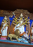
Durga Puja in Jharkhand

Chhau dance performing artists

Chhath Puja is one of the most famous festivals in Jharkhand

Karam festival in Jharkhand

Holi festival is celebrated with great joy and pomp


Paintings[]

The Sohrai and Khovar painting is a mural art form practiced by women. Sohrai painting is traditionally done at the Sohrai harvest festival, while Khovar painting is done at weddings.[86]
Tattoo[]
The tattoo making tradition of Godna is an essential part of local tradition.[86]
Cinema[]
Jharkhand produce many films in regional and Tribal languages including Nagpuri, Khortha, Santali, Ho and Kurukh.[87] Film industry in state of Jharkhand is known as Jhollywood.[88][89]
Media[]
There are some television channel, newspapers and radio which operates in Jharkhand. DD Jharkhand is important Channel in Jharkhand. All India Radio also operates from Ranchi.[90]
Hindustan, Dainik Jagran, Prabhat Khabar, Ranchi Express are some of the Hindi newspapers and The Times of India, Hindustan Times, Navbharat Times, The Pioneer, The Telegraph are some English newspapers in Jharkhand.
Transport[]
Air[]
Birsa Munda Airport is the largest domestic airport in the state with air connectivity to major Indian cities of Delhi, Kolkata, Bangalore, Mumbai, Hyderabad among others.[91]
Deoghar Airport is located in Deoghar, in the state of Jharkhand, India. The airport is being constructed to handle Airbus A320 type of aircraft. Prime Minister Narendra Modi laid the foundation stone of development of the airport in Jharkhand on 25 May 2018. After completion it will be second operational airport in state of Jharkhand after Ranchi.[92]
Other airports present in the state are Bokaro Airport, Jamshedpur Airport, Chakulia Airport, Dumka Airport and Dhanbad Airport which mostly run private and charter flights.[93]
Roads[]
Jharkhand has extensive network of National Highways and State Highways.[94] There is 2,661.83 kilometres (1,653.98 mi) of paved National Highways in the state as of 2016.[94] The National highways present in the state are numbered 18, 19, 20, 22, 33, 39, 43, 114A, 118, 133, 133A, 133B, 139, 143, 143A, 143AG, 143D, 143H, 218, 220, 320D, 320G, 333, 333A, 343, 419 and 522.[94] The Golden Quadrilateral network of Delhi – Kolkata route runs through Jharkhand notably at Dhanbad.[95][96]
Ports[]
Jharkhand is landlocked state but has numerous rivers and waterways.[97] A multi-modal port has been planned at Sahebganj where river Ganges flows.[98] The project is estimated to cost ₹65,000 million and phase-1 is estimated to be completed by 2019.[99]
Rail[]
Jharkhand is very well connected by railways. The state has numerous railway stations and railway junctions.[100] Hilly regions of state are equipped with tunnels that form essential organ of railways.
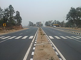
National Highway 33 near Ramgarh Cantonment

Beautiful view from the Sahibganj Railway Station


Education[]
As per the 2011 census conducted by Government of India the official literacy rate for the state was 67.63% (male: 78.45%; female: 56.21%) with nine districts above the average literacy rate:[101][102]
- Ranchi: 77.13% (male: 85.53%; female: 68.20%)
- East Singhbhum: 76.13% (male: 84.51%; female: 67.33%)
- Dhanbad: 75.71% (male: 85.68%; Female: 64.70%)
- Ramgarh: 73.92% (male: 83.51%; female: 63.49%)
- Bokaro: 78.48% (male: 84.50%; female: 61.46%)
- Hazaribagh: 70.48% (male: 81.15%; female: 59.25%)
- Saraikela Khasawan: 68.85% (male: 81.01%; female: 56.19%)
- Koderma: 68.35% (male: 81.25%; female: 54.77%)
- Lohardaga: 68.29% (male: 78.62%; female: 57.86%)
- Deoghar: 66.34% (male: 79.13%; female: 53.39%)
Since the formation of the new state, the Jharkhand Education Project Council (JEPC) has been implementing four projects to spread elementary education: DPEP, SSA, NPEGEL, and KGBV. The state has been moving towards the goal of universal elementary education but the target of 100% enrolment and retention of children in schools has not yet been attained.[103] Jharkhand has made primary education so accessible that 95% of children of ages 6–11 are enrolled in school, as opposed to 56% in 1993–94; this will likely improve literacy a great deal.[citation needed]
Schools[]
The medium of instruction in schools is Hindi/English with English/Hindi/Sanskrit/Bengali/Odia as second language. After 10 years of schooling, students can join two years of Intermediate course (or +2 courses) in Arts, Science and Commerce. This is followed by three years of degree courses (graduation) or four years of Engineering/Agriculture/Medicine degree.
The school system comprises various private and public schools. The government schools are abundant. Few notable schools are: St. Thomas School, Ranchi, Sainik School Tilaiya, Loyola School, Jamshedpur, Delhi Public School, Bokaro, Delhi Public School, Ranchi, Jawahar Vidya Mandir, Bishop Westcott Boys' School, Ramakrishna Mission Vidyapith, Deoghar and De Nobili School.
In May 2008, Jharkhand became the first in India to introduce free haircuts for poor students. 40,000 barbers will be employed with a monthly salary of 1000 rupees (25 US dollars) which will cost the state government 40 million rupees (1 million US dollars).[104] Under Rashtriya Madhyamik Shiksha Abhiyan 89 English medium senior secondary school named Model school have been established in about each block of the district in 2011.[citation needed]
Universities and colleges[]
- AISECT University, Jharkhand, Hazaribagh
- Arka Jain University, Jamshedpur
- Binod Bihari Mahto Koyalanchal University, Dhanbad
- Birsa Agricultural University, Kanke, Ranchi
- Central University of Jharkhand, Brambe, Ranchi
- Jharkhand Rai University, Ranchi
- Jharkhand Raksha Shakti University, Ranchi
- Kolhan University, Chaibasa
- National University of Study and Research in Law, Ranchi
- Nilamber-Pitamber University, Medininagar
- Ranchi University, Ranchi
- Sarala Birla University, Ranchi
- Sido Kanhu Murmu University, Dumka
- Tata College, Chaibasa
- Vinoba Bhave University, Hazaribagh
Autonomous[]
- Dr. Shyama Prasad Mukherjee University, formerly Ranchi college
- Indian Institute of Information Technology, Ranchi
- Indian Institute of Management Ranchi
- Indian Institute of Technology (Indian School of Mines), Dhanbad
- National Institute of Foundry and Forge Technology (NIFFT), Ranchi
- National University of Study and Research in Law
- National Institute of Technology, Jamshedpur
- St. Xavier's College, Ranchi
- Xavier Institute of Social Service (XISS), Ranchi
- Xavier Labour Relations Institute (XLRI), Jamshedpur
Agriculture[]
- Indian Institute of Agricultural Biotechnology, Ranchi
Engineering[]

- Birla Institute of Technology, Mesra, Ranchi
- Birsa Institute of Technology Sindri, Dhanbad
- Cambridge Institute of Technology, Ranchi
- DAV Institute of Engineering & Technology, Daltonganj
- Indian Institute of Technology (Indian School of Mines), Dhanbad, Dhanbad
- National Institute of Foundry and Forge Technology (NIFFT), Ranchi
- National Institute of Technology, Jamshedpur
Management[]
- Indian Institute of Management Ranchi IIM-Ranchi
- Institute of Management Studies, Ranchi IMS-RU
- XLRI - Xavier School of Management, Jamshedpur
- NSIBM - Netaji Subhas Institute of Hotel & Business Management, Jamshedpur
Medical colleges[]
- All India Institute of Medical Sciences (AIIMS), Deoghar
- Mahatma Gandhi Memorial Medical College (MGM), Jamshedpur
- Medinirai Medical College and Hospital, Palamu
- Patliputra Medical College (PMCH), Dhanbad
- Phulo Jhano Murmu Medical College and Hospital, Dumka
- Rajendra Institute of Medical Sciences (RIMS), Ranchi
- Shaheed Sheikh Bhikhari Medical College and Hospital, Hazaribagh
Psychiatry[]
- Central Institute of Psychiatry, Ranchi
Public Health[]
Because of its mild climate, Jharkhand, particularly its capital Ranchi, has been a health resort. As far back as 1918, facilities were set up for treatment of mentally challenged.[105][failed verification] European Mental Hospital was established along with Indian Mental Hospital. Today they are called Central Institute of Psychiatry and Ranchi Institute of Neuro-psychiatry and Allied Sciences respectively. In certain areas of Jharkhand, poverty and consequent malnutrition have given rise to diseases like tuberculosis (TB). In fact, TB has assumed epidemic proportions in certain areas of the state. For management and treatment of such TB, Itki TB Sanatorium, Ranchi, established in 1928 has been doing work as a premier institute for clinical and programmatic management of TB. The Itki TB Sanatorium is well equipped and accredited by the Indian government for quality assurance and Culture and Drug Sensitivity Testing for M.TB. It provides free of cost treatment for TB as well as drug-resistant TB. Likewise, in the field of treatment of cancer, Tata Main Hospital, Jamshedpur,[106] is rendering pioneering work. In the same way, Bokaro General Hospital equipped with modern facilities for the treatment of cancer and heart-related problems with the capacity of 1100 beds one of the largest in eastern India.
Although several public and private health facilities are available in the state, overall infrastructure for dispensing health related services require improvements. An exception is the Tata Motors Hospital which is an example of an ISO 14001 and 18001 certified hospital with DNB teaching facilities.[citation needed]
Ranchi, the capital, has witnessed a sharp growth in the number of hospitals.
Fluoride in groundwater presents a public health problem in Jharkhand. A recent survey led by the Birla Institute of Technology, Mesra, Ranchi in collaboration with UNICEF in the northwest districts of Palamau and Garhwa found fluoride levels above the drinking WHO drinking water guidelines.[107] Excessive amounts of fluoride in drinking water can lead to dental fluorosis, prevalent bone fractures, and skeletal fluorosis, an irreversible disabling condition.[108] Some work has focused on combating fluorosis through increased calcium intake by consuming local plants.[109] Researchers at Princeton University and the Birla Institute of Technology, Mesra, Ranchi are currently investigating defluoridation options, while performing an epidemiological survey to assess the extent of fluoride linked health problems and the impact of future interventions.[110][111]
Almost 80% of Jharkhand's people are farmers, although it contains 40% of India's mineral reserves it has some of India's poorest people, in Summer 2009 the state was threatened by drought, with people criticising the government for not providing food aid or assistance.[112]
Sports[]
JRD TATA Sports Complex, Jamshedpur hosts football matches of Indian Super League and is the home of ISL based football club Jamshedpur FC. Cricket, hockey, and football are common games in Jharkhand. Players like Jaipal Singh, a former Indian hockey captain and Olympian and Manohar Topno currently play for the Indian Hockey team. Jaipal Singh was the captain of the hockey team that won the first gold medal for India in the 1928 Summer Olympics in Amsterdam. Mahendra Singh Dhoni who was the captain of Indian cricket team and led the Indian cricket team to ICC Cricket World Cup glory on 2 April 2011, ending a 28-year wait to repeat the feat achieved by former Indian captain Kapil Dev in 1983 at Lord's, England.[113]
Other notable cricketers from Jharkhand are Varun Aaron, Shahbaz Nadeem, and Saurabh Tiwary. He was one of the key batsmen in the Indian team that won the 2008 U/19 Cricket World Cup in Malaysia. Other sportspeople include Deepika Kumari, a young archer who won gold medal in the 2010 Commonwealth games in the women's individual recurve event. Nikki Pradhan currently a member of the national hockey team. Pradhan was the first female hockey player from Jharkhand to represent India in the Olympics.
An International Cricket stadium with an indoor stadium and a practice ground has been constructed. This international stadium has hosted an International match between India and England on 19 January 2013.[114] Apart from that, this stadium has hosted two IPL 6 matches for KKR and qualifier 2 of IPL 8 between CSK and RCB and Celebrity Cricket League Matches for Bhojpuri Dabanggs. A tennis academy, which was inaugurated by Sania Mirza and Shoaib Malik, also runs besides the cricket stadium.[115] Ranchi is among six cities in Hockey India League to be played in January 2013. Ranchi franchise was bought by Patel-Uniexcel Group and the team named Ranchi Rhinos which is now being co-hosted by Mahendra Singh Dhoni and named as Ranchi Rays.[116]
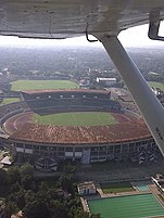
Aerial View of Keenan Stadium in Jamshedpur
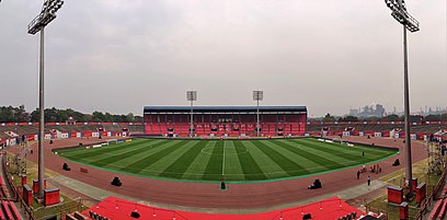
JRD Tata Sports Complex

Tourism[]
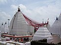
Jharkhand is known for its waterfalls, hills and holy places.[117][8] Parasnath, Baidyanath Dham, and Rajrappa are major religious places.[118]
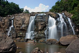
Itkhori is a holy place for Hindus, Buddhists and Jains. It is believed to be the place from where Gautama Buddha started his journey for Bodh Gaya. Many sculptures of Hindu, Jain and Buddhist art styles were found in 2018.[119][120] There are several waterfalls in the state including Jonha Falls, Hundru Falls, Dassam Falls and Panchghagh Falls.[121][122][123] Netarhat is a hill station in the state.[124][125][126]
There are several wildlife sanctuaries in Jharkhand including Betla National Park and Dalma Wildlife Sanctuary which are major attraction for tourists.[127][128][129][130]
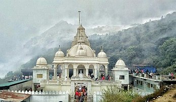
The ancient Vaidyanath Jyotirlinga Temple in Deoghar
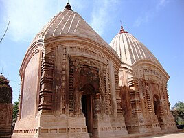
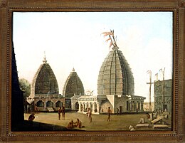
Jain temple at Samet Shikharji, the place from where twenty Tirthankars attained nirvana
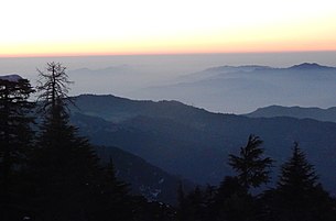
Netarhat hill station


See also[]
- List of people from Jharkhand
- JSCA International Stadium Complex
- Outline of India
References[]
- ^ "Jharkhand Profile 2011 Census" (PDF). Registrar General & Census Commissioner, India. Archived (PDF) from the original on 22 April 2016. Retrieved 13 February 2017.
- ^ "MOSPI Gross State Domestic Product". Ministry of Statistics and Programme Implementation, Government of India. 1 March 2019. Retrieved 9 June 2019.
- ^ Jump up to: a b c d "Report of the Commissioner for linguistic minorities: 52nd report (July 2014 to June 2015)" (PDF). Commissioner for Linguistic Minorities, Ministry of Minority Affairs, Government of India. pp. 43–44. Archived from the original (PDF) on 15 November 2016. Retrieved 16 February 2016.
- ^ Jump up to: a b "Jharkhand gives second language status to Magahi, Angika, Bhojpuri and Maithili". The Avenue Mail. 21 March 2018. Archived from the original on 28 March 2019. Retrieved 30 April 2019.
- ^ Jump up to: a b c "State animals, birds, trees and flowers" (PDF). Wildlife Institute of India. Archived from the original (PDF) on 4 March 2009. Retrieved 5 March 2012.
- ^ "Jharkhand". Merriam-Webster Dictionary.
- ^ "Jharkhand – At a Glance". Archived from the original on 5 May 2012. Retrieved 9 May 2012.
- ^ Jump up to: a b "Adventure capital of the east, Jharkhand will drive you crazy". nyoooz.com. Archived from the original on 3 April 2019. Retrieved 30 April 2019.
- ^ "Jharkhand registers 385% increase in foreign tourist visits". hindustantimes.com. Retrieved 30 April 2019.
- ^ "Resource Curse and Jharkhand" (PDF). Economic & Political Weekly. Archived (PDF) from the original on 13 December 2017. Retrieved 12 December 2017.
- ^ "Jharkhand: Here is why India's richest mineral state is not even close to development". Daily Bhaskar. 31 March 2014. Archived from the original on 4 April 2019. Retrieved 30 April 2019.
- ^ "UNDP- Jharkhand: Economic and Human Development Indicators" (PDF). www.in.undp.org. Archived (PDF) from the original on 27 January 2018. Retrieved 20 March 2017.
- ^ Jharkhand Profile (2011). "Census India" (PDF). censusindia.gov.in. Archived (PDF) from the original on 22 April 2016. Retrieved 20 March 2017.
- ^ "About Jharkhand: Information On Mining Industries, Economy, Agriculture & Geography". www.ibef.org. Archived from the original on 29 November 2016. Retrieved 30 April 2019.
- ^ Jump up to: a b India – Pre-historic and Proto-historic periods. Publications Division, Ministry of Information & Broadcasting. 2016. p. 14. ISBN 9788123023458.
- ^ Jump up to: a b "Cave paintings lie in neglect". The Telegraph. 13 March 2008. Archived from the original on 6 September 2018. Retrieved 30 April 2019.
- ^ Jump up to: a b Singh, Upinder (2008). A History of Ancient and Early Medieval India: From the Stone Age to the 12th Century. Pearson Education India. p. 220. ISBN 9788131711200.
- ^ Yule, Paul (8 January 2019). "Addenda to "The Copper Hoards of the Indian Subcontinent: Preliminaries for an Interpretation"". Man in Environment. 26: 117–120. doi:10.11588/xarep.00000510 – via crossasia-repository.ub.uni-heidelberg.de.
- ^ "KABRA – KALA". www.asiranchi.org. Archived from the original on 8 October 2013. Retrieved 30 April 2019.
- ^ Sharma, Tej Ram (1978). Personal and Geographical Names in the Gupta Inscriptions. Concept Publishing Company. p. 258.
- ^ Kiro, Santosh. The Life and Times of Jaipal Singh Munda. ISBN 9789352669431.
- ^ Roma Niyogi 1959, p. 119.
- ^ Jump up to: a b c Sinha, Anuj Kumar (January 2017). Unsung Heroes of Jharkhand Movement. ISBN 9789352660001. Retrieved 29 July 2019.
- ^ Gautam Kumar Bera (2008). The unrest axle: ethno-social movements in Eastern India. Mittal Publications. pp. 32–35. ISBN 978-81-8324-145-8.
- ^ Jump up to: a b "History | Latehar, Government of Jharkhand". Archived from the original on 28 March 2019. Retrieved 30 April 2019.
- ^ "The Nagbanshis and the Cheros". archive.org.
- ^ Lahiry 2014, p. 24.
- ^ "Archived copy". Archived from the original on 18 November 2015. Retrieved 20 December 2018.CS1 maint: archived copy as title (link)
- ^ "history". latehar.nic.in. Archived from the original on 28 March 2019. Retrieved 30 April 2019.
- ^ Hazaribagh District Gazetteer.
- ^ "चुआड़ विद्रोह के महानायक, क्रांतिवीर शहीद रघुनाथ महतो की 277 वीं जयंती". prabhatkhabar.com. Archived from the original on 3 July 2018. Retrieved 30 April 2019.
- ^ "Archived copy". Archived from the original on 30 December 2018. Retrieved 30 April 2019.CS1 maint: archived copy as title (link)
- ^ "Archived copy". Archived from the original on 7 September 2018. Retrieved 30 April 2019.CS1 maint: archived copy as title (link)
- ^ Mathur Das Ustad (1997). "The Role of Bishwanath Sahi of Lohardaga district, During the Revolt of 1857 in Bihar". Proceedings of the Indian History Congress. 58: 493–500. JSTOR 44143953.
- ^ "Archived copy". Archived from the original on 7 November 2018. Retrieved 30 April 2019.CS1 maint: archived copy as title (link)
- ^ "JPCC remembers freedom fighters Tikait Umrao Singh, Sheikh Bhikari". news.webindia123.com.
- ^ Kaul, Chandrika. "From Empire to Independence: The British Raj in India 1858–1947". Archived from the original on 17 June 2016. Retrieved 22 November 2018.
- ^ "Archived copy". Archived from the original on 13 October 2015. Retrieved 3 December 2018.CS1 maint: archived copy as title (link)
- ^ Birsa Munda and His Movement 1874–1901: A Study of a Millenarian Movement in Chotanagpur, by Kumar Suresh Singh. Oxford University Press, 1983
- ^ Hunter, William Wilson, Sir, et al. (1908). Imperial Gazetteer of India, Volume 12. 1908–1931; Clarendon Press, Oxford
- ^ "Archived copy". Archived from the original on 1 June 2013. Retrieved 3 December 2018.CS1 maint: archived copy as title (link)
- ^ Danik jagran Ranchi Page No.14, 2 October 2011
- ^ "Error". Archived from the original on 5 March 2016. Retrieved 30 April 2019.
- ^ "Photo Gallery of Mahatma Gandhi (1933-1948)". Archived from the original on 4 March 2016. Retrieved 30 April 2019.
- ^ "RAMGARH SESSION-1940". Archived from the original on 11 December 2017. Retrieved 30 April 2019.
- ^ "Chronology 1940". Archived from the original on 22 November 2018. Retrieved 30 April 2019.
- ^ Eastern States Agency. List of ruling chiefs & leading personages Delhi: Agent to Governor-General, Eastern States, 1936
- ^ Kumāra, Braja Bihārī (1998). Small States Syndrome in India. ISBN 9788170226918.
- ^ "Tributes pour in for Justice Shahdeo". 10 January 2018. Retrieved 14 November 2019.
- ^ "Remembering Justice LPN Shahdeo on his 7th death anniversary". 10 January 2019. Retrieved 14 November 2019.
- ^ gigisoftsolutions. "History of Jharkhand, Jharkhand History". traveljharkhand.com. Archived from the original on 19 April 2015. Retrieved 20 July 2015.
- ^ "About : Official Website of Government of Jharkhand". www.jharkhand.gov.in. Archived from the original on 23 November 2016. Retrieved 2 February 2017.
- ^ Bhaumik, Subir (5 February 2009). "Cell phones to fight India rebels". BBC News. Archived from the original on 8 February 2009. Retrieved 6 May 2010.
- ^ Jump up to: a b c "Rising Maoists Insurgency in India". Global Politician. 15 January 2007. Archived from the original on 11 April 2010. Retrieved 18 July 2010.
- ^ Maoists who menace India Archived 17 October 2015 at the Wayback Machine, New York Times, 17 April 2006
- ^ Jump up to: a b c "Hidden civil war drains India's energy". Asia Times Online. 9 August 2006. Archived from the original on 4 June 2011. Retrieved 18 July 2010.CS1 maint: unfit URL (link)
- ^ Thaker, Jayesh (12 April 2014). "Ex-MPs add she might to LS fight". The Telegraph. Kolkata. Archived from the original on 21 September 2017. Retrieved 30 April 2019.
- ^ "Archived copy". Archived from the original on 15 October 2018. Retrieved 30 April 2019.CS1 maint: archived copy as title (link)
- ^ "Archived copy". Archived from the original on 18 April 2019. Retrieved 30 April 2019.CS1 maint: archived copy as title (link)
- ^ https://ranchi.nic.in/tourist-place/tagore-hill/
- ^ "Birds and animals found in the forest of the Palamau district". Official website of the Palamau district. Archived from the original on 12 January 2009. Retrieved 5 April 2009.
- ^ "Census Population" (PDF). Census of India. Ministry of Finance India. Archived from the original (PDF) on 19 December 2008. Retrieved 18 December 2008.
- ^ Jump up to: a b c "Jharkhand Provisional Result-Census 2011-Data Sheet" (PDF). Office of the Registrar General & Census Commissioner, India. Ministry of Home Affairs, Government of India. Archived (PDF) from the original on 17 May 2017. Retrieved 13 July 2017.
- ^ "Language – India, States and Union Territories" (PDF). Census of India 2011. Office of the Registrar General. pp. 13–14. Archived (PDF) from the original on 14 November 2018. Retrieved 30 April 2019.
- ^ "C-16 Population By Mother Tongue". census.gov.in. Retrieved 6 March 2020.
- ^ "Bedlam & bill rush in Assembly". The Telegraph. 21 June 2018. Archived from the original on 23 July 2018. Retrieved 30 April 2019.
- ^ Jump up to: a b c "Population by religion community – 2011". Census of India, 2011. The Registrar General & Census Commissioner, India. Archived from the original on 25 August 2015.
- ^ "In Jharkhand's Singhbhum, religion census deepens divide among tribals". The Times of India. Archived from the original on 23 September 2015. Retrieved 20 July 2015.
- ^ Ashraf, Ajaz. "Census data shows the outcry against Christian missionaries by Hindutva groups is propaganda". Scroll.in. Retrieved 18 May 2020.
- ^ "'Treated as Mere Vote Bank,' Say Muslims Left Out of Jharkhand's Grand Alliance". thewire.in. Retrieved 18 May 2020.
- ^ "Districts of Jharkhand". www.jharkhand.gov.in. Government of Jharkhan. Archived from the original on 3 February 2017. Retrieved 4 February 2017.
- ^ "Jharkhand". Office of the Registrar General and Census Commissioner. 18 March 2007. Archived from the original on 15 September 2008. Retrieved 23 July 2008.
- ^ "Jharkhand Budget Analysis 2020-21". PRSIndia. 23 March 2020. Retrieved 25 March 2020.
- ^ "Jharkhand" (PDF). India Brand Equity Foundation. Archived (PDF) from the original on 24 September 2015. Retrieved 28 January 2014.
- ^ "Tata Steel > Listing Details > Steel – Large > Listing Details of Tata Steel – BSE: 500470, NSE: TATASTEEL". Archived from the original on 7 July 2017. Retrieved 12 June 2017.
- ^ "NTPC eyes 20K crore thermal plant in MP". business.rediff.com. Archived from the original on 15 July 2011. Retrieved 27 October 2010.
- ^ "Archived copy". Archived from the original on 17 October 2018. Retrieved 30 April 2019.CS1 maint: archived copy as title (link)
- ^ "10 Dishes of Cuisine of Jharkhand you must try at least once in Life". Great Indian Food. 30 September 2016. Archived from the original on 3 February 2017. Retrieved 2 February 2017.
- ^ "Jharkhand Tourism::Cusines". www.jharkhandtourism.in. Archived from the original on 26 February 2017. Retrieved 2 February 2017.
- ^ "Rugra on a rain high - Mushroom demand shoots up in holy month of Shravan". www.telegraphindia.com. Archived from the original on 28 March 2019. Retrieved 9 October 2018.
- ^ "Archived copy". Archived from the original on 18 April 2019. Retrieved 30 April 2019.CS1 maint: archived copy as title (link)
- ^ "Hadia is a popular beverage of Jharkhand | Rice Knowledge Management Portal – Rice, Paddy, Dhan, Chawal, Rice Research Domain, Rice Extension Domain, Rice Farmers Domain, Rice General Domain, Rice Service Domain, RKMP, Rice in India, Rice Government Schemes, Rice ITKs, Rice FLDs, Rice Package of Practices". www.rkmp.co.in. Archived from the original on 3 February 2017. Retrieved 2 February 2017.
- ^ "The Telegraph – Calcutta : Jharkhand". www.telegraphindia.com. Archived from the original on 3 February 2017. Retrieved 2 February 2017.
- ^ "High time to make most of mahua – Times of India". The Times of India. Archived from the original on 9 February 2017. Retrieved 2 February 2017.
- ^ "Archived copy". Archived from the original on 5 August 2018. Retrieved 30 April 2019.CS1 maint: archived copy as title (link)
- ^ Jump up to: a b c Khanna, Dr. C. L. (September 2010). Jharkhand General Knowledge. ISBN 9788174822468.
- ^ "Archived copy". Archived from the original on 14 October 2018. Retrieved 30 April 2019.CS1 maint: archived copy as title (link)
- ^ "Here comes Jollywood". India today.
- ^ "Jollywood gets moving forward in regional film industry". Jharkhandstatenews.
- ^ "Jharkhand Media". mapsofindia.com. Archived from the original on 30 April 2019. Retrieved 30 April 2019.
- ^ "Ranchi Airport crosses one million mark of passengers. PASSENGERS". Pioneer. www.dailypioneer.com. Archived from the original on 30 July 2017. Retrieved 6 April 2017.
- ^ "Construction work at Jharkhand's Deoghar airport to be completed soon: AAI". Business Standard India. Press Trust of India. 3 September 2020. Retrieved 28 March 2021.
- ^ "Dhanbad, Dumka on chartered flight path". The Telegraph. 14 August 2011. Archived from the original on 30 December 2013. Retrieved 29 December 2013.
- ^ Jump up to: a b c "National highways in Jharkhand". pib.nic.in. Press Information Bureau, Government of India. Archived from the original on 13 December 2017. Retrieved 6 December 2017.
- ^ "Golden Quadrilateral Highway Network". roadtraffic-technology.com. Archived from the original on 13 December 2017. Retrieved 12 December 2017.
- ^ "NHAI". www.nhai.org. National Highway Authority of India (NHAI), Government of India. Archived from the original on 4 March 2016. Retrieved 9 December 2017.
- ^ "Multi-model port to come up at Sahibganj: Gadkari". The Pioneer. 28 January 2016. Archived from the original on 22 August 2017. Retrieved 17 June 2017.
- ^ "Sahibganj to be exim hub with a multimodal plan: Nitin Gadkari". Business Standard. 13 October 2016. Archived from the original on 22 August 2017. Retrieved 17 June 2017.
- ^ Arora, Rajat (19 October 2016). "L&T to construct Sahibganj Multi modal transportation terminal". The Economic Times. Archived from the original on 29 June 2017. Retrieved 17 June 2017.
- ^ Rail funds up this time Archived 30 March 2018 at the Wayback Machine The Telegraph 7 February 2018
- ^ Dr. Arun C. Mehta. "District-specific Literates and Literacy Rates, 2001". Educationforallinindia.com. Archived from the original on 14 April 2010. Retrieved 12 November 2011.
- ^ "National Family Health Survey, 1998–99: Fact Sheet, Jharkhand, Section: Basic Socio-Demographic Features of Jharkhand" (PDF). p. 3. Archived from the original (PDF) on 3 October 2007. Retrieved 21 August 2009.
- ^ Sanjay Pandey (16 October 2007). "The poor state of girl child education in Jharkhand State". MyNews.in.[permanent dead link]
- ^ Tewary, Amarnath (13 May 2008). "South Asia | Free haircuts for India students". BBC News. Archived from the original on 10 April 2013. Retrieved 12 November 2011.
- ^ Central Institute of Psychiatry Archived 24 March 2005 at the Wayback Machine, Ranchi.
- ^ "Welcome to Tata Memorial Centre". Tatamemorialcentre.com. 1 January 2004. Archived from the original on 18 February 2010. Retrieved 18 July 2010.
- ^ "Fluoride alert for groundwater". The Telegraph, Calcutta. 11 January 2008. Archived from the original on 9 July 2017. Retrieved 4 February 2017.
- ^ Khandare, AL; Harikumar, R; Sivakumar, B (2005). "Severe bone deformities in young children from vitamin D deficiency and fluorosis in Bihar-India". Calcified Tissue International. 76 (6): 412–8. doi:10.1007/s00223-005-0233-2. PMID 15895280. S2CID 21536934.
- ^ "Fluoride Toxicity in Jharkhand State of India". Disability News India. Archived from the original on 7 January 2009. Retrieved 4 February 2017.
- ^ "Fluoride alert for groundwater," The Telegraph, Calcutta, Friday 11 January 2008.[1] Archived 6 December 2008 at the Wayback Machine
- ^ MacDonald, L. "Water and Health:An effective, sustainable treatment strategy to halt the fluorosis endemic in rural villages of Jharkhand State, India" Archived 1 December 2008 at the Wayback Machine
- ^ Pandey, Geeta (1 August 2009). "Jharkhand farmers despair at drought". BBC News. Retrieved 12 November 2011.
- ^ "Dhoni's world cup bat sold for Rs. 72 lakhs". Ndtv.com. 19 July 2011. Archived from the original on 7 October 2012. Retrieved 9 May 2012.
- ^ "Ranchi's new stadium set to host maiden One-Day International on January 19". The Times of India. 19 October 2012. Archived from the original on 9 May 2013. Retrieved 18 March 2013.
- ^ "Tennis takes Sania-Shoaib to Ranchi". Archived from the original on 8 April 2011. Retrieved 4 February 2017.
- ^ "Ranchi franchise becomes third team in Hockey India League". The Times of India. 14 September 2012. Archived from the original on 8 May 2013. Retrieved 18 March 2013.
- ^ "Places to Visit in Jharkhand". Maps of India. Archived from the original on 3 April 2019. Retrieved 30 April 2019.
- ^ "Jharkhand registers 385% increase in foreign tourist visits". Hindustan Times. Archived from the original on 3 April 2019. Retrieved 30 April 2019.
- ^ Jaipuriar, Vishvendu (21 November 2017). "Cop picket plan for temple". The Telegraph. Retrieved 29 July 2019.
- ^ Ravi, S. (11 May 2018). "Deciphering the past". The Hindu. Retrieved 29 July 2019.
- ^ "Jharkhand steps up plastic policing at picnic spots". The Telegraph. Archived from the original on 3 April 2019. Retrieved 30 April 2019.
- ^ "'Emerging' tourist destinations vie for attention at IITM". The Hindu.
- ^ "Adventure tourism extravaganza kick-starts today". The Pioneer. Archived from the original on 3 April 2019. Retrieved 30 April 2019.
- ^ "Autumn of thrill at hill station of Netarhat". The Telegraph. Archived from the original on 3 April 2019. Retrieved 30 April 2019.
- ^ "Netarhat: Jharkhand's Secret Hill Station". Outlook. Archived from the original on 3 April 2019. Retrieved 30 April 2019.
- ^ "Netarhat is Home to Innumerable Waterfalls And Unlimited Peace". India.com. Archived from the original on 3 April 2019. Retrieved 30 April 2019.
- ^ "BETLA NATIONAL PARK & TIGER RESERVE". WebIndia123. Archived from the original on 3 April 2019. Retrieved 30 April 2019.
- ^ "You Can Walk Amid Wildlife at Dalma Wildlife Sanctuary in Jharkhand". India.com. Archived from the original on 3 April 2019. Retrieved 30 April 2019.
- ^ "Winter holiday rush at Betla, Netarhat". The Telegraph. Archived from the original on 3 April 2019. Retrieved 30 April 2019.
- ^ "Dalma Wildlife Sanctuary bursts at the seams of autumn season". The Pioneer. Archived from the original on 3 April 2019. Retrieved 30 April 2019.
External links[]
 Definitions from Wiktionary
 Media from Wikimedia Commons
 News from Wikinews
 Quotations from Wikiquote
 Texts from Wikisource
 Textbooks from Wikibooks
 Travel guides from Wikivoyage
 Resources from Wikiversity
Government
General information
| show Places adjacent to Jharkhand |
|---|
| show |
|---|
| show Authority control |
|---|
- Jharkhand
- States and union territories of India
- States and territories established in 2000
- 2000 establishments in India