Kilifi County
Kilifi County | |
|---|---|
 | |
 Flag  Coat of arms | |
 Location in Kenya | |
| Country | Kenya |
| County | Kilifi County |
| Sub-counties | , , Ganze, Malindi, Magarini, Kaloleni and Rabai |
| Divisions and locations | (Tezo, Roka, Ngerenya, Matsangoni, Township), Kikambala (Mtwapa, Junju. Takaungu), Vitengeni (Mwahera, Vitengeni, Sokoke, Mrima wa Ndege, Dida), Ganze (Ganze, Palakumi, Dungicha), (Jaribuni, Kauma, Vyambani), (Bamba, Mtsara Watsatsu, Ndigiria, Bandari, Mitangani), Chonyi (Mwarakaya, Ziana, Chasimba, Banda Ra Sarama), Arabuko Sokoke Forest (Arabuko Sokoke Forest), Kaloleni (Kaloleni, Jibana, Kambe, Ribe, Kayafungo), Rabai (Ruruma, Rabai, Mwawesa), Mariakani (Mariakani, Mwanamwinga, Tsangatsini), Malindi (Malindi, Ganda, Goshi, Watamu, Gede), Marafa (Marafa, Bungale, Garashi, Dagamara, Adu), Magarini (Magarini, Fundissa, Gondoni), and (Langobaya, Jilore, Malanga, Chakama) |
| Formed | March 4, 2013 |
| Capital | Kilifi |
| Government | |
| • Governor | Amason Kingi |
| Area | |
| • Total | 12,245.9 km2 (4,728.2 sq mi) |
| Population (2019) | |
| • Total | 1,453,787 |
| • Density | 120/km2 (310/sq mi) |
| Time zone | UTC+3 (EAT) |
| Website | kilifi.go.ke |
Kilifi County is a county of Kenya. It was formed in 2010 as a result of a merger of Kilifi District and Malindi District. Its capital is Kilifi and its largest town is Malindi. The county has a population of 1,453,787. It covers an area of 12,245.90 km2 (4,728.17 sq mi).[1][2]
The county is located north and northeast of Mombasa. Kilifi has fewer tourists than Mombasa County, but there are some tourists beaches in Kikambala, Watamu, Malindi and Kilifi.
Tourism[]
Tourism and fishing in Kilifi are major economic activities due to its proximity to the Indian Ocean. The county has some of the best beaches and popular resorts and hotels.[3] Other attractions include historical sites such as the Mnarani ruins that date back to between the fourteenth and seventeenth century.[4]
Trade and Commerce[]
The county has a strong industrial sector with the Mabati Rolling Mill and the Athi River Cement Factory contributing heavily to the region's economy both in employment provision and income generation.[5]
Agriculture[]
Opportunities exist in agriculture, particularly dairy and crop farming thanks to fertile soils and a good weather pattern. The Kilifi County Minister for Agriculture, Livestock and Fisheries is Mwalimu Menza. The county had a successful cashew nut milling industry and opportunities exist in its revival.[6]
Demographic[]
Kilifi county has a total population of 1,453,787 of which 704,089 are males, 749,673 females and 25 intersex persons. There are 298,472 household with an average household size of 4.4 persons per household and a population density 116 people per square kilometre.[7]
| Sub-County | Male | Female | Intersex | Total |
|---|---|---|---|---|
| Chonyi | 29,527 | 32,807 | 1 | 62,335 |
| Ganze | 66,921 | 76,981 | 4 | 143,906 |
| Kaloleni | 92,614 | 101,063 | 5 | 193,682 |
| Kaum a | 10,965 | 11,673 | 5 | 22,638 |
| Kilifi North | 86,986 | 91,836 | 178,824 | |
| Kilifi South | 101,852 | 104,897 | 2 | 206,753 |
| Magarini | 93,302 | 98,308 | 4 | 191,610 |
| Malindi | 163,351 | 169,866 | 333,226 | |
| Rabai | 58,571 | 62,242 | 9 | 120,813 |
| Total | 704,089 | 749,673 | 25 | 1,453,787 |
Source [8]
| Year | Pop. | ±% |
|---|---|---|
| 1979 | 430,986 | — |
| 1989 | 591,903 | +37.3% |
| 1999 | 825,855 | +39.5% |
| 2009 | 1,109,735 | +34.4% |
| 2019 | 1,453,787 | +31.0% |
| source:[9] | ||
Religion[]
Administrative and Political Units[]
Administrative Units[]
There are seven sub counties, thirty five county assembly wards and fifty two locations.[11]
Constituencies[]
The county has seven constituencies:[12]
| Constituency | Popln 2009 Census | Area | No of wards | Wards |
|---|---|---|---|---|
| Kilifi North Constituency | 207,587 | 405 | 7 | , Sokoni, Kibarani, Dabaso, Matsangoni, Watamu, Mnarani |
| Kilifi South Constituency | 171,607 | 401 | 5 | Junju, Mwarakaya, Shimo la Tewa, Chasimba, Mtepeni |
| Kaloleni Constituency | 139,302 | 651 | 4 | Mariakani, Kayafungo, Kaloleni, Mwana Mwinga |
| Rabai Constituency | 113,622 | 241 | 4 | Mwawesa, Ruruma, Kambe-Ribe, Rabai/Kisurutuni |
| Ganze Constituency | 137,664 | 2,942 | 4 | Ganze, Bamba, Jaribuni, Sokoke |
| Malindi Constituency | 162,712 | 627 | 5 | Jilore, Kakuyuni, Ganda, Malindi Town, Shella |
| Magarini Constituency | 177,241 | 6,979 | 6 | Maarafa, Magarini, Gongoni, Adu, Garashi, Sabaki |
| 1,109,735 | 12,245.90 | 35 |
Bahari Constituency which was formed 1988 was disbanded in 2013 by creation of two new constituencies, Kilifi North Constituency and Kilifi South Constituency
Political Leadership[]
Amason Jeffa Kingi is the Governor and serving his last term after being elected twice 2013, 2017 and his deputised by Gideon Edmund Saburi.[13][14] is the senator since 2013.[15][16] Gertrude Mbeyu Mwanyanje is the women representative and came into office in 2017.[17] First women representative Aisha Jumwa decided to for member of parliament in 201.[18]
For Kilif County, the County Executive Committee comprises:-
| Number | |
|---|---|
| The Governor | 1 |
| The Deputy Governor | 1 |
| The County Secretary | 1 |
| The CEC Members | 10 |
| Total | 13 |
Source [19]
Education[]
There are 1071 ECD centres 757 primary schools and 178 secondary schools, 13 Youth Polytechnics, 280 adult education centres.[20]
| Category | Public | Private | Total | Enrolment |
|---|---|---|---|---|
| ECD Centres | 602 | 469 | 1071 | 104,362 |
| Primary schools | 526 | 231 | 757 | 310,007 |
| Secondary schools | 132 | 46 | 178 | 47,010 |
| Youth Polytechnics | 13 | 0 | 13 | |
| Adult Education Centres | 280 | 0 | 280 |
Source [21]
Health[]
There are a total of 235 health facilities in the county with one county referral hospital.[22]
| Government | *FBO | Private | NGO | TOTAL | |
|---|---|---|---|---|---|
| Hospitals | 5 | 2 | 10 | 17 | |
| Health centres | 13 | 1 | 3 | 17 | |
| Dispensaries | 70 | 11 | 2 | 4 | 87 |
| Clinics | 1 | 109 | 4 | 113 |
Source [23]
Transport and Communication[]
The county is covered by 3,678.6 Km of road network. of this 2,230.9 km is covered by earth surface, 1,091.5 km is murram surface and 356.2 km is covered by bitumen.[22]
There are 7 Post Offices with 6,800 installed letter boxes, 6,120 rented letter boxes and 680 vacant letter boxes.[24]
Image gallery[]

Diani Beach sunrise
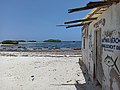
Watamu Beach

Sun rises over the Indian Ocean at Malindi


Villages and settlements[]
See also[]
References[]
- ^ Government, Kilifi County. "Position and Size". Kilifi County Government. Retrieved 29 May 2020.
- ^ "2019 Kenya Population and House Census: Distribution of by Administrative Units. Volume 2" (PDF). Africa Check. 2019. Retrieved 29 May 2020.
- ^ Government, Kilifi County. "Welcome to Kilifi". Kilifi County Government. Retrieved 18 May 2020.
- ^ Kilifi County Archived 20 January 2013 at the Wayback Machine
- ^ MRM (4 May 2020). "MABATI ROLLING MILLS (MRM) DONATES FOOD STUFFS TO FAMILIES IN KILIFI COUNTY". MABATI ROLLING MILLS LIMITED. Retrieved 29 May 2020.
- ^ Government, Kilifi County. "AGRICULTURE, LIVESTOCK & FISHERIES". Kilifi County Government. Retrieved 29 May 2020.
- ^ Munene, Evans (4 November 2019). "2019 Kenya Population and Housing Census Results". Kenya National Bureau of Statistics. Retrieved 29 May 2020.
- ^ 2019 Kenya Population and House Census: Volume 1 - Population by County and Sub-county. Kenya National Bureau of Statistics. 2019. pp. 17, 19, 20, 22, 31, 40. ISBN 9789966102096.
- ^ KENYA: Administrative Division population statistics
- ^ "2019 Kenya Population and Housing Census Volume IV: Distribution of Population by Socio-Economic Characteristics" (PDF). Kenya National Bureau of Statistics. Retrieved 2 May 2021.
- ^ "The Report of the Interim Independent Boundaries Review Commission (IIBRC): Delimitation of Constituencies and Recommendations on Local Authority Electoral Units and Administrative Boundaries for Districts and Other Units" (PDF). IEBC. 2010. Retrieved 29 May 2020.
- ^ Kilifi County
- ^ "Governors & Deputy Governors". cog.go.ke. Retrieved 29 May 2020.
- ^ "Amason Kingi". Mzalendo. Retrieved 29 May 2020.
- ^ "Members of the Senate | The Kenyan Parliament Website". www.parliament.go.ke. Retrieved 29 May 2020.
- ^ "Stewart Mwachiru Shadrack Madzayo". Mzalendo. Retrieved 29 May 2020.
- ^ "Gertrude Mbeyu Mwanyanje". Mzalendo. Retrieved 29 May 2020.
- ^ "Women Representatives | KEWOPA KENYA". Retrieved 29 May 2020.
- ^ "179. County executive committees - Kenya Law Reform Commission (KLRC)". www.klrc.go.ke. Retrieved 29 May 2020.
- ^ "Ministry of Education". www.education.go.ke. Retrieved 29 May 2020.
- ^ "Publications". Kenya National Bureau of Statistics. Retrieved 29 May 2020.
- ^ Jump up to: a b "Kilifi County Statistical Abstract 2015". Kenya National Bureau of Statistics. Retrieved 29 May 2020.
- ^ Government, Kilifi County. "Health Services Kilifi County". Kilifi County Government. Retrieved 29 May 2020.
- ^ County Statistical Abstract Kilifi County 2015. Kenya National Bureau of Statistics. 2015. p. 38.
External links[]

- Kilifi County
- Counties of Kenya