Lamu County
Lamu County | |
|---|---|
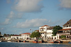 Lamu, Lamu Island | |
 Location in Kenya | |
| Country | |
| Formed | 4 March 2013 |
| Capital | Lamu |
| Government | |
| • Governor | |
| • Commissioner | Irungu Macharia [1] |
| Area | |
| • Total | 6,273.1 km2 (2,422.1 sq mi) |
| • Land | 6,273.1 km2 (2,422.1 sq mi) |
| Elevation | 110 m (360 ft) |
| Population (2019) | |
| • Total | 143,920 |
| • Density | 23/km2 (59/sq mi) |
| Time zone | UTC+3 (EAT) |
| Website | lamu.go.ke |
Lamu County is located in the Northern Coast of Kenya and is one of the Six Coastal Counties in Kenya. It borders Tana River County in the southwest, Garissa County to the north, Republic of Somalia to the northeast and the Indian Ocean to the South. It lies 1° 40’ and 2° 30’ south and longitude 40° 15’ and 40° 38’ east. The county has a land surface of 6,273.1 km that include the mainland and over 65 islands that form the Lamu Archipelago. The total length of the coastline is 130 km while land water mass area stands at 308 km.[2]
The county has 2 constituencies namely Lamu West and Lamu East. These two also consist of the two districts referred to as the sub-counties in Lamu County. Lamu West has Amu Mkomani, Shela, Hindi, Mkunumbi, Hongwe, Bahari and Witu Divisions while Lamu East has Faza, Basuba and Kiunga divisions. There are 10 wards, 23 locations, and 38 sub-locations in the county.
The main economic activities in the county include crop production, livestock production, fisheries, tourism and mining, most notably quarrying. Among the challenges facing Lamu is population growth owing to migration into Lamu from other parts of the country, fuelled partly by the anticipated opportunities accruing from the Lamu Port South Sudan-Ethiopia Transport (LAPSSET) Corridor. Other challenges include landlessness and poor land management, insufficient social services such as healthcare and education, inadequate supply of piped and fresh water, under-developed infrastructure, and food insecurity.
There are extensive mangrove forests in the area.
| Constituency | County wards | Land Area (km2) |
|---|---|---|
| LAMU WEST | Shella | 54.7 |
| Mkomani | 172.5 | |
| Hindi | 1150.8 | |
| Mkunumbi | 1366.1 | |
| Hongwe | 128.5 | |
| Bahari | 123.3 | |
| Witu | 975.4 | |
| LAMU EAST | Faza | 79.2 |
| Basuba | 1708.7 | |
| Kiunga | 513.9 | |
| TOTAL | 6273.1 | |
| Source: Lamu County CIDP 2013-2017[3] | ||
| Administrative divisions | |||
| Division | Population* | Urban pop.* | Headquarters |
|---|---|---|---|
| Amu | 17,310 | 12,839 | Lamu |
| Faza | 7,474 | 0 | Faza |
| Hindi | 7,072 | 1,335 | |
| Kiunga | 3,310 | 0 | Kiunga |
| Kizingitini | 6,010 | 0 | Kizingitini |
| Mpeketoni | 25,530 | 773 | Mpeketoni |
| Witu | 5,980 | 1,322 | Witu |
| Total | 72,686 | 16,269 | - |
| * 1999 census. Sources[4][5] | |||
Demographics[]
The county is made of cosmopolitan population composed of indigenous communities made of Swahilis, Arabs, , Boni and Ormas and migrant communities from the rest of the country. The county has a total population of 143,920 of which76,103 are males 67,813 females and 4 intersex persons. There are 37,963 household with an average household size of 3.7 persons per household and a population density 23 people per square kilometre.[6]
The LAPSSET project is expected to attract a huge migrant population estimated to be over one million. This will certainly overstretch the county's social services necessitating commensurate development planning for adequate service provision.[7]
| Year | Pop. | ±% |
|---|---|---|
| 1979 | 42,299 | — |
| 1989 | 56,783 | +34.2% |
| 1999 | 72,686 | +28.0% |
| 2009 | 101,539 | +39.7% |
| 2019 | 143,920 | +41.7% |
| source:[8] | ||
Religion[]
Administrative and political units[]
Administrative units[]
There are two sub counties, seven divisions, twenty three locations and thirty nine nine sub-locations.[10]
Political units[]
There are two constituencies and ten county assembly wards.
Constituencies[]
- MP - Hon. Muthama, Stanley Muiruri[11] Lamu West Constituency[12]
- MP - Hon. Ali, Sharif Athman[13] Lamu East Constituency[14]
Source [15]
Political leadership[]
Fahim Yasin Twaha is the second governor and is deputised by Abdulhakim Aboud Bwana Governor.[16][17] First elected governor for the county was Issa Timamy. Anuar Loitiptip is also the second elected senator after Abu Chiaba.[18][19] is the women representative and was elected in 2017, before her was Shakila Abdalla who was elected in 2013.[20][21]
For Lamu County, the County Executive Committee comprises:-
| Number | |
|---|---|
| The Governor | 1 |
| The Deputy Governor | 1 |
| The County Secretary | 1 |
| The CEC Members | 10 |
| Total | 13 |
Source[22]
Education[]
There are 203 ECD centres 139 primary schools and 25 secondary schools. The county has also 58 adult training institutions, 6 vocational training centres, 3 university campus,[23]
Health[]
There are a total of 45 health facilities in the county with one county referral hospital. County has 316 health personnel of different cadre.[24]
HIV prevalence is at 3.5% below the national 5.9%.[25]
Transport and communication[]
The county is covered by 923.07 km of road network. Of this, 718.66 km is covered by earth surface, 198.41 km is murram surface and 6 km is covered by bitumen.[when?][26][27]
There are five Post Offices with 1,250 installed letter boxes, 653 rented letter boxes and 597 vacant letter boxes.[28][29]
Trade and commerce[]
There are 9 trading centres, 606 registered businesses, 465 licensed retail traders, 7 supermarkets, 27 licensed wholesale traders and 98 registered hotels.[28]
Villages and settlements[]
See also[]
References[]
- ^ Paraxides, Ceti (8 July 2017). "Nine dead after al Shabaab massacre in Lamu's Jima, Poromoko villages". The Star. Archived from the original on 10 July 2017.
Lamu County Commissioner Joseph Kanyiri also confirmed that there had been an attack but said he didn’t have clear information on the number of casualties.
- ^ Lamu County Integrated Development Plan CIDP 2018-2022. Lamu County Government. 2018. p. 1.
- ^ "Lamu County CIDP 2013-2017" (PDF). The Council of Governors. Lamu County Government. Retrieved 10 April 2016.
- ^ [1] Archived 16 June 2007 at the Wayback Machine
- ^ "Urban Poverty All Kenya Provinces". Archived from the original on 18 July 2011. Retrieved 26 May 2014.
- ^ 2019 Kenya Population and House Census: Volume 1- Population by County and Sub-county. Kenya National Bureau of Statistics. 2019. pp. 17, 19, 20. ISBN 9789966102096.
- ^ "Brief on LAPSSET Corridor Project 2016" (PDF). LAPSSET Corridor Development Authority. 2016. Retrieved 29 May 2020.
- ^ KENYA: Administrative Division population statistics
- ^ "2019 Kenya Population and Housing Census Volume IV: Distribution of Population by Socio-Economic Characteristics" (PDF). Kenya National Bureau of Statistics. Retrieved 2 May 2021.
- ^ "Ministry of Interior and Coordination of National Government". Ministry of Interior and Coordination of National Government. Retrieved 30 May 2020.
- ^ "Hon. Muthama, Stanley Muiruri | The Kenyan Parliament Website". www.parliament.go.ke. Retrieved 30 May 2020.
- ^ "Stanley Muiruri Muthama". Mzalendo. Retrieved 30 May 2020.
- ^ "Hon. Ali, Sharif Athman | The Kenyan Parliament Website". www.parliament.go.ke. Retrieved 30 May 2020.
- ^ "Shariff Athman Ali". Mzalendo. Retrieved 30 May 2020.
- ^ "The Report of the Interim Independent Boundaries Review Commission (IIBRC): Delimitation of Constituencies and Recommendations on Local Authority Electoral Units and Administrative Boundaries for Districts and Other Units" (PDF). IEBC. 2010. Retrieved 29 May 2020.
- ^ "Governors & Deputy Governors". cog.go.ke. Retrieved 29 May 2020.
- ^ "Yasin Fahim Twaha". Mzalendo. Retrieved 29 May 2020.
- ^ "Members of the Senate | The Kenyan Parliament Website". www.parliament.go.ke. Retrieved 29 May 2020.
- ^ "Anwar Loitiptip". Mzalendo. Retrieved 29 May 2020.
- ^ "Women Representatives | KEWOPA KENYA". Retrieved 29 May 2020.
- ^ "Ruweida Mohamed Obo". Mzalendo. Retrieved 29 May 2020.
- ^ "179. County executive committees - Kenya Law Reform Commission (KLRC)". www.klrc.go.ke. Retrieved 29 May 2020.
- ^ Lamu County Integrated Development Plan CIDP 2018-2022. Lamu County Governmnet. 2018. pp. 37–42.
- ^ "CoG Reports". www.cog.go.ke. Retrieved 29 May 2020.
- ^ "Kenya HIV Estimates Report 2018" (PDF). National AIDS Control Council. 2018. Retrieved 30 May 2020.
- ^ County Statistical Abstract Lamu County 2015. Kenya National Bureau of Statistics. 2015. p. 33.
- ^ "Kenya Rural Roads Authority". Kenya Rural Roads Authority. Retrieved 30 May 2020.
- ^ Jump up to: a b "Publications". Kenya National Bureau of Statistics. Retrieved 29 May 2020.
- ^ "Home". kura.go.ke. Retrieved 30 May 2020.
www.lamu.go.ke
External links[]
- Office for the Coordination of Humanitarian Affairs – Kenya AdminLevels 1-4
- http://www.mambolook.com/lamu
Coordinates: 2°18′0″S 40°42′0″E / 2.30000°S 40.70000°E

| Authority control |
|---|
- Lamu County
- Counties of Kenya