Killaly, Saskatchewan
Killaly | |
|---|---|
Village | |
| Village of Killaly | |
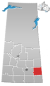
 Location of Killaly in Saskatchewan | |
| Coordinates: 50°45′11″N 102°49′48″W / 50.753°N 102.830°W | |
| Country | |
| Province | |
| Region | Southeast |
| Census division | 5 |
| Rural Municipality | McLeod No. 185 |
| Government | |
| • Type | Municipal |
| • Governing body | Killaly Village Council Lisa Ross,Susana Jacques |
| • Mayor | Robert Blake |
| • Administrator | Crystal Campbell |
| • MP | Robert Kitchen |
| • MLA | Dan D'Autremont |
| Area | |
| • Total | 2.59 km2 (1.00 sq mi) |
| Population (2006) | |
| • Total | 77 |
| • Density | 29.7/km2 (77/sq mi) |
| Time zone | UTC-6 (CST) |
| Postal code | S0A 1X0 |
| Area code(s) | 306 |
| Highways | |
| Railways | (Pulled) |
Killaly (2016 population: 65) is a village in the Canadian province of Saskatchewan within the Rural Municipality of McLeod No. 185 and Census Division No. 5. The village is located 23 km south of the City of Melville on Highway 47 at the intersection of Highway 22 and 47, and only 17 minutes north of Crooked Lake.
History[]
Killaly incorporated as a village on April 28, 1909.[1]
Demographics[]
In the 2016 Census of Population conducted by Statistics Canada, the Village of Killaly recorded a population of 65 living in 28 of its 48 total private dwellings, a -13.8% change from its 2011 population of 74. With a land area of 2.59 km2 (1.00 sq mi), it had a population density of 25.1/km2 (65.0/sq mi) in 2016.[4]
In the 2011 Census of Population, the Village of Killaly recorded a population of 74, a -3.9% change from its 2006 population of 77. With a land area of 2.59 km2 (1.00 sq mi), it had a population density of 28.6/km2 (74.0/sq mi) in 2011.[5]
See also[]
- List of communities in Saskatchewan
- Villages of Saskatchewan
References[]
- ^ "Urban Municipality Incorporations". Saskatchewan Ministry of Government Relations. Archived from the original on October 15, 2014. Retrieved June 1, 2020.
- ^ "Saskatchewan Census Population" (PDF). Saskatchewan Bureau of Statistics. Archived from the original (PDF) on September 24, 2015. Retrieved May 31, 2020.
- ^ "Saskatchewan Census Population". Saskatchewan Bureau of Statistics. Retrieved May 31, 2020.
- ^ "Population and dwelling counts, for Canada, provinces and territories, and census subdivisions (municipalities), 2016 and 2011 censuses – 100% data (Saskatchewan)". Statistics Canada. February 8, 2017. Retrieved May 30, 2020.
- ^ "Population and dwelling counts, for Canada, provinces and territories, and census subdivisions (municipalities), 2011 and 2006 censuses (Saskatchewan)". Statistics Canada. June 3, 2019. Retrieved May 30, 2020.
Coordinates: 50°45′11″N 102°49′48″W / 50.753°N 102.830°W
- Villages in Saskatchewan
- McLeod No. 185, Saskatchewan
- Division No. 5, Saskatchewan
- Saskatchewan Division No. 5 geography stubs


