Kimchaek
This article needs additional citations for verification. (May 2013) |
Kimchaek
김책시 | |
|---|---|
| Korean transcription(s) | |
| • Chosŏn'gŭl | 김책시 |
| • Hancha | 金策市 |
| • McCune-Reischauer | Kimch'aek si |
| • Revised Romanization | Gimchaek-si |
 Map of North Hamgyong showing the location of Kimchaek | |
 | |
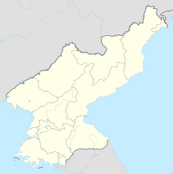 Kimchaek Location within North Korea | |
| Coordinates: 40°40′2″N 129°12′2″E / 40.66722°N 129.20056°ECoordinates: 40°40′2″N 129°12′2″E / 40.66722°N 129.20056°E | |
| Country | North Korea |
| Province | North Hamgyong |
| Administrative divisions | 22 tong, 22 ri |
| Population (2008) | |
| • Total | 207,699 |
| • Dialect | Hamgyŏng |
| Time zone | UTC+9 (Pyongyang Time) |

Kimch'aek (Korean pronunciation: [kim.tsʰɛk̚]), formerly Sŏngjin (Chosŏn'gŭl: 성진, Hancha: 城津), is a city in North Hamgyong Province, North Korea. It was an open port in 1899.[1] It has a population of 207,699.
Etymology[]
The city received its current name in 1951 during the Korean War, in honor of the Korean People's Army (KPA) general, Kim Chaek.[1] It was known as "Shirotsu" during Japanese rule between 1910 and 1945.
Climate[]
Kimchaek has a hot-summer humid continental climate (Köppen climate classification: Dfb).[2]
| hideClimate data for Kimchaek (1981–2010, extremes 1906–present) | |||||||||||||
|---|---|---|---|---|---|---|---|---|---|---|---|---|---|
| Month | Jan | Feb | Mar | Apr | May | Jun | Jul | Aug | Sep | Oct | Nov | Dec | Year |
| Record high °C (°F) | 14.0 (57.2) |
16.7 (62.1) |
27.8 (82.0) |
35.2 (95.4) |
34.0 (93.2) |
34.3 (93.7) |
37.0 (98.6) |
36.6 (97.9) |
32.9 (91.2) |
30.2 (86.4) |
23.7 (74.7) |
17.8 (64.0) |
37.0 (98.6) |
| Average high °C (°F) | 1.1 (34.0) |
2.1 (35.8) |
6.6 (43.9) |
13.3 (55.9) |
17.2 (63.0) |
20.1 (68.2) |
23.6 (74.5) |
25.7 (78.3) |
22.6 (72.7) |
17.5 (63.5) |
9.9 (49.8) |
3.7 (38.7) |
13.6 (56.5) |
| Daily mean °C (°F) | −3.8 (25.2) |
−2.1 (28.2) |
2.2 (36.0) |
7.9 (46.2) |
12.3 (54.1) |
16.3 (61.3) |
20.4 (68.7) |
22.2 (72.0) |
18.3 (64.9) |
12.3 (54.1) |
5.0 (41.0) |
−1.2 (29.8) |
9.2 (48.6) |
| Average low °C (°F) | −8.4 (16.9) |
−6.5 (20.3) |
−1.8 (28.8) |
3.6 (38.5) |
8.6 (47.5) |
13.7 (56.7) |
18.2 (64.8) |
19.4 (66.9) |
14.4 (57.9) |
7.4 (45.3) |
0.4 (32.7) |
−5.3 (22.5) |
5.3 (41.5) |
| Record low °C (°F) | −26.0 (−14.8) |
−20.0 (−4.0) |
−15.0 (5.0) |
−7.1 (19.2) |
−0.5 (31.1) |
1.0 (33.8) |
9.0 (48.2) |
10.6 (51.1) |
2.8 (37.0) |
−4.0 (24.8) |
−16.6 (2.1) |
−25.1 (−13.2) |
−26.0 (−14.8) |
| Average precipitation mm (inches) | 18.9 (0.74) |
16.6 (0.65) |
16.9 (0.67) |
42.3 (1.67) |
48.8 (1.92) |
75.5 (2.97) |
129.6 (5.10) |
114.0 (4.49) |
77.8 (3.06) |
38.8 (1.53) |
36.2 (1.43) |
25.4 (1.00) |
640.8 (25.23) |
| Average precipitation days (≥ 0.1 mm) | 5.5 | 3.9 | 4.3 | 5.3 | 6.9 | 8.9 | 11.0 | 8.6 | 6.2 | 4.5 | 5.2 | 5.7 | 76.0 |
| Average snowy days | 7.9 | 6.5 | 4.6 | 0.5 | 0.0 | 0.0 | 0.0 | 0.0 | 0.0 | 0.2 | 2.3 | 6.4 | 28.4 |
| Average relative humidity (%) | 66.5 | 69.8 | 71.3 | 71.8 | 79.0 | 86.2 | 88.8 | 85.8 | 79.1 | 71.9 | 66.7 | 65.7 | 75.2 |
| Mean monthly sunshine hours | 173 | 197 | 231 | 225 | 222 | 141 | 141 | 173 | 207 | 218 | 172 | 161 | 2,261 |
| Source 1: Korea Meteorological Administration[3] | |||||||||||||
| Source 2: Deutscher Wetterdienst (sun, 1961–1990),[4][5][a] Meteo Climat (extremes)[6] | |||||||||||||
Administrative divisions[]
Kimch'aek-si is divided into 22 tong (neighbourhoods) and 22 ri (villages):
|
|
Economy[]
Kimchaek is an important port on the Sea of Japan (East Sea of Korea), and is home to an ironworks and the .[1]
Transport[]
Kimchaek is on the Pyongra Line railway.
The city has one trolleybus line, with a length of 9.1 km, running from Songnam-dong to Haksong-dong with the depot located in Sinpyong-dong.[7][8]
See also[]
- List of cities in North Korea
- List of Korea-related topics
- Geography of North Korea
Notes[]
- ^ Station ID for Kimchaek is 47025 Use this station ID to locate the sunshine duration
References[]
- ^ Jump up to: a b c "Kimch'aek". Encyclopaeida Britannica’. Retrieved 8 December 2012.
- ^ "Kimchaek climate: Average Temperature, weather by month, Kimchaek weather averages". Climate-Data.org. Retrieved 6 November 2019.
- ^ "30 years report of Meteorological Observations in North Korea" (in Korean). Korea Meteorological Administration. pp. 232–281. Archived from the original on 21 December 2020. Retrieved 23 December 2020.
- ^ "Klimatafel von Kimchaek / Korea (Nordkorea)" (PDF). Baseline climate means (1961-1990) from stations all over the world (in German). Deutscher Wetterdienst. Retrieved 6 November 2016.
- ^ "Station 47025 Kimchaek". Global station data 1961–1990—Sunshine Duration. Deutscher Wetterdienst. Archived from the original on 17 October 2017. Retrieved 6 November 2016.
- ^ "Station Songjin (Kimchaek)" (in French). Meteo Climat. Retrieved 6 November 2016.
- ^ "북한지역정보넷". www.cybernk.net. Retrieved 2021-01-28.
- ^ "Photo: Kimchaek — Maps". transphoto.org. Retrieved 2020-10-16.
Further reading[]
- Dormels, Rainer. North Korea's Cities: Industrial facilities, internal structures and typification. Jimoondang, 2014. ISBN 978-89-6297-167-5
| Wikimedia Commons has media related to Kimchaek. |
External links[]

| Rank | Name | Administrative division | Pop. | Rank | Name | Administrative division | Pop. | ||
|---|---|---|---|---|---|---|---|---|---|
 Pyongyang 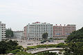 Hamhung |
1 | Pyongyang | Pyongyang Capital City | 3,255,288 | 11 | Sunchon | South Pyongan | 297,317 |  Chongjin  Nampo |
| 2 | Hamhung | South Hamgyong | 768,551 | 12 | Pyongsong | South Pyongan | 284,386 | ||
| 3 | Chongjin | North Hamgyong | 667,929 | 13 | Haeju | South Hwanghae | 273,300 | ||
| 4 | Nampo | South Pyongan Province | 366,815 | 14 | Kanggye | Chagang | 251,971 | ||
| 5 | Wonsan | Kangwon | 363,127 | 15 | Anju | South Pyongan | 240,117 | ||
| 6 | Sinuiju | North Pyongan | 359,341 | 16 | Tokchon | South Pyongan | 237,133 | ||
| 7 | Tanchon | South Hamgyong | 345,875 | 17 | Kimchaek | North Hamgyong | 207,299 | ||
| 8 | Kaechon | South Pyongan | 319,554 | 18 | Rason | Rason Special Economic Zone | 196,954 | ||
| 9 | Kaesong | North Hwanghae | 308,440 | 19 | Kusong | North Pyongan | 196,515 | ||
| 10 | Sariwon | North Hwanghae | 307,764 | 20 | Hyesan | Ryanggang | 192,680 | ||
| show Authority control |
|---|
This North Korea location article is a stub. You can help Wikipedia by . |
- Cities in North Hamgyong
- Port cities and towns in North Korea
- North Korea geography stubs