Kinsley, Kansas
Kinsley, Kansas | |
|---|---|
City and County seat | |
 Water tower (2008) | |
 | |
 | |
| Coordinates: 37°55′20″N 99°24′42″W / 37.92222°N 99.41167°WCoordinates: 37°55′20″N 99°24′42″W / 37.92222°N 99.41167°W | |
| Country | United States |
| State | Kansas |
| County | Edwards |
| Founded | 1870s |
| Platted | 1873 |
| Incorporated | 1878 |
| Named for | E.W. Kinsley |
| Area | |
| • Total | 1.30 sq mi (3.36 km2) |
| • Land | 1.30 sq mi (3.36 km2) |
| • Water | 0.00 sq mi (0.00 km2) |
| Elevation | 2,172 ft (662 m) |
| Population | |
| • Total | 1,457 |
| • Estimate (2019)[3] | 1,353 |
| • Density | 1,043.98/sq mi (403.20/km2) |
| Time zone | UTC-6 (CST) |
| • Summer (DST) | UTC-5 (CDT) |
| ZIP code | 67547 |
| Area code | 620 |
| FIPS code | 20-37075 [4] |
| GNIS ID | 0473545 [5] |
| Website | kinsleyks.com |

Kinsley is a city in and the county seat of Edwards County, Kansas, United States.[6] As of the 2010 census, the city population was 1,457.[7]
History[]
Kinsley was originally called Petersburg, and under the latter name laid out in 1873. It was later renamed Peter's City, and finally the name Kinsley was adopted honoring E.W. Kinsley, a capitalist from Boston.[8][9]
The first post office in Kinsley was established under the name Peters in April 1873. The post office was renamed Kinsley in January, 1874.[10]
Geography[]
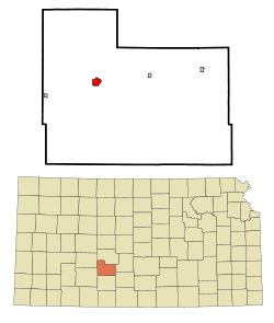
Kinsley is located at 37°55′20″N 99°24′42″W / 37.92222°N 99.41167°W (37.922354, -99.411531).[11] According to the United States Census Bureau, the city has a total area of 1.29 square miles (3.34 km2), all of it land.[12]
Kinsley is approximately 35 miles (56 km) east of Dodge City.
Climate[]
The climate in this area is characterized by hot, humid summers and generally mild to cool winters. According to the Köppen Climate Classification system, Kinsley has a humid subtropical climate, abbreviated "Cfa" on climate maps.[13]
Area attractions[]
- Edwards County Historical Sod House and Museum
https://www.edwardscountymuseum.com/
- Carnival Heritage Center & Museum, 200 E 6th.[14][15]
- Half Way Sign. The sign says the distances to San Francisco and New York City are identical at 1,561 miles (2,512 km).[16]
Demographics[]
| Historical population | |||
|---|---|---|---|
| Census | Pop. | %± | |
| 1880 | 457 | — | |
| 1890 | 771 | 68.7% | |
| 1900 | 780 | 1.2% | |
| 1910 | 1,547 | 98.3% | |
| 1920 | 1,986 | 28.4% | |
| 1930 | 2,270 | 14.3% | |
| 1940 | 2,178 | −4.1% | |
| 1950 | 2,479 | 13.8% | |
| 1960 | 2,263 | −8.7% | |
| 1970 | 2,212 | −2.3% | |
| 1980 | 2,074 | −6.2% | |
| 1990 | 1,875 | −9.6% | |
| 2000 | 1,658 | −11.6% | |
| 2010 | 1,457 | −12.1% | |
| 2019 (est.) | 1,353 | [3] | −7.1% |
| U.S. Decennial Census | |||
2010 census[]
As of the census[2] of 2010, there were 1,457 people, 654 households, and 384 families residing in the city. The population density was 1,129.5 inhabitants per square mile (436.1/km2). There were 813 housing units at an average density of 630.2 per square mile (243.3/km2). The racial makeup of the city was 93.1% White, 0.8% African American, 0.3% Native American, 0.8% Asian, 3.4% from other races, and 1.6% from two or more races. Hispanic or Latino of any race were 14.7% of the population.
There were 654 households, of which 26.6% had children under the age of 18 living with them, 46.5% were married couples living together, 8.1% had a female householder with no husband present, 4.1% had a male householder with no wife present, and 41.3% were non-families. 37.9% of all households were made up of individuals, and 17.7% had someone living alone who was 65 years of age or older. The average household size was 2.17 and the average family size was 2.86.
The median age in the city was 44.5 years. 23.5% of residents were under the age of 18; 5.5% were between the ages of 18 and 24; 21.7% were from 25 to 44; 28.7% were from 45 to 64; and 20.5% were 65 years of age or older. The gender makeup of the city was 48.2% male and 51.8% female.
2000 census[]
As of the census[4] of 2000, there were 1,658 people, 757 households, and 433 families residing in the city. The population density was 1,278.5 people per square mile (492.4/km2). There were 894 housing units at an average density of 689.4 per square mile (265.5/km2). The racial makeup of the city was 94.63% White, 0.48% African American, 0.54% Native American, 0.42% Asian, 3.32% from other races, and 0.60% from two or more races. Hispanic or Latino of any race were 7.48% of the population.
There were 757 households, out of which 24.8% had children under the age of 18 living with them, 46.8% were married couples living together, 7.3% had a female householder with no husband present, and 42.8% were non-families. 39.5% of all households were made up of individuals, and 22.7% had someone living alone who was 65 years of age or older. The average household size was 2.11 and the average family size was 2.84.
In the city, the population was spread out, with 22.1% under the age of 18, 6.9% from 18 to 24, 23.4% from 25 to 44, 21.2% from 45 to 64, and 26.4% who were 65 years of age or older. The median age was 43 years. For every 100 females, there were 92.6 males. For every 100 females age 18 and over, there were 91.7 males.
The median income for a household in the city was $27,791, and the median income for a family was $37,961. Males had a median income of $28,063 versus $19,079 for females. The per capita income for the city was $17,219. About 6.6% of families and 9.6% of the population were below the poverty line, including 7.0% of those under age 18 and 9.6% of those age 65 or over.
Transportation[]
U.S. Route 50 passes through Kinsley.
Notable people[]
- Madge Blake, (1899–1969), actress (Batman)
- Kyle Burkhart, former NFL/CFL offensive lineman
- Freedy Johnston, singer/songwriter
- Peter Mehringer, men's freestyle wrestling gold medal at 1932 Summer Olympics.
- Earl Winfield Spencer Jr., first commanding officer of Naval Air Station, San Diego, California, and first husband of Wallis, Duchess of Windsor
See also[]
References[]
- ^ "2019 U.S. Gazetteer Files". United States Census Bureau. Retrieved July 24, 2020.
- ^ Jump up to: a b "U.S. Census website". United States Census Bureau. Retrieved 2012-07-06.
- ^ Jump up to: a b "Population and Housing Unit Estimates". United States Census Bureau. May 24, 2020. Retrieved May 27, 2020.
- ^ Jump up to: a b "U.S. Census website". United States Census Bureau. Retrieved 2008-01-31.
- ^ "US Board on Geographic Names". United States Geological Survey. 2007-10-25. Retrieved 2008-01-31.
- ^ "Find a County". National Association of Counties. Archived from the original on 2011-05-31. Retrieved 2011-06-07.
- ^ "2010 City Population and Housing Occupancy Status". U.S. Census Bureau. Retrieved March 27, 2011.[dead link]
- ^ Kansas State Historical Society (1916). Biennial Report of the Board of Directors of the Kansas State Historical Society. Kansas State Printing Plant. pp. 183.
- ^ "Profile for Kinsley, Kansas". ePodunk. Archived from the original on 19 June 2017. Retrieved 9 June 2014.
- ^ "Kansas Post Offices, 1828-1961 (archived)". Kansas Historical Society. Archived from the original on 9 October 2013. Retrieved 8 June 2014.
- ^ "US Gazetteer files: 2010, 2000, and 1990". United States Census Bureau. 2011-02-12. Retrieved 2011-04-23.
- ^ "US Gazetteer files 2010". United States Census Bureau. Archived from the original on 2012-07-02. Retrieved 2012-07-06.
- ^ Climate Summary for Kinsley, Kansas
- ^ Carnival Museum 1
- ^ Carnival Museum 2[permanent dead link]
- ^ Brackman, Barbara (1997). Kansas Trivia. Thomas Nelson Inc. p. 12. ISBN 9781418553814.
Further reading[]
External links[]
| Wikimedia Commons has media related to Kinsley, Kansas. |
- City of Kinsley
- Kinsley - Directory of Public Officials
- USD 347, local school district
- Santa Fe Trail Research Site
- Kinsley City Map, EdwardsCounty.org
- Kinsley City Map, KDOT
| hide Municipalities and communities of Edwards County, Kansas, United States | ||
|---|---|---|
| Cities |  | |
| Unincorporated communities | ||
| Townships | ||
| ||
| show Authority control |
|---|
- Cities in Kansas
- County seats in Kansas
- Cities in Edwards County, Kansas
- 1873 establishments in Kansas
- Populated places established in 1873