Klerksdorp
This article needs additional citations for verification. (February 2015) |
Klerksdorp | |
|---|---|
 Dutch Reformed Church, Klerksdorp | |
 Klerksdorp | |
| Coordinates: 26°52′S 26°40′E / 26.867°S 26.667°ECoordinates: 26°52′S 26°40′E / 26.867°S 26.667°E | |
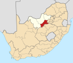
| Country | South Africa |
| Province | North West |
| District | Dr Kenneth Kaunda |
| Municipality | City of Matlosana |
| Area | |
| • Total | 105.98 km2 (40.92 sq mi) |
| Population (2011)[1] | |
| • Total | 186,515 |
| • Density | 1,800/km2 (4,600/sq mi) |
| Racial makeup (2011) | |
| • Black African | 74.0% |
| • Coloured | 6.4% |
| • Indian/Asian | 1.3% |
| • White | 18.0% |
| • Other | 0.3% |
| First languages (2011) | |
| • Tswana | 42.7% |
| • Afrikaans | 23.8% |
| • Xhosa | 11.7% |
| • Sotho | 10.7% |
| • Other | 11.2% |
| Time zone | UTC+2 (SAST) |
| Postal code (street) | 2571 |
| PO box | 2570 |
| Area code | 018 |
| Website | http://www.klerksdorp.co.za/ |


Klerksdorp (/klɑːrksdɔːrp/) is located in the North West Province, South Africa. Klerksdorp used to be the largest city in the North West Province located south-easterly to Mahikeng.[2] Klerksdorp was also the first capital of the then Transvaal Republic and used to be the home of the first Stock Exchange in the region. It became an important trading town linking Kimberley to Johannesburg. It became home to a mix of farmers, miners and immigrants servicing the two industries.
History[]
Beginnings (1837/38 and on)[]
The city was founded in 1837 or 1838[3] when the Voortrekkers settled on the banks of the Schoonspruit [3] ("Clear stream"), which flows through the town. Klerksdorp is the oldest European settlement north of the Vaal River, and thus of the former Zuid-Afrikaansche Republiek (Z.A.R), also known as the Transvaal Republic.
The most prominent of the first settlers was Hendrik Grobler[4] who claimed a farm of about 160 km2, called it Elandsheuwel ("Hill of the Eland"). He gave plots of land and communal grazing rights on this farm to other Voortrekkers in return for their labour in building a dam and an irrigation canal. This collection of smallholdings was later given the name of Klerksdorp in honour of the first landdrost (magistrate) of the area, Jacob de Clercq.
Gold rush of 1885[]
In November 1885[4] gold was discovered in the Klerksdorp district by M. G. Jansen van Vuuren[5] as well as on the Witwatersrand, which lies about 160 km to the east. As a consequence, thousands of fortune-seekers descended on the small village, turning it into a town with 70 taverns and even a stock exchange of its own. This stock exchange opened its doors in 1888 and soon did a roaring trade, selling as much as the equivalent of R20 000 in one day.[6]

However, the nature of the gold reef demanded expensive and sophisticated equipment to mine and extract the gold, causing the majority of diggers to move away in the late 1890s and leading to a decline in the gold mining industry. This also led to an early demise for the Stock Exchange that stood empty for many years, were converted to a movie theatre in 1912 and finally being demolished 1958.[7] The amalgamation process[8] used to extract the gold from the crushed ore was relatively inefficient and largely contributed to decline.[9] By 1893 the new MacArthur-Forrest process used for gold extraction brought a short-lived revival in the Klerksdorp gold mining industry, but uncertainty created by the Jameson Raid of December 1895 as well as transport problems created by the Rinderpest[10] of 1896 soon led to a near collapse of the industry.[11]
Second Boer War (1899-1902)[]
During the Second Boer War (1899-1902), heavy fighting occurred in the area, which also housed two large concentration camps, one for Whites (centred on modern day Klerksdorp High School) and a separate one for Africans (situated in the area that is today the Ellaton and Neserhof suburbs).


The most famous of the battles around Klerksdorp, is that of the Battle of Ysterspruit ("Iron Stream"), in which the Boer general Koos de la Rey achieved a great victory. The battle is one of the most celebrated of the general's career, being the battle in which the Boer soldiers pioneered the art of firing from horseback. On April 11, 1902, Rooiwal, near Klerksdorp, saw the Battle of Rooiwal, the last major engagement of the war, where a Boer charge was beaten off by entrenched British troops.

The graves of the victims of both the concentration camps can still be visited today in the Old Cemetery Complex just outside town,[13] numbering just below a thousand.
Railroad connection[]
Klerksdorp was connected by rail to Krugersdorp on 3 August 1897 and to Kimberley in 1906.
Desmond Tutu and Boer heritage[]
Today Klerksdorp is celebrated as the birthplace of Anglican Archbishop Emeritus Desmond Mpilo Tutu on October 7, 1931. He received the Nobel Peace Prize in 1984 for his work towards "a democratic and just society without racial divisions". The life work of Desmond Tutu has been to heal the scars left among the descendants of the many battles for control of South Africa. There is an irony of his birthplace set amidst Boer monuments and old battlefields, early settlements by those same Boers, among them famous leaders like , even close to Witwatersrand where gold was discovered. He somehow managed to rise beyond pettiness and division to bring all these forces together with displaced native peoples in places such as this creating an international role model. He was later awarded multiple worldwide honors for his achievements in the reconciliation of the ethnic and cultural divisions in the history of his country.[1]
Economic revival since 1932[]
The gold mining industry was revived by large mining companies in 1932, causing the town to undergo an economic revival, which accelerated after World War II.
Geography[]
Climate[]
Klerksdorp has a semi-arid climate (BSh/BSk, according to the Köppen climate classification), with warm to hot summers and cool, dry winters. The average annual precipitation is 482 mm (19 in), with most rainfall occurring mainly during summer.
| Klerksdorp | ||||||||||||||||||||||||||||||||||||||||||||||||||||||||||||
|---|---|---|---|---|---|---|---|---|---|---|---|---|---|---|---|---|---|---|---|---|---|---|---|---|---|---|---|---|---|---|---|---|---|---|---|---|---|---|---|---|---|---|---|---|---|---|---|---|---|---|---|---|---|---|---|---|---|---|---|---|
| Climate chart (explanation) | ||||||||||||||||||||||||||||||||||||||||||||||||||||||||||||
| ||||||||||||||||||||||||||||||||||||||||||||||||||||||||||||
| ||||||||||||||||||||||||||||||||||||||||||||||||||||||||||||
Klerksdorp today[]
The greater city area surrounding Klerksdorp incorporates the towns of Orkney, Kanana, Stilfontein, Khuma, Hartbeesfontein and Tigane, giving it a population of more than 350,000 inhabitants (Census Statistics South Africa 2001). Together with Rustenburg, Klerksdorp forms the economic heart of North West Province. It is one of the hubs of the South African gold mining industry, although its importance has been decreasing in recent years. A major earthquake in March 2005 caused significant damage to the eastern suburb of Stilfontein and caused widespread damage to mining activities. It is expected to be a large uranium producer in the future.
Apart from mining, Klerksdorp is positioned as a notable medical, retail and educational centre for North West Province and Northern Free State.
The Klerksdorp district is a major contributor to South African agriculture; maize, sorghum, groundnuts and sunflower are important crops farmed in the district. Klerksdorp has the largest agricultural co-op in the southern hemisphere, named 'Senwes'.
The farming district is also known for its Sussex cattle herds - the city is the headquarters of the South African Sussex Cattle Breeders Association.
Tourist attractions[]
- Mining shafts excavated in the 1880s.
- The Klerksdorp Museum. It was built in 1891 as a prison and served as such until 1973. The house of the warden hosts period exhibitions. It exhibits the Klerksdorp spheres, spherical to subspherical objects that pseudoarcheologists consider to be man-made.
- The Faan Meintjies Nature Reserve, located about 15 km from Klerksdorp. It has 30 species of game and 150 species of birds.
- The Oudorp hiking trail. It is a 12 km long trail and winds its way through the oldest parts of the town.
- Goudkoppie (Gold Hill) is the city's latest tourist attraction. It is situated near both the N12 highway and the Johannesburg-Cape Town railway line.
- The Klerksdorp Dam, 10 km outside Klerksdorp on the road to Ventersdorp.
- Rio Casino Resort,[14]
- The newly built Matlosana Mall, the largest shopping centre in the North-West Province
- The Klerksdorp Air Show is organised and run by pilots, including South African Aerobatic Championship winner Clifford Lotter, at the PC Pelser Airport annually and remains one of the best air shows in South Africa.
Sport[]
The Harry Oppenheimer Stadium situated between Klerksdorp and Vaal River Operations is a popular sports field for some of the bigger schools' athletics competitions. The stadium was originally considered as one of the host cities for the 2010 FIFA World Cup but lost its bid to the Rustenburg Royal Bafokeng Stadium.
Health[]
Four private hospitals in the city lifts Klerksdorp's medical status in the North West Province. Adding to this is the advanced cancer treatment at some hospitals drawing in patients from all over the district.
Crime in Klerksdorp[]
The latest crime statistics for Klerksdorp Police Precinct was issued by the South African Police Service (SAPS) in September 2012. The SAPS crime report[15] showed the following information:
In comparison to other major towns and cities in South Africa, Klerksdorp is still considered one of the safer locations in the nation.
Other towns in the Klerksdorp district[]
- Hartbeesfontein
- Orkney
- Stilfontein
References[]
- ^ Jump up to: a b c d "Main Place Klerksdorp". Census 2011.
- ^ http://www.matlosana.gov.za/Documents/IDP/IDP%20REVIEW%20DOCUMENT%20%202017-2018%20DRAFT1.pdf
- ^ Jump up to: a b Chisholm, Hugh, ed. (1911). . Encyclopædia Britannica. 15 (11th ed.). Cambridge University Press. p. 846.
- ^ Jump up to: a b Marx, Roelf (1987). Marx, Roelf (ed.). Klerksdorp Groeiende Reus [Klerksdorp Growing Giant] (in Afrikaans) (1st ed.). Klerksdorp: Klerksdorp City Council. pp. 11–12.
- ^ Janse van Vuuren, M.G. (November 1885). "Letter by M.G. Janse van Vuuren to Z.A.R. Government" – via Transvaal Archives Depot R5804/85.
- ^ Guest, H. (1938). Klerksdorp's Fifty Years of Mining. Klerksdorp: Klerksdorp Record. p. 21.
- ^ Brown, A. (1983). Golden Heritage. Stilfontein: Andrew Brown. p. 93.
- ^ "Does mining use mercury?". Miningfacts.org. 2012. Retrieved 2018-03-12.
- ^ Klerksdorp, Hub of the Golden West. Klerksdorp. 1957. p. 47.
- ^ The Editors of Encyclopaedia Britannica (2017-06-27). "Rinderpest". Encyclopaedia Britannica. Retrieved 2018-03-12.
- ^ Marx, Roelf (1987). Klerksdorp Groeiende Reus. Klerksdorp: Klerksdorp City Council. p. 29.
- ^ Klerksdorp Museum Collection. "Klerksdorp Concentration Camp for Whites".
- ^ "MATLOSANA MUNICIPALITY Catalogue of Heritage Sites". Retrieved 2018-03-12.
- ^ "The 20 Biggest Casinos: 5. Tusk Rio Casino Resort - BusinessWeek". Images.businessweek.com. Retrieved 2013-11-30.
- ^ Klerksdorp 2012 Crime Statistics
External links[]
| Wikisource has the text of the 1911 Encyclopædia Britannica article Klerksdorp. |
 Klerksdorp travel guide from Wikivoyage
 Media related to Klerksdorp at Wikimedia Commons
| show Municipalities and communities of Dr Kenneth Kaunda District Municipality, North West |
|---|
| show Authority control |
|---|
- Populated places established in 1837
- Populated places in the City of Matlosana Local Municipality
- Second Boer War concentration camps
- Populated places founded by Afrikaners