Leeudoringstad
Leeudoringstad | |
|---|---|
 Leeudoringstad | |
| Coordinates: 27°14′S 26°14′E / 27.233°S 26.233°ECoordinates: 27°14′S 26°14′E / 27.233°S 26.233°E | |
| Country | South Africa |
| Province | North West |
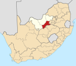
| District | Dr Kenneth Kaunda |
| Municipality | Maquassi Hills |
| Area | |
| • Total | 5.63 km2 (2.17 sq mi) |
| Population (2011)[1] | |
| • Total | 5,054 |
| • Density | 900/km2 (2,300/sq mi) |
| Racial makeup (2011) | |
| • Black African | 77.4% |
| • Coloured | 1.3% |
| • Indian/Asian | 0.8% |
| • White | 20.1% |
| • Other | 0.4% |
| First languages (2011) | |
| • Tswana | 57.0% |
| • Afrikaans | 21.8% |
| • Sotho | 10.4% |
| • Xhosa | 4.1% |
| • Other | 6.6% |
| Time zone | UTC+2 (SAST) |
| Postal code (street) | 2640 |
| PO box | 2640 |
| Area code | 018 581 |


Leeudoringstad (Afrikaans for Lion thorn city) is a small farming town situated on the main Cape Town - Johannesburg railway line in North West Province of South Africa.
Leeudoringstad was established in 1920 and named after the Lion-thorn, the African Devil's Claw (Harpagophytum procumbens). The town hit the headlines on 17 July 1932 when a train carrying 320 to 330 tons (previously incorrectly stated as 1,200 tons) of dynamite from the De Beers factory at Somerset West to the Witwatersrand exploded and flattened the town. Five people were killed.
The paper, "The Star" of July 18, 1932 carried extensive articles.
Today, Leeudoringstad hosts the headquarters of Suidwes Landbou, one of the largest agricultural companies in South Africa.[2]
References[]
- ^ Jump up to: a b c d "Main Place Leeudoringstad". Census 2011.
- ^ "Suidwes". Retrieved 26 February 2015.
| show Municipalities and communities of Dr Kenneth Kaunda District Municipality, North West |
|---|
| show Authority control |
|---|
This North West Province location article is a stub. You can help Wikipedia by . |
- Populated places in the Maquassi Hills Local Municipality
- Populated places established in 1920
- North West (South Africa) geography stubs