Venterskroon
Venterskroon | |
|---|---|
 The gravel road through Venterskroon | |
 Venterskroon | |
| Coordinates: 26°53′13″S 27°16′10″E / 26.88694°S 27.26944°ECoordinates: 26°53′13″S 27°16′10″E / 26.88694°S 27.26944°E | |
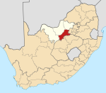
| Country | South Africa |
| Province | North West |
| District | Dr Kenneth Kaunda |
| Municipality | JB Marks |
| Time zone | UTC+2 (SAST) |


Venterskroon is a town in Tlokwe Local Municipality in the North West province of South Africa. It is an old mining town, located in a valley in the middle of the .[1]
Venterskroon is home to the Vredefort Dome Information Centre. The Vredefort Dome is the world's largest, oldest, and most deeply eroded complex meteorite impact structure in the world, and has been listed by UNESCO as World Heritage Site [2][3]
Evidence of the earliest inhabitants of the Venterskroon area has been found at the farm Thabela Thabeng and consists of petroglyphs representing hippo and rhino [4]
References[]
- ^ David Fleminger (2006). Vredefort Dome. 30° South Publishers. p. 110. ISBN 978-0-9584891-4-0. Retrieved 10 September 2013.
- ^ UNESCO https://whc.unesco.org/en/list/1162
- ^ "Venterskroon". WhereToStay. Retrieved 10 September 2013.
- ^ 'The Rock that Shocked, Country Life (2016)
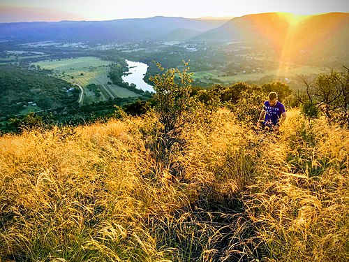
The view from the top of Aasvoelkop in the heart of the Vredefort Crater with the Vaal River and Venterskroon on its right in the background
Municipalities and communities of Dr Kenneth Kaunda District Municipality, North West | ||
|---|---|---|
District seat: Klerksdorp | ||
| JB Marks |
|  |
| City of Matlosana |
| |
| Maquassi Hills |
| |
This North West Province location article is a stub. You can help Wikipedia by . |
Categories:
- Populated places in the JB Marks Local Municipality
- North West (South Africa) geography stubs