Kondagaon district
Kondagaon district | |
|---|---|
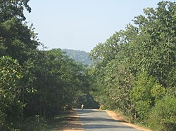 NH-43 near Keskal | |
 Location of Kondagaon district in Chhattisgarh | |
| Coordinates (Kondagaon): 19°35′N 81°39′E / 19.59°N 81.65°ECoordinates: 19°35′N 81°39′E / 19.59°N 81.65°E | |
| Country | |
| State | Chhattisgarh |
| Division | Bastar |
| Established | 24 January 2012 |
| Headquarters | Kondagaon |
| Area | |
| • Total | 7,768 km2 (2,999 sq mi) |
| Population | |
| • Total | 578,326 |
| • Density | 74/km2 (190/sq mi) |
| Time zone | UTC+05:30 (IST) |
| Website | https://kondagaon.gov.in/ |

Kondagaon district is a district of Chhattisgarh, India, and separated from Bastar district on 24 January 2012.[1] with headquarters in Kondagaon.It is mostly renowned for its bell metal craft and other art forms native to the tribal of Bastar. Also known as the Shilp sheher (lit. craft city) of Chhattisgarh owing to the variety of indigenous crafts produced in the area.
The common name for Kondagaon is Kondanar, which means 'village of horses' in Gondi. On 15 August 2011, Chief Minister Raman Singh declared Kondagaon as a separate district.
Demographics[]
According to the 2011 census, the population was 578,326. 520,841 is rural and 57,485 urban. Scheduled Castes and Scheduled Tribes made up 4.15% and 70.1% of the population respectively.[2]
Languages of Kondagaon district (2011 census)
At the time of the 2011 census, 42.44% of the population spoke Halbi, 28.06% Gondi, 22.21% Chhattisgarhi, 3.40% Hindi and 1.39% Bhatri as their first language.
Tourism[]
Covered by green forest, Kondagaon is known for its natural environment and archeology.[citation needed] In the Keshkal block of district Kondagaon, more a dozen of waterfall and few caves have been found out a couple of years ago.[when?] Some of the best known waterfalls, caves, valleys and archeological sites include:[citation needed]
Waterfalls[]
- Katulkasa Waterfall, Honhed
- Bijkudum Waterfall, Uper-murvend
- Umradah Waterfall
- Ling-Darha Waterfall
- Amadarha-1 Waterfall
- Amadarha-2 Waterfall
- Hankhi-kudum Waterfall
- Ghumur Waterfall
- Kudarwahi Waterfall
- Uperbedi Waterfall
- Mirde Waterfall
- Mutte-Khadka Waterfall
- Cherbeda Waterfall
Caves[]
- Alor cave
- Bijkudum cave
- Katthan-gundi cave
Valleys[]
- Keshkal Valley
Archeological sites[]
- Gobrahin
- Garh-dhanora
- Amrawati
Megalithic sites[]
- Umradah (Here rock paintings have been found)
- Hata Pathra(Here rock paintings have been found)
- Ling-Darha Waterfall(Here rock paintings have been found)
References[]
- ^ "Blocks of Kondagaon, Chhattisgarh". National Panchayat Directory. Ministry of Panchayati Raj. Archived from the original on 4 October 2013.
- ^ "About District | District Kondagaon - Government of Chhattisgarh | India". Retrieved 22 October 2020.
- ^ "C-16 Population By Religion - Chhattisgarh". census.gov.in. Office of the Registrar General & Census Commissioner, India.
This article related to a location in the Indian state of Chhattisgarh is a stub. You can help Wikipedia by . |
- Kondagaon district
- Districts of Chhattisgarh
- 2012 establishments in Chhattisgarh
- States and territories established in 2012
- Chhattisgarh geography stubs