Kumara, New Zealand
Kumara | |
|---|---|
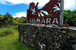 Sign beside SH 73 on the outskirts of Kumara | |
 | |
| Coordinates: 42°37′52″S 171°11′13″E / 42.63111°S 171.18694°ECoordinates: 42°37′52″S 171°11′13″E / 42.63111°S 171.18694°E | |
| Country | New Zealand |
| Region | West Coast |
| District | Westland District |
| Ward | Northern |
| Electorates | West Coast-Tasman Te Tai Tonga |
| Population (2018 Census)[1] | |
| • Total | 285 |
| Time zone | UTC+12 (NZST) |
| • Summer (DST) | UTC+13 (NZDT) |
| Postcode | 7832 |
| Area code(s) | 03 |
| Local iwi | Ngāi Tahu |


Kumara is a town on the West Coast of the South Island of New Zealand. It is located 30 kilometres (19 mi) south of Greymouth, close to the western end of State Highway 73, which leads across Arthur's Pass to Christchurch. The Taramakau River flows past to the north.[2][3]
The population was 285 in the 2018 census, a decrease of 24 (7.76%) from 2013.
The name may come from the Māori language Kohe mara, which is the blossom of the , or bush lawyer.[4]
The Coast to Coast annual multisport race starts at Kumara Beach.[5]
History[]
Kumara was founded and became one of the country's chief gold mining centres following the discovery of gold at , about 3 kilometres (2 mi) to the south-east, in 1876. The tramline from Greymouth to Paroa was extended to Kumara the following year. The population was 4,220 in October 1877. The town became a borough in 1877.[4] Kumara Hospital was operating by 1881[6] and continued into the twentieth century.[7] In 1882, the Kumara volunteer fire brigade was formed.[8]
Kumara was the home town of prominent politician Richard Seddon, who was elected mayor of the town in 1877,[9] and served as Prime Minister of New Zealand from 1893 until his death in 1906.
In 1925, the manager of Pearns Hotel in Kumara was charged by police after she refused to supply accommodation to two visiting temperance lecturers.[10] The Pearn's Brewery became part of Westland Ales around this time.[11]
Although the town once had 50 pubs, the numbers dwindled. In June 2009, the last remaining pub, the Empire Hotel, had its licence cancelled by the Liquor Licensing Authority.[12] In 2010, the last store of the town faced closure, with only a few hundred inhabitants left, but it was hoped that one of the New Zealand Cycle Trails to run through the town would lift the settlement's fortunes again.[13] In November 2012 the Theatre Royal Hotel reopened as the only pub serving Kumara, and in November 2013 the West Coast Wilderness Trail cycleway running from Greymouth to Ross was officially opened with a ceremony in Kumara.[14]
Demographics[]
The population of Kumara was 285 in the 2018 census, a decrease of 24 from 2013. There were 141 males and 141 females. 92.6% of people identified as European/Pākehā, 11.6% as Māori, 2.1% as Pacific peoples and 3.2% as Asian. 13.7% were under 15 years old, 10.5% were 15–29, 56.8% were 30–64, and 20.0% were 65 or older.[1]
| Year | Pop. | ±% p.a. |
|---|---|---|
| 2006 | 954 | — |
| 2013 | 1,167 | +2.92% |
| 2018 | 1,233 | +1.11% |
| Source: [15] | ||
The statistical area of Arahura-Kumara, which at 262 square kilometres (101 sq mi) is much larger than this town, had a population of 1,233 at the 2018 New Zealand census, an increase of 66 people (5.7%) since the 2013 census, and an increase of 279 people (29.2%) since the 2006 census. There were 522 households. There were 639 males and 591 females, giving a sex ratio of 1.08 males per female. The median age was 49.8 years (compared with 37.4 years nationally), with 183 people (14.8%) aged under 15 years, 132 (10.7%) aged 15 to 29, 705 (57.2%) aged 30 to 64, and 210 (17.0%) aged 65 or older.
Ethnicities were 89.1% European/Pākehā, 13.6% Māori, 1.0% Pacific peoples, 3.2% Asian, and 3.4% other ethnicities (totals add to more than 100% since people could identify with multiple ethnicities).
The proportion of people born overseas was 12.4%, compared with 27.1% nationally.
Although some people objected to giving their religion, 49.9% had no religion, 37.2% were Christian, 0.5% were Hindu, 0.2% were Muslim and 1.9% had other religions.
Of those at least 15 years old, 147 (14.0%) people had a bachelor or higher degree, and 249 (23.7%) people had no formal qualifications. The median income was $31,000, compared with $31,800 nationally. The employment status of those at least 15 was that 546 (52.0%) people were employed full-time, 171 (16.3%) were part-time, and 24 (2.3%) were unemployed.[15]
Notable buildings[]
Bank of New Zealand[]
The Bank of New Zealand was first established in Kumara in 1876.

St Patrick's Catholic Church[]
St Patrick's was built by the parishioners in 1877.

Education[]

Kumara School is a coeducational full primary school (years 1–8), with a roll of 37 as of November 2021.[16][17] The school celebrated 120 years of education in the district in 1997.[18]
References[]
| Wikimedia Commons has media related to Kumara, New Zealand. |
- ^ a b "Age and sex by ethnic group (grouped total response), for census usually resident population counts, 2006, 2013, and 2018 Censuses (urban rural areas)". Statistics New Zealand. Retrieved 8 February 2021.
- ^ Peter Dowling (editor) (2004). Reed New Zealand Atlas. Reed Books. map 69. ISBN 0-7900-0952-8.CS1 maint: extra text: authors list (link)
- ^ Roger Smith, GeographX (2005). The Geographic Atlas of New Zealand. Robbie Burton. map 156. ISBN 1-877333-20-4.
- ^ a b Dollimore, Edward Stewart. - "Kumara, Westland". - Encyclopedia of New Zealand (1966).
- ^ "Race profile: Speight's Coast to Coast". Coast to Coast. 2014. Archived from the original on 13 January 2015. Retrieved 13 January 2015.
- ^ "Kumara Hospital". West Coast Times. 6 August 1881. p. 2.
- ^ Rogers, Anna (2005). Illustrated History of the West Coast. Auckland: Reed Books. p. 113. ISBN 0-7900-1022-4.
- ^ Rogers, p. 115.
- ^ Rogers, pp. 71–72.
- ^ Brien, Bill. "Tales from the Past - a look at the history of HANZ". Retrieved 13 August 2008.
- ^ Rogers, p. 160.
- ^ "Residents angry after town's only pub shut down". The New Zealand Herald. 11 June 2009.
- ^ "Hope rests on cycleway". The Press. 18 March 2010. Retrieved 31 March 2010.
- ^ "West Coast welcomes cyclists". The Press. 18 November 2013. Retrieved 13 January 2015.
- ^ a b "Statistical area 1 dataset for 2018 Census". Statistics New Zealand. March 2020. Arahura-Kumara (311400). 2018 Census place summary: Arahura-Kumara
- ^ "New Zealand Schools Directory". New Zealand Ministry of Education. Retrieved 22 December 2021.
- ^ Education Counts: Kumara School
- ^ "Jubilees & reunions: Goldfields Schools" (– Scholar search). Education Gazette New Zealand. 76 (9). 26 May 1997.[dead link]
- Westland District
- Populated places in the West Coast, New Zealand