La Fajolle
show This article may be expanded with text translated from the corresponding article in French. (December 2008) Click [show] for important translation instructions. |
La Fajolle | |
|---|---|
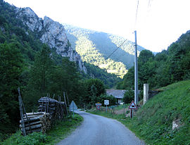 The road into La Fajolle | |
 Coat of arms | |
show Location of La Fajolle | |
 La Fajolle | |
| Coordinates: 42°46′17″N 1°57′54″E / 42.7714°N 1.965°ECoordinates: 42°46′17″N 1°57′54″E / 42.7714°N 1.965°E | |
| Country | France |
| Region | Occitanie |
| Department | Aude |
| Arrondissement | Limoux |
| Canton | La Haute-Vallée de l'Aude |
| Intercommunality | |
| Government | |
| • Mayor (2020–2026) | Marc San Francisco[1] |
| Area 1 | 15.79 km2 (6.10 sq mi) |
| Population (Jan. 2018)[2] | 12 |
| • Density | 0.76/km2 (2.0/sq mi) |
| Time zone | UTC+01:00 (CET) |
| • Summer (DST) | UTC+02:00 (CEST) |
| INSEE/Postal code | 11135 /11140 |
| Elevation | 1,069–2,059 m (3,507–6,755 ft) (avg. 1,100 m or 3,600 ft) |
| 1 French Land Register data, which excludes lakes, ponds, glaciers > 1 km2 (0.386 sq mi or 247 acres) and river estuaries. | |


La Fajolle (French pronunciation: [la faʒɔl] (![]() listen); Occitan: La Fajòla) is a commune in the Aude department in southern France.
listen); Occitan: La Fajòla) is a commune in the Aude department in southern France.
Population[]
| Year | Pop. | ±% |
|---|---|---|
| 2006 | 13 | — |
| 2007 | 14 | +7.7% |
| 2008 | 14 | +0.0% |
| 2009 | 15 | +7.1% |
| 2010 | 15 | +0.0% |
| 2011 | 13 | −13.3% |
| 2012 | 12 | −7.7% |
| 2013 | 10 | −16.7% |
| 2014 | 10 | +0.0% |
| 2015 | 9 | −10.0% |
| 2016 | 10 | +11.1% |
Politics[]
Presidential Elections Second Round:[3]
| Election | Winning Candidate | Party | % | |
|---|---|---|---|---|
| 2017 | Emmanuel Macron | EM | 68.75 | |
| 2012 | François Hollande | PS | 75.00 | |
| 2007 | Nicolas Sarkozy | UMP | 58.82 | |
| 2002 | Jacques Chirac | RPR | 95.65 | |
See also[]
- Communes of the Aude department
References[]
- ^ "Répertoire national des élus: les maires". data.gouv.fr, Plateforme ouverte des données publiques françaises (in French). 2 December 2020.
- ^ "Populations légales 2018". INSEE. 28 December 2020.
- ^ http://www.lemonde.fr/data/france/presidentielle-2017/
| Wikimedia Commons has media related to La Fajolle. |
| show Communes of the Aude department |
|---|
This Aude geographical article is a stub. You can help Wikipedia by . |
Categories:
- Communes of Aude
- Aude geography stubs