Lac-de-la-Maison-de-Pierre, Quebec
Lac-de-la-Maison-de-Pierre | |
|---|---|
Unorganized territory | |
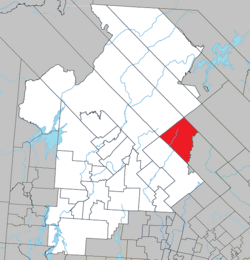 Location within Antoine-Labelle RCM. | |
 Lac-de-la-Maison-de-Pierre Location in central Quebec. | |
| Coordinates: 46°53′N 74°42′W / 46.883°N 74.700°WCoordinates: 46°53′N 74°42′W / 46.883°N 74.700°W[1] | |
| Country | |
| Province | |
| Region | Laurentides |
| RCM | Antoine-Labelle |
| Constituted | January 1, 1986 |
| Government | |
| • Federal riding | Laurentides—Labelle |
| • Prov. riding | Labelle |
| Area | |
| • Total | 488.10 km2 (188.46 sq mi) |
| • Land | 478.27 km2 (184.66 sq mi) |
| Population (2011)[3] | |
| • Total | 0 |
| • Density | 0.0/km2 (0/sq mi) |
| • Pop 2006-2011 | |
| • Dwellings | 0 |
| Time zone | UTC−5 (EST) |
| • Summer (DST) | UTC−4 (EDT) |
| Highways | No major routes |

Lac-de-la-Maison-de-Pierre is an unorganized territory in the Laurentides region of Quebec, Canada, and one of eleven unorganized areas in the Antoine-Labelle Regional County Municipality.
See also[]
References[]
Adjacent Municipal Subdivisions | ||||||||||||||||
|---|---|---|---|---|---|---|---|---|---|---|---|---|---|---|---|---|
| ||||||||||||||||
| Cities/towns | |
|---|---|
| Municipalities |
|
| Villages | |
| Unorganized territories | |
| |
This Quebec location article is a stub. You can help Wikipedia by . |
Categories:
- Unorganized territories in Laurentides
- Quebec geography stubs