Lakeside, Missouri
Lakeside, Missouri | |
|---|---|
Inactive City | |
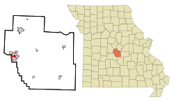 Location of Lakeside, Missouri | |
| Coordinates: 38°12′6″N 92°37′16″W / 38.20167°N 92.62111°WCoordinates: 38°12′6″N 92°37′16″W / 38.20167°N 92.62111°W | |
| Country | United States |
| State | Missouri |
| County | Miller |
| Area | |
| • Total | 0.7 sq mi (1.7 km2) |
| • Land | 0.3 sq mi (0.9 km2) |
| • Water | 0.3 sq mi (0.8 km2) |
| Elevation | 830 ft (253 m) |
| Population (2010) | |
| • Total | 0 |
| • Density | 0/sq mi (0/km2) |
| Time zone | UTC-6 (Central (CST)) |
| • Summer (DST) | UTC-5 (CDT) |
| FIPS code | 29-40142[1] |
| GNIS feature ID | 0738309[2] |

Lakeside is an inactive city in Miller County, Missouri, United States, located along the Osage River near the Bagnell Dam. The population was 37 at the 2000 census. As of the 2020 census, the population has remained at 0, with one housing unit.[3]
History[]
The city had developed at the time of construction of the Bagnell Dam and power plant, and many workers lived here. Few people were needed as residents to administer the complex, but Union Electric Administration Building-Lakeside was built in association with the dam project.
This building was added to the National Register of Historic Places in 1998. A boundary increase for the property was recorded as an addition in 2011.[4][5]
Geography[]
Lakeside is located at 38°12′6″N 92°37′16″W / 38.20167°N 92.62111°W (38.201533, -92.621012).[6] According to the United States Census Bureau, the city has a total area of 0.7 square miles (1.8 km2), of which 0.3 square miles (0.78 km2) is land and 0.3 square miles (0.78 km2) (46.97%) is water.
Demographics[]
| Historical population | |||
|---|---|---|---|
| Census | Pop. | %± | |
| 1970 | 124 | — | |
| 1980 | 115 | −7.3% | |
| 1990 | 38 | −67.0% | |
| 2000 | 37 | −2.6% | |
| 2010 | 0 | −100.0% | |
| 2020 | 0 | — | |
| U.S. Decennial Census | |||
As of the census[1] of 2000, there were 37 people, 14 households, and 13 families residing in the city. The population density was 106.0 people per square mile (40.8/km2). There were 15 housing units at an average density of 43.0 per square mile (16.5/km2). The racial makeup of the city was 100.00% White.
There were 14 households, out of which 42.9% had children under the age of 18 living with them, 92.9% were married couples living together, and 7.1% were non-families. 7.1% of all households were made up of individuals, and none had someone living alone who was 65 years of age or older. The average household size was 2.64 and the average family size was 2.77.
In the city, the population was spread out, with 21.6% under the age of 18, 2.7% from 18 to 24, 40.5% from 25 to 44, and 35.1% from 45 to 64. The median age was 44 years. For every 100 females, there were 146.7 males. For every 100 females age 18 and over, there were 107.1 males.
The median income for a household in the city was $69,375, and the median income for a family was $72,500. Males had a median income of $63,750 versus $20,625 for females. The per capita income for the city was $32,786. None of the population were below the poverty line.
By the 2010 census, the population fell to 0.
References[]
- ^ a b "U.S. Census website". United States Census Bureau. Retrieved 2008-01-31.
- ^ "US Board on Geographic Names". United States Geological Survey. 2007-10-25. Retrieved 2008-01-31.
- ^ "U.S. Census website". U.S. Census Bureau. Retrieved 10 November 2021.
{{cite web}}: CS1 maint: url-status (link) - ^ "National Register Information System". National Register of Historic Places. National Park Service. July 9, 2010.
- ^ "National Register of Historic Places Listings". Weekly List of Actions Taken on Properties: 6/20/11 through 6/24/11. National Park Service. 2011-07-01.
- ^ "US Gazetteer files: 2010, 2000, and 1990". United States Census Bureau. 2011-02-12. Retrieved 2011-04-23.
Municipalities and communities of Miller County, Missouri, United States | ||
|---|---|---|
| Cities |  | |
| Villages | ||
| Townships | ||
| CDP | ||
| Other communities | ||
| Footnotes | ‡This populated place also has portions in an adjacent county or counties | |
| ||
- Cities in Miller County, Missouri
- Cities in Missouri