Lambton, Quebec
Lambton | |
|---|---|
Municipality | |
 | |
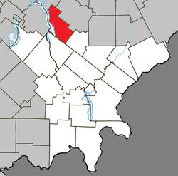 Location within Le Granit RCM | |
 Lambton Location in southern Quebec | |
| Coordinates: 45°50′N 71°05′W / 45.83°N 71.08°WCoordinates: 45°50′N 71°05′W / 45.83°N 71.08°W[1] | |
| Country | |
| Province | |
| Region | Estrie |
| RCM | Le Granit |
| Constituted | December 23, 1976 |
| Government | |
| • Mayor | Ghislain Bolduc |
| • Federal riding | Mégantic—L'Érable |
| • Prov. riding | Mégantic |
| Area | |
| • Total | 124.70 km2 (48.15 sq mi) |
| • Land | 108.34 km2 (41.83 sq mi) |
| Population | |
| • Total | 1,584 |
| • Density | 14.6/km2 (38/sq mi) |
| • Pop 2006-2011 | |
| • Dwellings | 1,216 |
| Time zone | UTC−5 (EST) |
| • Summer (DST) | UTC−4 (EDT) |
| Postal code(s) | G0M 1H0 |
| Area code(s) | 418 and 581 |
| Highways | |
| Website | www |

Lambton is a municipality of about 1600 people in Le Granit Regional County Municipality in the Estrie region of Quebec, Canada.
Lambton is mostly rural and agricultural area with some business on the two main roads in town.
Transportation[]
The main roads connecting Lambton are Route 108 and Route 263.
References[]
- ^ Reference number 80867 of the Commission de toponymie du Québec (in French)
- ^ Jump up to: a b Geographic code 30095 in the official Répertoire des municipalités (in French)
- ^ Jump up to: a b "(Code 2430095) Census Profile". 2011 census. Statistics Canada. 2012.
External links[]
 Media related to Lambton, Quebec at Wikimedia Commons
| show Places adjacent to Lambton, Quebec |
|---|
| show |
|---|
This Estrie location article is a stub. You can help Wikipedia by . |
Categories:
- Municipalities in Quebec
- Incorporated places in Estrie
- Le Granit Regional County Municipality
- Estrie geography stubs